MyTopo
McIntyre Pennsylvania US Topo Map
Couldn't load pickup availability
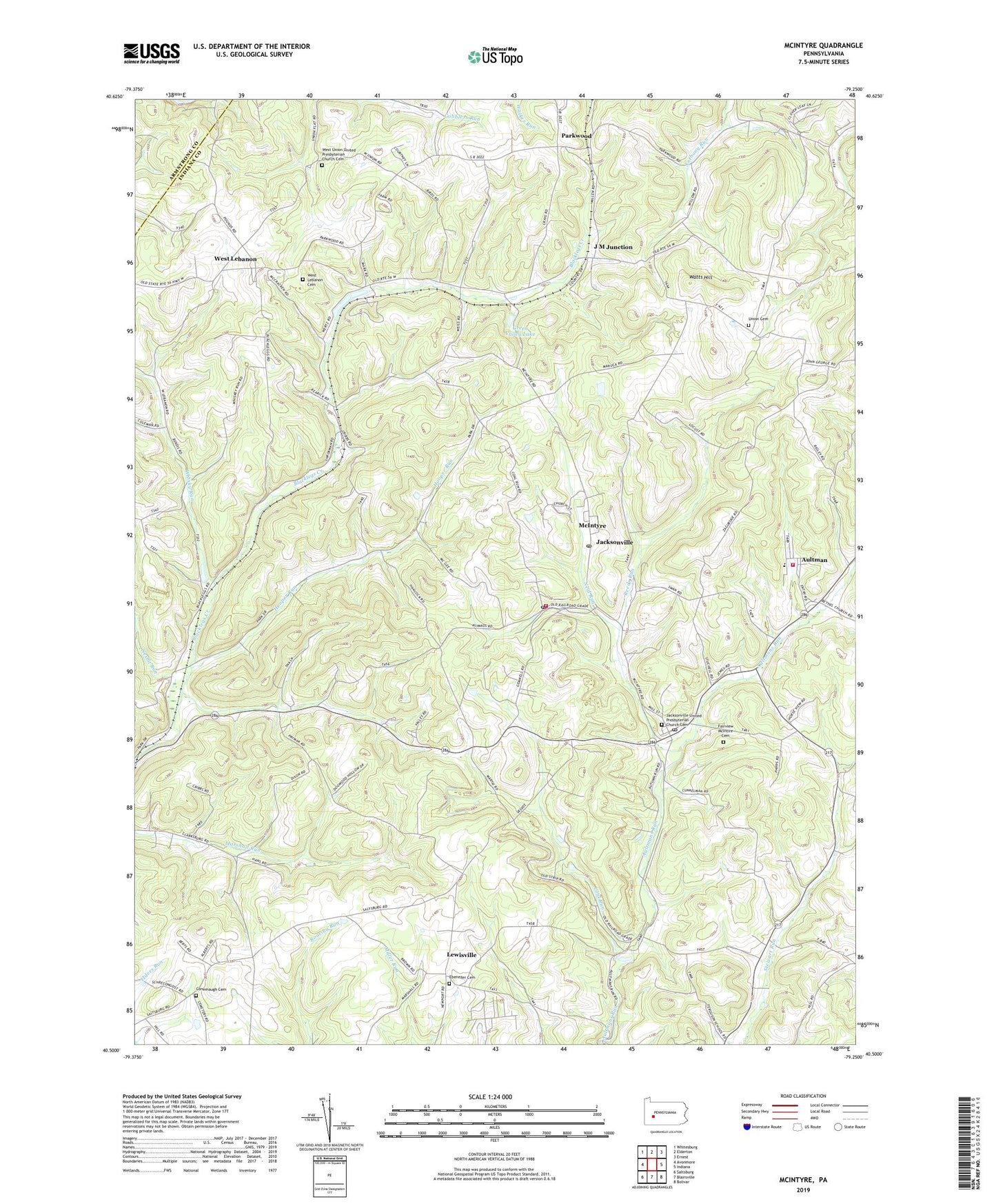
2023 topographic map quadrangle McIntyre in the state of Pennsylvania. Scale: 1:24000. Based on the newly updated USGS 7.5' US Topo map series, this map is in the following counties: Indiana, Armstrong. The map contains contour data, water features, and other items you are used to seeing on USGS maps, but also has updated roads and other features. This is the next generation of topographic maps. Printed on high-quality waterproof paper with UV fade-resistant inks.
Quads adjacent to this one:
West: Avonmore
Northwest: Whitesburg
North: Elderton
Northeast: Ernest
East: Indiana
Southeast: Bolivar
South: Blairsville
Southwest: Saltsburg
This map covers the same area as the classic USGS quad with code o40079e3.
Contains the following named places: Aultman, Aultman Volunteer Fire Department Station 270, Borough of Jacksonville, Clune Post Office, Coal Run, Coal Run - McIntyre Volunteer Fire Department Station 290, Conemaugh Cemetery, Conemaugh Church, Ebenezer Cemetery, Ebenezer Church, Fairview McIntire Cemetery, Green Valley Lake, Hooper Run, J M Junction, Jacksonville, Jacksonville Census Designated Place, Jacksonville United Presbyterian Church Cemetery, Kent Post Office, Lewisville, McIntyre, McIntyre Post Office, Neal Run, Nesbit Run, Parkwood, Reeds Run, Saint Anthonys Church, Stewardsville, Township of Young, Union Cemetery, Watts Hill, West Lebanon, West Lebanon Cemetery, West Lebanon Station, West Union Church, West Union United Presbyterian Church Cemetery, Whisky Run, ZIP Codes: 15713, 15725, 15727, 15752, 15756, 15783