MyTopo
Jenningsville Pennsylvania US Topo Map
Couldn't load pickup availability
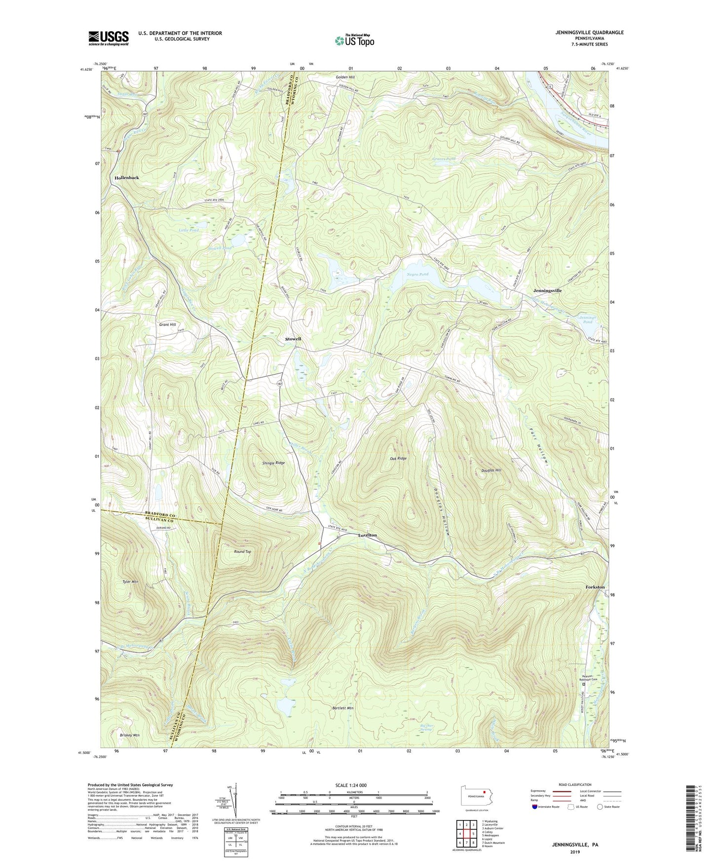
2019 topographic map quadrangle Jenningsville in the state of Pennsylvania. Scale: 1:24000. Based on the newly updated USGS 7.5' US Topo map series, this map is in the following counties: Wyoming, Bradford, Sullivan. The map contains contour data, water features, and other items you are used to seeing on USGS maps, but also has updated roads and other features. This is the next generation of topographic maps. Printed on high-quality waterproof paper with UV fade-resistant inks.
Quads adjacent to this one:
West: Colley
Northwest: Wyalusing
North: Laceyville
Northeast: Auburn Center
East: Meshoppen
Southeast: Noxen
South: Dutch Mountain
Southwest: Lopez
Contains the following named places: Barnes Brook, Bartlett Mountain, Big Deer Swamp, Briskey Mountain, Burgess Brook, Catlin Brook, Chamberlain Pond, Coffee Brook, Douglas Hill, Douglas Hollow, Farr Hollow, Forkston, Golden Hill, Grant Hill, Grant Hill School, Graves Pond, Hollenback, Jennings Pond, Jennings Pond Dam, Jenningsville, Little Pond, Lovelton, Miller Brook, Negro Pond, Negro Pond Dam, Oak Ridge, Panther Lick Creek, Roaring Run, Robinson Cemetery, Rock Cabin Run, Round Top, Sciota Brook, Sciotavale, Sharpe Pond, Sharpe Pond Dam, Shingle Ridge, Stowell, Stowell Pond, Sugar Hill School, Sugar Run, Sugar Run Post Office, Township of North Branch, Township of Windham, ZIP Codes: 18629, 18846