MyTopo
Lopez Pennsylvania US Topo Map
Couldn't load pickup availability
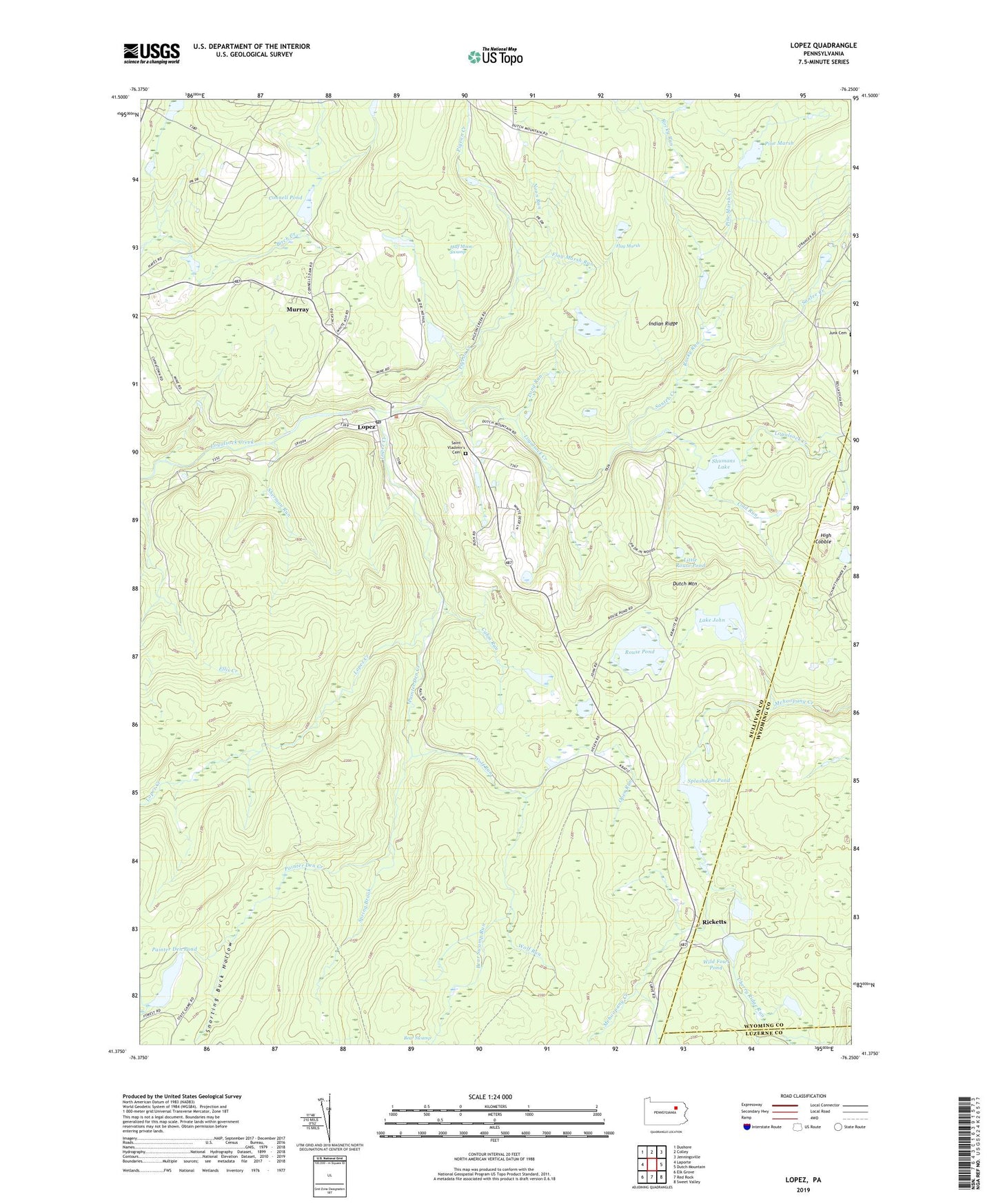
2023 topographic map quadrangle Lopez in the state of Pennsylvania. Scale: 1:24000. Based on the newly updated USGS 7.5' US Topo map series, this map is in the following counties: Sullivan, Wyoming, Luzerne. The map contains contour data, water features, and other items you are used to seeing on USGS maps, but also has updated roads and other features. This is the next generation of topographic maps. Printed on high-quality waterproof paper with UV fade-resistant inks.
Quads adjacent to this one:
West: Laporte
Northwest: Dushore
North: Colley
Northeast: Jenningsville
East: Dutch Mountain
Southeast: Sweet Valley
South: Red Rock
Southwest: Elk Grove
This map covers the same area as the classic USGS quad with code o41076d3.
Contains the following named places: Bear Swamp Run, Cabin Run, Cherry Ridge Run, Cold Run, Connell Dam, Connell Pond, Creveling Lake Dam, Flag Marsh, Flag Marsh Run, Half Moon Swamp, High Cobble, Indian Ridge, Lake John, Lake John Dam, Little Rouse Pond, Long Run, Lopez, Lopez Creek, Lopez Post Office, McCarroll Corner, Murray, Noon Run, Open Run, Painter Den Club, Painter Den Creek, Painter Den Pond, Pigeon Creek, Pine Marsh, Pine Marsh Creek, Ricketts, Rocky Run, Rouse Pond, Ryman Pond, Saint Vladimir's Cemetery, Saint Vladimirs Church, Santee Creek, Sherman Run, Shumans Lake, Snorting Buck Hollow, Splash Dam, Splashdam Pond, Spring Brook, State Game Lands Number 57, State Game Lands Number 66, Township of Colley, Wild Fowl Pond, Wolf Run, Yellow Run, ZIP Code: 18628