MyTopo
Oxford Pennsylvania US Topo Map
Couldn't load pickup availability
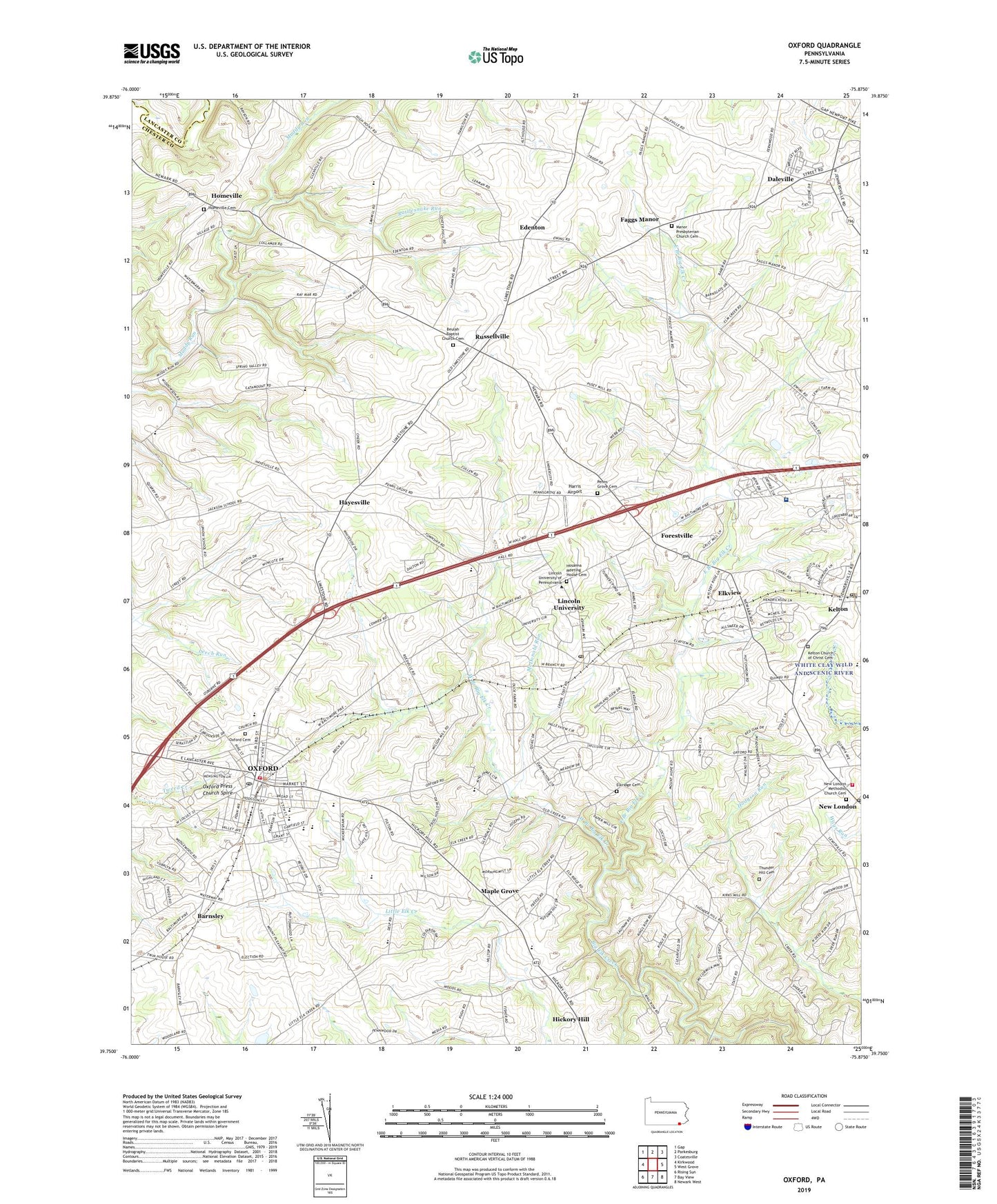
2023 topographic map quadrangle Oxford in the state of Pennsylvania. Scale: 1:24000. Based on the newly updated USGS 7.5' US Topo map series, this map is in the following counties: Chester, Lancaster. The map contains contour data, water features, and other items you are used to seeing on USGS maps, but also has updated roads and other features. This is the next generation of topographic maps. Printed on high-quality waterproof paper with UV fade-resistant inks.
Quads adjacent to this one:
West: Kirkwood
Northwest: Gap
North: Parkesburg
Northeast: Coatesville
East: West Grove
Southeast: Newark West
South: Bay View
Southwest: Rising Sun
This map covers the same area as the classic USGS quad with code o39075g8.
Contains the following named places: Amos Hall, Barnsley, Beulah Baptist Church Cemetery, Beulah Church, Black Walnut Creek, Borough of Oxford, Buena Vista School, Camp Saginaw, Cannon House, Charlton School, Chestnut Grove School, Collamer Post Office, Cream School, Daleville, East Branch Big Elk Creek, Edenton, Elkdale, Elkridge Cemetery, Elkview, Elkview School, Elliot Cresson Hall, Faggs Manor, Forestville, Frederick Douglass Hall, Grim Hall, Guest House, Harris Airport, Hayesville, Henry Howard Houston Hall, Hickory Hill School, Homeville, Homeville Cemetery, Hosanna Meeting House Cemetery, Hozannah Church, Isaac Norton and John Ballard Rendall Hall, Jehudi Ashmun Hall, Jennersville Regional Hospital, John Miller Dickey Hall, Jordan Bank Hopewell Elementary School, Kelton, Kelton Church of Christ Cemetery, Kelton Post Office, Langston Hughes Memorial Library, Lincoln University, Lincoln University Census Designated Place, Lincoln University Post Office, Londonderry Post Office, Lorraine Hansberry Hall, Lucy Laney Hall, Manor Presbyterian Church Cemetery, Manuel Rivero Hall, Maple Grove, Mary Dod Brown Memorial Chapel, McDonald Run, Media School, New London, New London Airport, New London Methodist Church Cemetery, New London Post Office, Nottingham Elementary School, Oak Grove School, Oxford, Oxford Area High School, Oxford Area Middle School, Oxford Borough Police Department, Oxford Cemetery, Oxford Mall, Oxford Post Office, Oxford Press Church Spire, Penns Grove Cemetery, Penns Grove Church, Penns Grove School, Pleasant View School, President's House - Lincoln University, Rattlesnake Run, Rattlesnake Run School, Robert Baxter McRary Hall, Russellville, Southern Chester County Emergency Medical Services Medic 94, Thunder Hill Cemetery, Thurgood Marshall Living Learning Center North, Thurgood Marshall Living Learning Center South, Township of East Nottingham, Township of Londonderry, Township of Lower Oxford, Township of New London, Township of Upper Oxford, Union Fire Company 1 Mid - Town Station 21, Vail Memorial Hall, West Branch Big Elk Creek, West Grove Fire Company Station 22 New London, WLIU-FM (Lincoln University), ZIP Codes: 19330, 19352, 19363