MyTopo
Lawton Pennsylvania US Topo Map
Couldn't load pickup availability
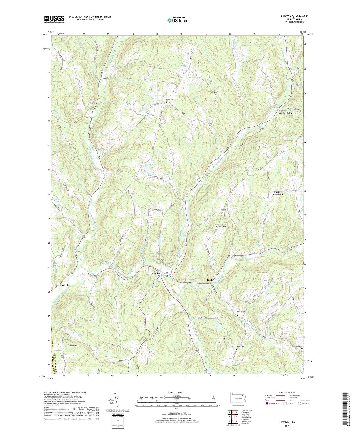
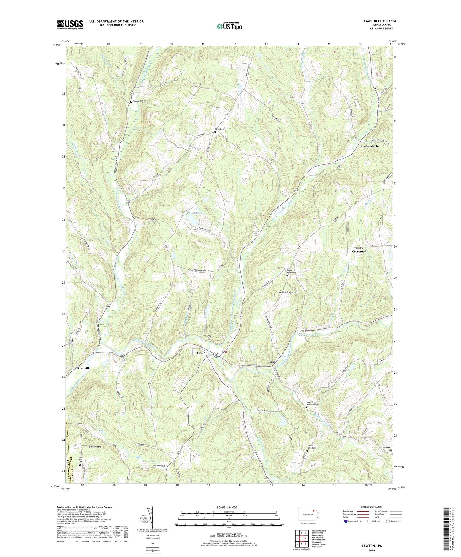
2019 topographic map quadrangle Lawton in the state of Pennsylvania. Scale: 1:24000. Based on the newly updated USGS 7.5' US Topo map series, this map is in the following counties: Susquehanna, Bradford. The map contains contour data, water features, and other items you are used to seeing on USGS maps, but also has updated roads and other features. This is the next generation of topographic maps. Printed on high-quality waterproof paper with UV fade-resistant inks.
Quads adjacent to this one:
West: Le Raysville
Northwest: Little Meadows
North: Friendsville
Northeast: Laurel Lake
East: Montrose West
Southeast: Springville
South: Auburn Center
Southwest: Laceyville
Contains the following named places: Birchardsville Post Office, Birchardville, County Home Cemetery, Deer Lick Creek, Deuel Creek, Devine Ridge, Devine Ridge Cemetery, East Branch Wyalusing Creek, East Rush Cemetery, Elk Lake Stream, Flynn School, Fowler Hill, Fowler Hill Cemetery, Gaylord Creek, Lawton, Lawton Post Office, Logan Hill School, Middle Branch Wyalusing Creek, North Branch Wyalusing Creek, Parks Crossroad, Rigsby Pond, Rush, Rush Center Memorial Park, Rush Volunteer Fire Department, Rushville, Saint Johns Cemetery, Saint Patricks Church, Snell Creek, Steadwell Cemetery, Stonestreet Creek, Summers Creek, Terry Creek, Township of Middletown, Township of Rush, ZIP Code: 18828