MyTopo
Friendsville Pennsylvania US Topo Map
Couldn't load pickup availability
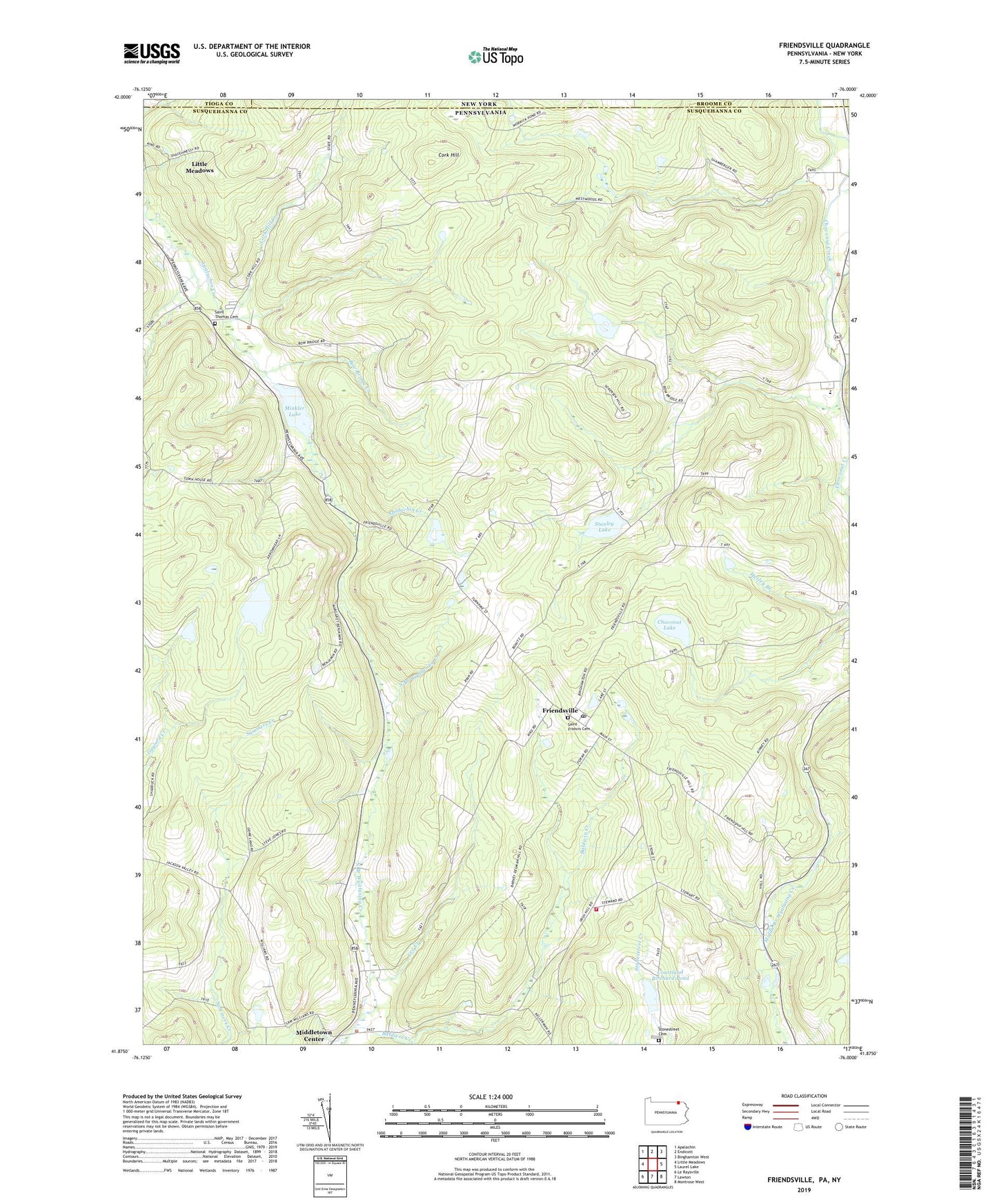
2023 topographic map quadrangle Friendsville in the states of Pennsylvania, New York. Scale: 1:24000. Based on the newly updated USGS 7.5' US Topo map series, this map is in the following counties: Susquehanna, Broome, Tioga. The map contains contour data, water features, and other items you are used to seeing on USGS maps, but also has updated roads and other features. This is the next generation of topographic maps. Printed on high-quality waterproof paper with UV fade-resistant inks.
Quads adjacent to this one:
West: Little Meadows
Northwest: Apalachin
North: Endicott
Northeast: Binghamton West
East: Laurel Lake
Southeast: Montrose West
South: Lawton
Southwest: Le Raysville
This map covers the same area as the classic USGS quad with code o41076h1.
Contains the following named places: Baldwin Creek, Borough of Friendsville, Bow Bridge Creek, Camp Arrowhead, Camp Choconut, Carmault Lake, Choconut Chapel, Choconut Lake, Cork Hill, Cork Hill Creek, Courtland Birchard Pond, Friendsville, Friendsville Post Office, Lee Creek, Middletown Center, Minkler Lake, Minkler Lake Dam, Rush Volunteer Fire Department Station 2, Saint Francis Cemetery, Saint Francis Church, Saint Thomas the Apostle Cemetery, Stanley Lake, Stanley Lake Dam, State Game Lands Number 140, Stone Lake Dam, Stonestreet Cemetery, Township of Apolacon, Township of Choconut, Turrell Corners, ZIP Codes: 18818, 18830