MyTopo
Little Meadows Pennsylvania US Topo Map
Couldn't load pickup availability
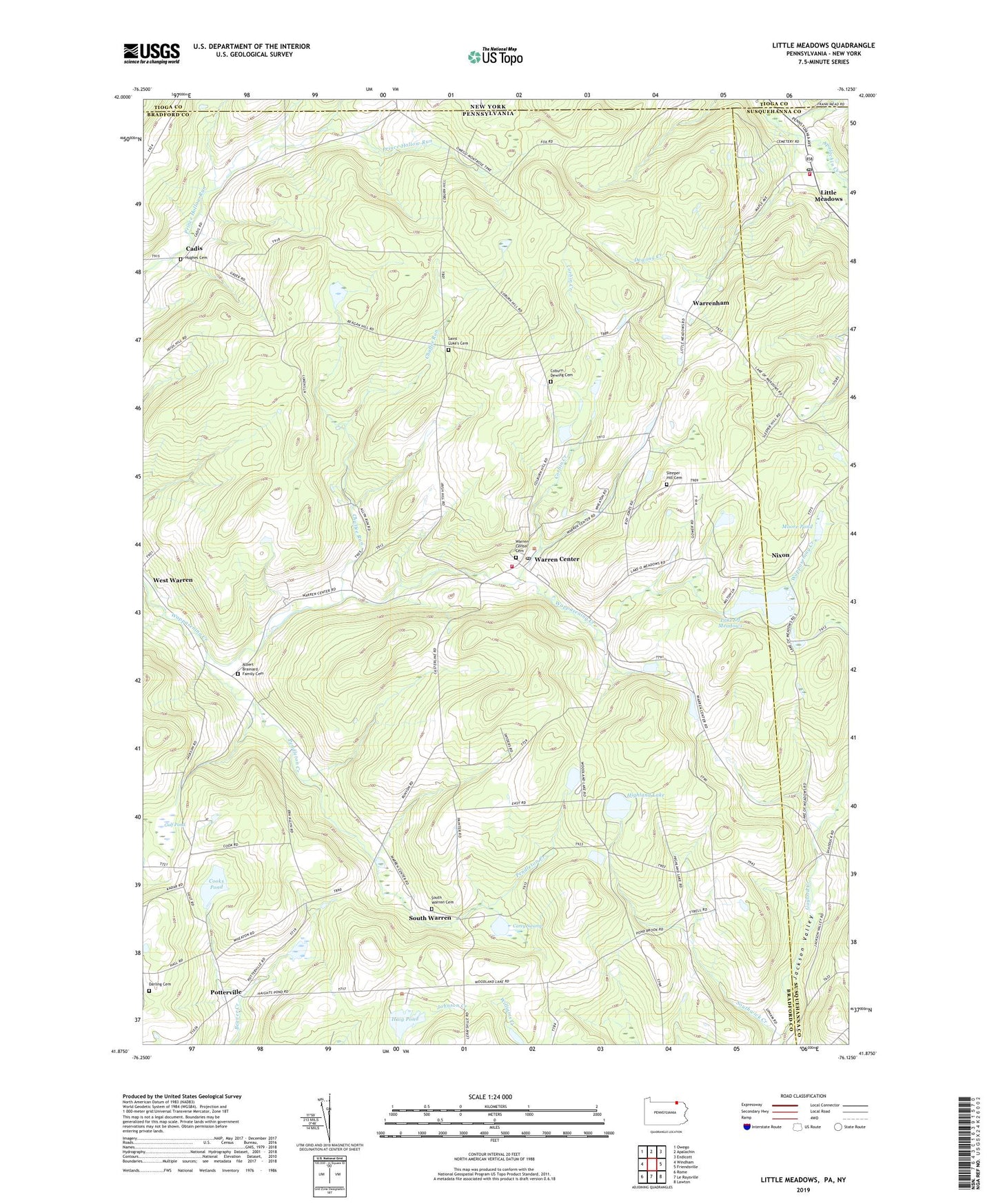
2023 topographic map quadrangle Little Meadows in the state of Pennsylvania. Scale: 1:24000. Based on the newly updated USGS 7.5' US Topo map series, this map is in the following counties: Bradford, Susquehanna, Tioga. The map contains contour data, water features, and other items you are used to seeing on USGS maps, but also has updated roads and other features. This is the next generation of topographic maps. Printed on high-quality waterproof paper with UV fade-resistant inks.
Quads adjacent to this one:
West: Windham
Northwest: Owego
North: Apalachin
Northeast: Endicott
East: Friendsville
Southeast: Lawton
South: Le Raysville
Southwest: Rome
This map covers the same area as the classic USGS quad with code o41076h2.
Contains the following named places: Albert Brainard Family Cemetery, Borough of Little Meadows, Cadis, Cadis Cemetery, Carey Swamp, Cases Creek, Chaffee Run, Coburn Dewing Cemetery, Cooks Pond, Cooks Pond Dam, Corbin Creek, Darling Cemetery, Dewing Creek, Fisher Hall Creek, Gulf Pond, Haig Pond, Highland Lake, Jackson Valley, Lake Of Meadows, Little Meadows, Little Meadows Post Office, Little Meadows Volunteer Fire Company - Little Meadows Rescue Squad, Moore Pond, Nixon, North Warren Church, Pendleton Creek, Potterville, Saint Luke's Cemetery, Saint Thomas Church, Sleeper Hill Cemetery, South Warren, South Warren Cemetery, Southwick Creek, Township of Warren, Warren Center, Warren Center Cemetery, Warren Center Post Office, Warren Township Volunteer Fire Department Station 18, Warrenham, ZIP Code: 18851