MyTopo
Laurel Lake Pennsylvania US Topo Map
Couldn't load pickup availability
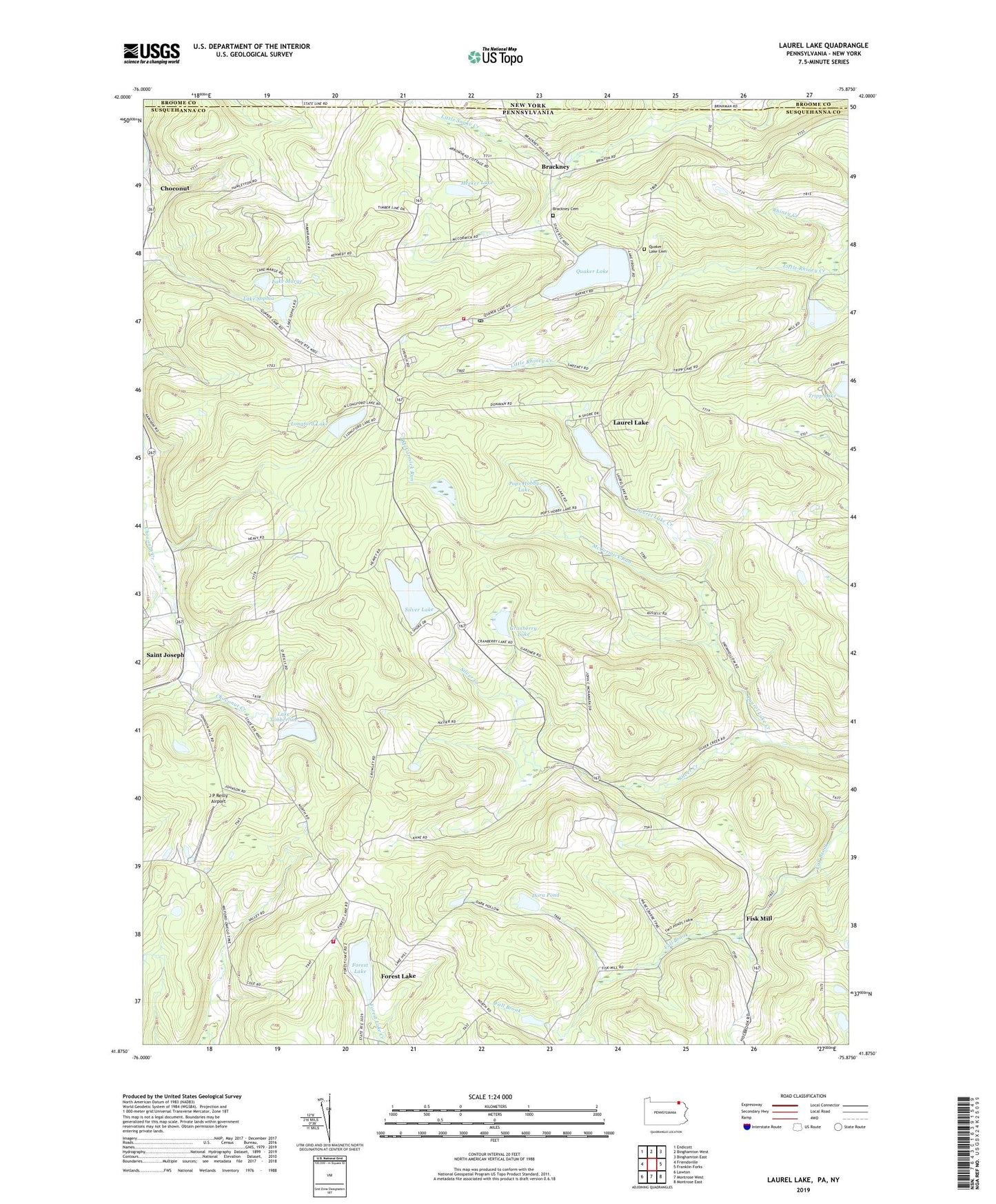
2023 topographic map quadrangle Laurel Lake in the state of Pennsylvania. Scale: 1:24000. Based on the newly updated USGS 7.5' US Topo map series, this map is in the following counties: Susquehanna, Broome. The map contains contour data, water features, and other items you are used to seeing on USGS maps, but also has updated roads and other features. This is the next generation of topographic maps. Printed on high-quality waterproof paper with UV fade-resistant inks.
Quads adjacent to this one:
West: Friendsville
Northwest: Endicott
North: Binghamton West
Northeast: Binghamton East
East: Franklin Forks
Southeast: Montrose East
South: Montrose West
Southwest: Lawton
This map covers the same area as the classic USGS quad with code o41075h8.
Contains the following named places: Baker Dam, Brackney, Brackney Cemetery, Brackney Post Office, Choconut, Cranberry Lake, Cranberry Lake Dam, Dacey School, Dora Pond, Fisk Mill, Forest Lake, Forest Lake Dam, Forest Lake Volunteer Fire Company, Hurley Branch, J P Reilly Airport, Kane School, Lake Marge, Lake Sophia, Lake Sophia Dam, Lake Stanmor, Lake Timberline, Lake Timberline Dam, Laurel Lake, Laurel Lake Creek, Little Rhiney Creek, Longford Lake, Longford Lake Dam, McCormick Run, Meeker Lake, Pops Hobby Lake, Quaker Lake, Quaker Lake Cemetery, Saint Augustine Church, Saint Joseph, Silver Lake, Silver Lake Dam, Silver Lake Volunteer Fire Company, Township of Forest Lake, Township of Silver Lake, Ward School, ZIP Code: 18812