MyTopo
McAlevys Fort Pennsylvania US Topo Map
Couldn't load pickup availability
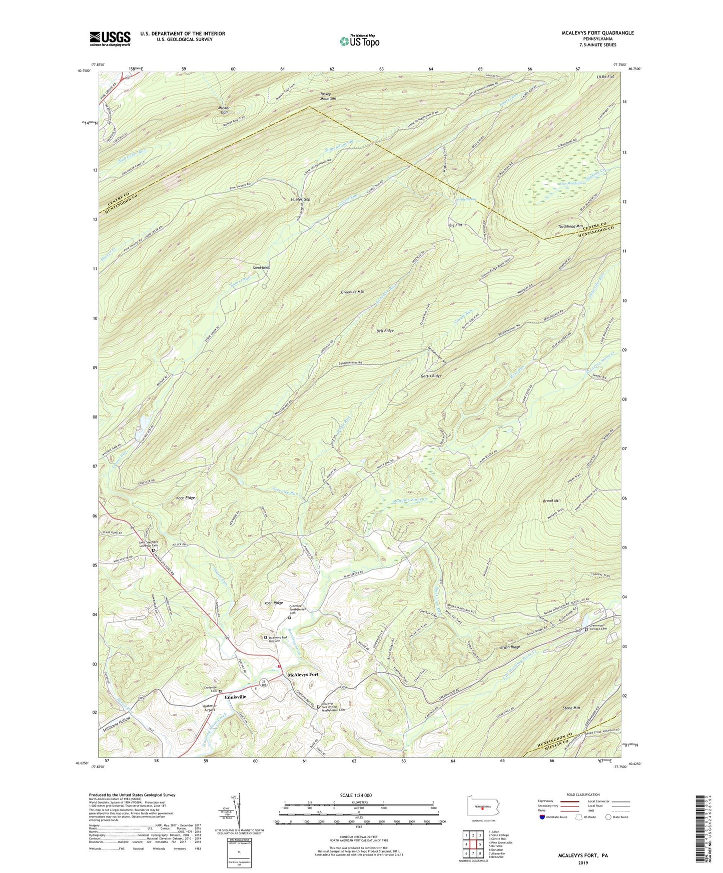
2019 topographic map quadrangle McAlevys Fort in the state of Pennsylvania. Scale: 1:24000. Based on the newly updated USGS 7.5' US Topo map series, this map is in the following counties: Huntingdon, Centre, Mifflin. The map contains contour data, water features, and other items you are used to seeing on USGS maps, but also has updated roads and other features. This is the next generation of topographic maps. Printed on high-quality waterproof paper with UV fade-resistant inks.
Quads adjacent to this one:
West: Pine Grove Mills
Northwest: Julian
North: State College
Northeast: Centre Hall
East: Barrville
Southeast: Belleville
South: Allensville
Southwest: Donation
Contains the following named places: Alan Seeger Natural Area, Alan Seeger Picnic Area, Alexander Trail, Bear Meadows, Bear Meadows Natural Area, Beidler Trail, Bell Ridge, Big Flat, Big Flat Laurel Viewing Area, Black Lick Run, Brush Ridge, Brush Ridge School, Brush Trail, Croyle Run, Detweiler Run, Ennisville, Ennisville Cemetery, Gettis Ridge, Goose Club Trail, Greenlee Mountain, Greenlee Presbyterian Cemetery, Greenlee Run, Greenwood Furnace Cemetery, Greenwood Furnace State Park, Greenwood Nursery, Griffith Trail, Hostetler Airport, Hubler Gap, Jackson Miller School, Keith Spring, Kepler Trail, Koch Ridge, Laurel Run, Little Flat, McAlevys Fort, McAlevys Fort Hill Cemetery, McAlevys Fort United Presbyterian Cemetery, Musser Gap, Musser Trail, Owl Gap CCC Camp, Owl Gap Trail, Ross Run, Rothrock State Forest, Saint Stephens Church, Saint Stephens Lutheran Cemetery, Sand Knob, Sand Knob Trail, Seeger Place, Shingletown Branch, Slate Hill School, Steffey School, Stillhouse Hollow, Stone Creek Valley Volunteer Fire Company Station 19, Stone Valley School, Telephone Trail, The Pennsylvania State University Experimental Forest, Township of Jackson, Wallace Trail, Whipple Dam, Whipple Dam State Park, White Church