MyTopo
Donation Pennsylvania US Topo Map
Couldn't load pickup availability
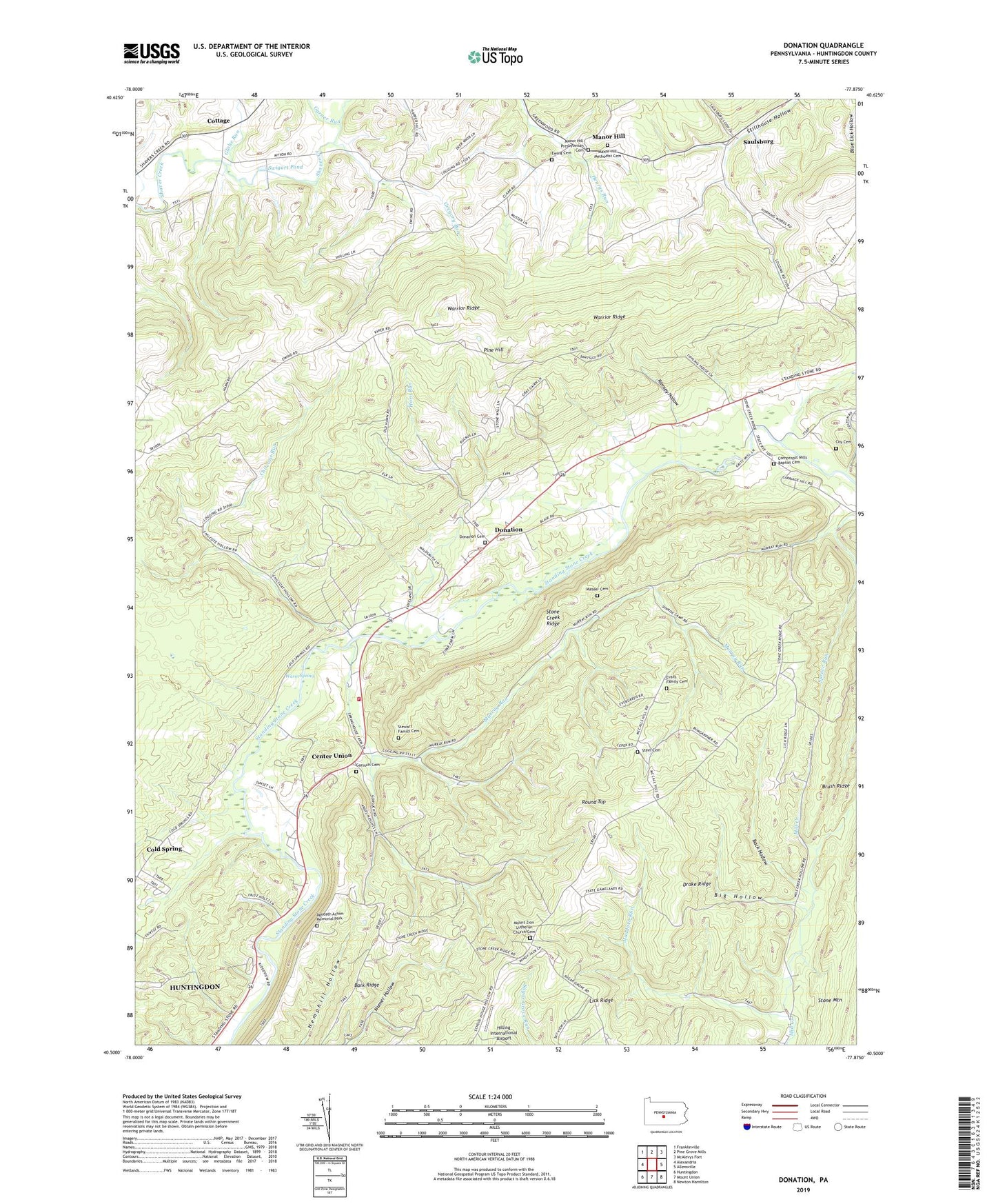
2023 topographic map quadrangle Donation in the state of Pennsylvania. Scale: 1:24000. Based on the newly updated USGS 7.5' US Topo map series, this map is in the following counties: Huntingdon. The map contains contour data, water features, and other items you are used to seeing on USGS maps, but also has updated roads and other features. This is the next generation of topographic maps. Printed on high-quality waterproof paper with UV fade-resistant inks.
Quads adjacent to this one:
West: Alexandria
Northwest: Franklinville
North: Pine Grove Mills
Northeast: McAlevys Fort
East: Allensville
Southeast: Newton Hamilton
South: Mount Union
Southwest: Huntingdon
This map covers the same area as the classic USGS quad with code o40077e8.
Contains the following named places: Agudath Achim Memorial Park, Back Hollow, Barkridge School, Big Hollow, Center Union, Chilcoat Run, Cold Spring, Cold Spring School, Cornpropst Mills, Cornpropst Mills Baptist Cemetery, Cottage, Coy Cemetery, Donation, Donation Cemetery, Drake Ridge, Evans Family Cemetery, Ewing Cemetery, Feltenberger Airport, Garner Run, Globe Run, Gorsuch Cemetery, Gregory Run, Hilling International Airport, Horn Run, Huntingdon Regional Fire and Rescue Department 65 Station 18, Maddern Run, Manor Hill, Manor Hill Methodist Cemetery, Manor Hill Presbyterian Cemetery, Mateer Cemetery, Mount Zion Church, Mount Zion Lutheran Church Cemetery, Murray Run, Myton School, Pennsylvania State University Experimental Forest, Pine Hill, Ramsey Hollow, Ramsey Trail, Ridge School, Round Top, Saulsburg, Smith School, Standing Stone Golf Course, State Game Lands Number 112, Steel Cemetery, Stewart Family Cemetery, Stone Creek Ridge, Stone Creek Valley Park, Swigart Pond, Township of Henderson, Township of Oneida, Union Church, Union School, Warm Spring, ZIP Code: 16652