MyTopo
Pine Grove Mills Pennsylvania US Topo Map
Couldn't load pickup availability
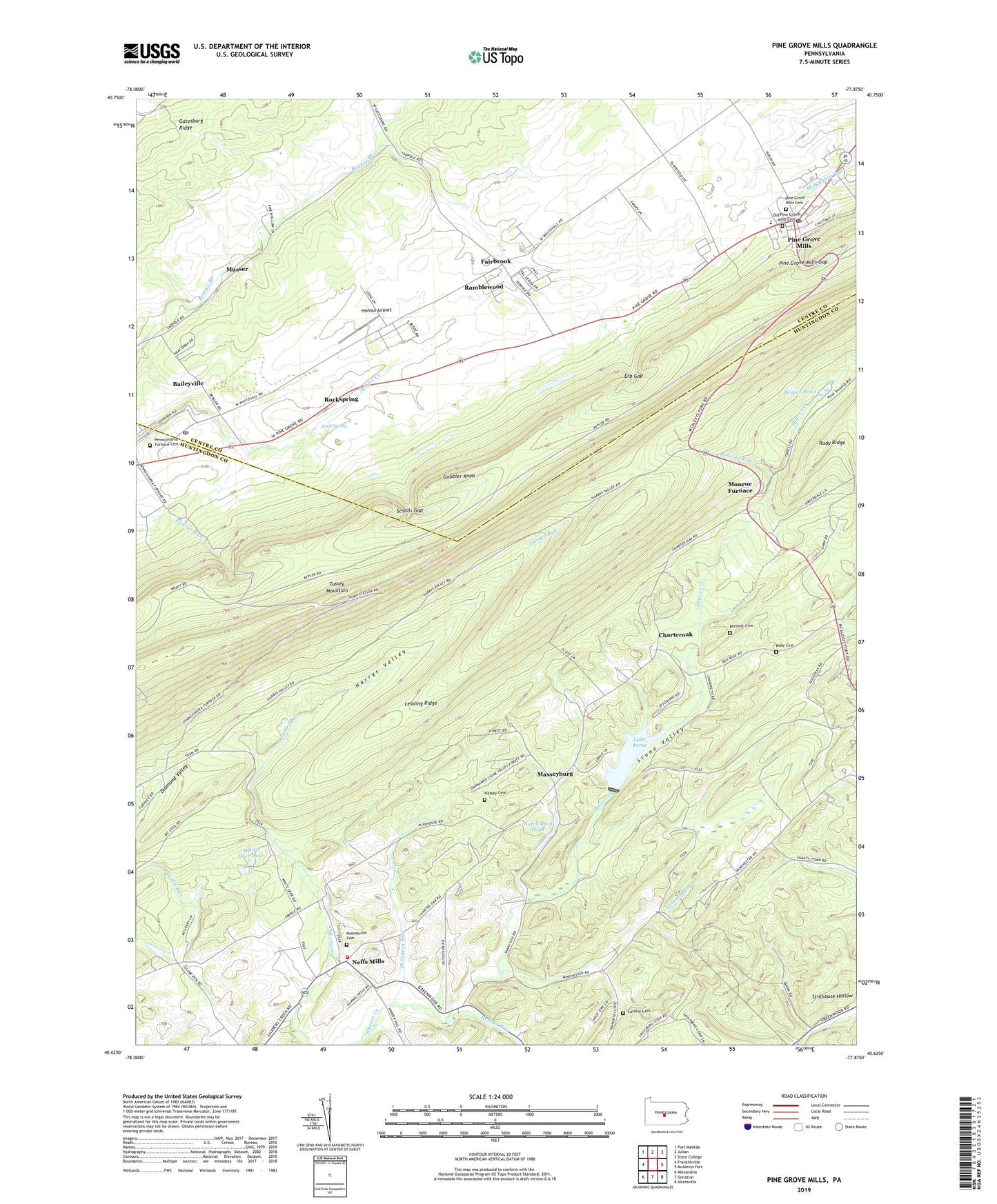
2023 topographic map quadrangle Pine Grove Mills in the state of Pennsylvania. Scale: 1:24000. Based on the newly updated USGS 7.5' US Topo map series, this map is in the following counties: Huntingdon, Centre. The map contains contour data, water features, and other items you are used to seeing on USGS maps, but also has updated roads and other features. This is the next generation of topographic maps. Printed on high-quality waterproof paper with UV fade-resistant inks.
Quads adjacent to this one:
West: Franklinville
Northwest: Port Matilda
North: Julian
Northeast: State College
East: McAlevys Fort
Southeast: Allensville
South: Donation
Southwest: Alexandria
This map covers the same area as the classic USGS quad with code o40077f8.
Contains the following named places: Armond Run, Baileyville, Baileyville Census Designated Place, Beaver Pond, Bennett Cemetery, Carolus Cemetery, Charteroak, Crownover Trail, Diamond Valley, Erb Gap, Fairbrook, Gobbler Knob, Harrys Valley, Henrys Run, Homan Airport, Hutchinson Pond, Hutchison Dam, Indian Steps Trail, Lake Perez, Leading Ridge, Massey Cemetery, Masseysburg, Monroe Furnace, Mooresville, Mooresville Cemetery, Musser, Neffs Mills, Old Pine Grove Mills Cemetery, Pennsylvania Furnace Cemetery, Pennsylvania Furnace Post Office, Pennsylvania State University C E Camp, Pennsylvania State University Experimental Forest, Pennsylvania State University Forestry Camp, Pennsylvania State University Recreation Are, Phranton Run, Pine Grove Mills, Pine Grove Mills Cemetery, Pine Grove Mills Census Designated Place, Pine Grove Mills Gap, Pine Grove Mills Post Office, Ramblewood, Ramblewood Census Designated Place, Roaring Run, Rock Spring, Rockspring, Rudy Cemetery, Rudy Ridge, Schalls Gap, Shavers Creek Volunteer Fire Company Station 11, Stone Valley, Stone Valley Recreation Area, Township of Barree, Township of Ferguson, Township of West, Twin Creeks Community Volunteer Ambulance 1100, University Dam, University Watershed Reservoir Project, White Deer Lake, ZIP Codes: 16669, 16865, 16868