MyTopo
Centre Hall Pennsylvania US Topo Map
Couldn't load pickup availability
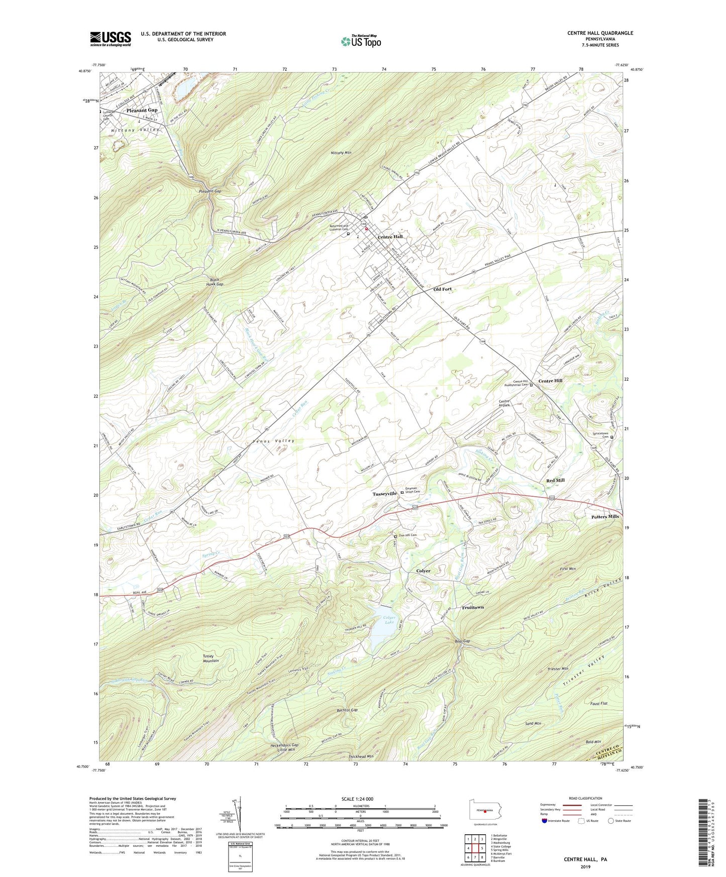
2023 topographic map quadrangle Centre Hall in the state of Pennsylvania. Scale: 1:24000. Based on the newly updated USGS 7.5' US Topo map series, this map is in the following counties: Centre, Mifflin. The map contains contour data, water features, and other items you are used to seeing on USGS maps, but also has updated roads and other features. This is the next generation of topographic maps. Printed on high-quality waterproof paper with UV fade-resistant inks.
Quads adjacent to this one:
West: State College
Northwest: Bellefonte
North: Mingoville
Northeast: Madisonburg
East: Spring Mills
Southeast: Burnham
South: Barrville
Southwest: McAlevys Fort
This map covers the same area as the classic USGS quad with code o40077g6.
Contains the following named places: Bald Mountain, Bechtol Gap, Bethany Church, Black Hawk Gap, Black Hawk Gap Run, Black Hawk Quarry, Boal Gap, Boal Gap Run, Borough of Centre Hall, Centre Airpark, Centre Hall, Centre Hall Fire Company 4, Centre Hall Post Office, Centre Hill, Centre Hill Presbyterian Cemetery, Colyer, Colyer Lake, Colyer Lake Dam, Deaf Run Trail, Earlytown School, Emanuel Union Cemetery, Emanuels Church, Faust Flat, First Mountain, Fruittown, Gap Run, Garbrick Airport, Goodhart Ridge Farm, Gregg School, Heckendorn Gap, Independent Church, Indian Lane Grave, Little Mountain, Meadows Psychiatric Center, Nittany Hall, Nittany Mountain Overlook, Oaks Spring Farm, Old Fort, Penns Cave, Pennsylvania State University Agronomy Research Farm, Pine Stump School, Pleasant Gap, Pleasant Gap Census Designated Place, Plum Grove School, Potter Brook, Potter Run, Potters Mills, Potters Mills Census Designated Place, Red Mill, Reformed and Lutheran Cemetery, Smith Gap, Smith Trail, Sprucetown Cemetery, Sprucetown Church, Stavefield Trail, Stonefence Farm, Township of Potter, Triester Mountain, Tussey Mountain Trail, Tussey Sink School, Tusseyridge Farm, Tusseyville, Twin Fir Farm, Underwood Trail, Willow Run Farms, Zion Hill Cemetery, ZIP Code: 16828