MyTopo
Millville Pennsylvania US Topo Map
Couldn't load pickup availability
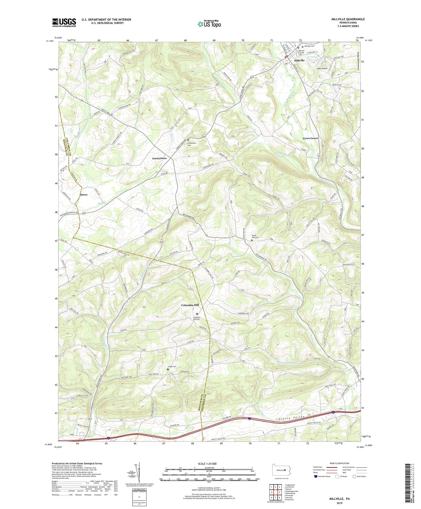
2019 topographic map quadrangle Millville in the state of Pennsylvania. Scale: 1:24000. Based on the newly updated USGS 7.5' US Topo map series, this map is in the following counties: Columbia, Montour. The map contains contour data, water features, and other items you are used to seeing on USGS maps, but also has updated roads and other features. This is the next generation of topographic maps. Printed on high-quality waterproof paper with UV fade-resistant inks.
Quads adjacent to this one:
West: Washingtonville
Northwest: Hughesville
North: Lairdsville
Northeast: Benton
East: Bloomsburg
Southeast: Catawissa
South: Danville
Southwest: Riverside
Contains the following named places: Borough of Millville, Buckhorn, Columbia Hill, Columbia Hill Cemetery, Derry, Dutch Hill Cemetery, Dutch Hill Church, Dutch Hill School, East Millville, Eyers Grove, Eyers Grove Census Designated Place, Frosty Valley, Frozen Run, Jerseytown, Jerseytown Cemetery, Jerseytown Census Designated Place, Lake Airport, Longs Cemetery, Longs Church, Millville, Millville Cemetery, Millville Community Fire Company Station 230, Millville Friends Cemetery, Millville Post Office, Saint Johns Church, Saint Peters Church, Spruce Run, Township of Hemlock, Township of Madison, Township of West Hemlock, Valley View Lake, Valley View Lake Dam, West Hemlock Creek