MyTopo
Benton Pennsylvania US Topo Map
Couldn't load pickup availability
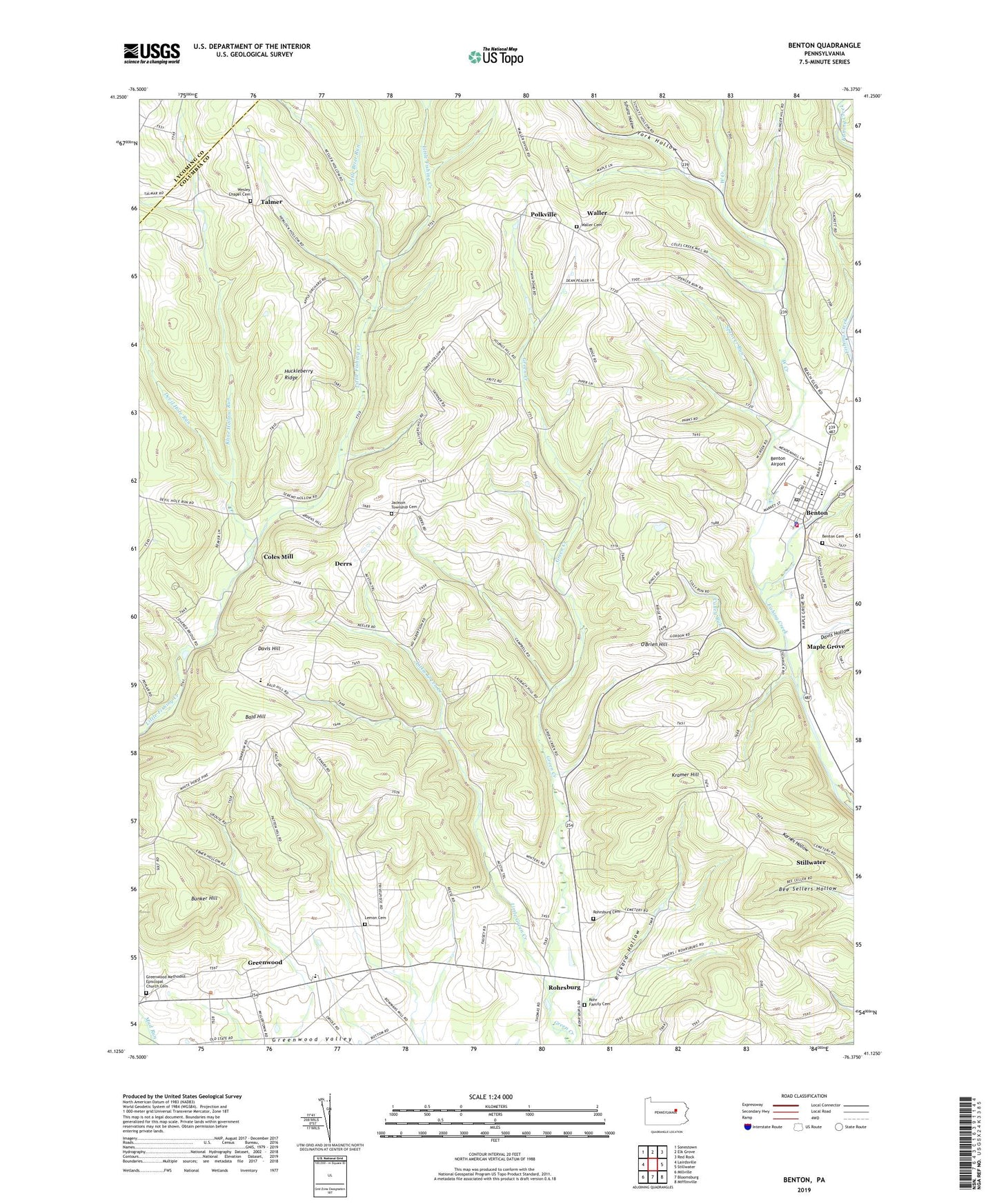
2023 topographic map quadrangle Benton in the state of Pennsylvania. Scale: 1:24000. Based on the newly updated USGS 7.5' US Topo map series, this map is in the following counties: Columbia, Lycoming. The map contains contour data, water features, and other items you are used to seeing on USGS maps, but also has updated roads and other features. This is the next generation of topographic maps. Printed on high-quality waterproof paper with UV fade-resistant inks.
Quads adjacent to this one:
West: Lairdsville
Northwest: Sonestown
North: Elk Grove
Northeast: Red Rock
East: Stillwater
Southeast: Mifflinville
South: Bloomsburg
Southwest: Millville
This map covers the same area as the classic USGS quad with code o41076b4.
Contains the following named places: Bald Hill, Benton, Benton Airport, Benton Boro Police Department, Benton Cemetery, Benton Post Office, Benton Volunteer Fire Company Station 150, Borough of Benton, Bunker Hill, Coles Mill, Culley Run, Davis Hill, Davis Hollow, Derrs, Devil Hole Run, Greenwood, Greenwood Methodist Episcopal Church Cemetery, Greenwood Union Church, Huckleberry Ridge, Jackson, Jackson Township Cemetery, Karnes Hollow, Kline Hollow Run, Kramer Hill, Lemon Cemetery, Little Brier Run, Little Green Creek, Maple Grove, O'Brien Hill, Polkville, Rickard Hollow, Rohr Family Cemetery, Rohrsburg, Rohrsburg Cemetery, Rohrsburg Census Designated Place, Schultz Hollow, Spencer Run, Talmer, Township of Greenwood, Township of Jackson, Waller, Waller Cemetery, Waller Census Designated Place, Waterville, Wesley Chapel Cemetery, West Creek, York Hollow