MyTopo
Bloomsburg Pennsylvania US Topo Map
Couldn't load pickup availability
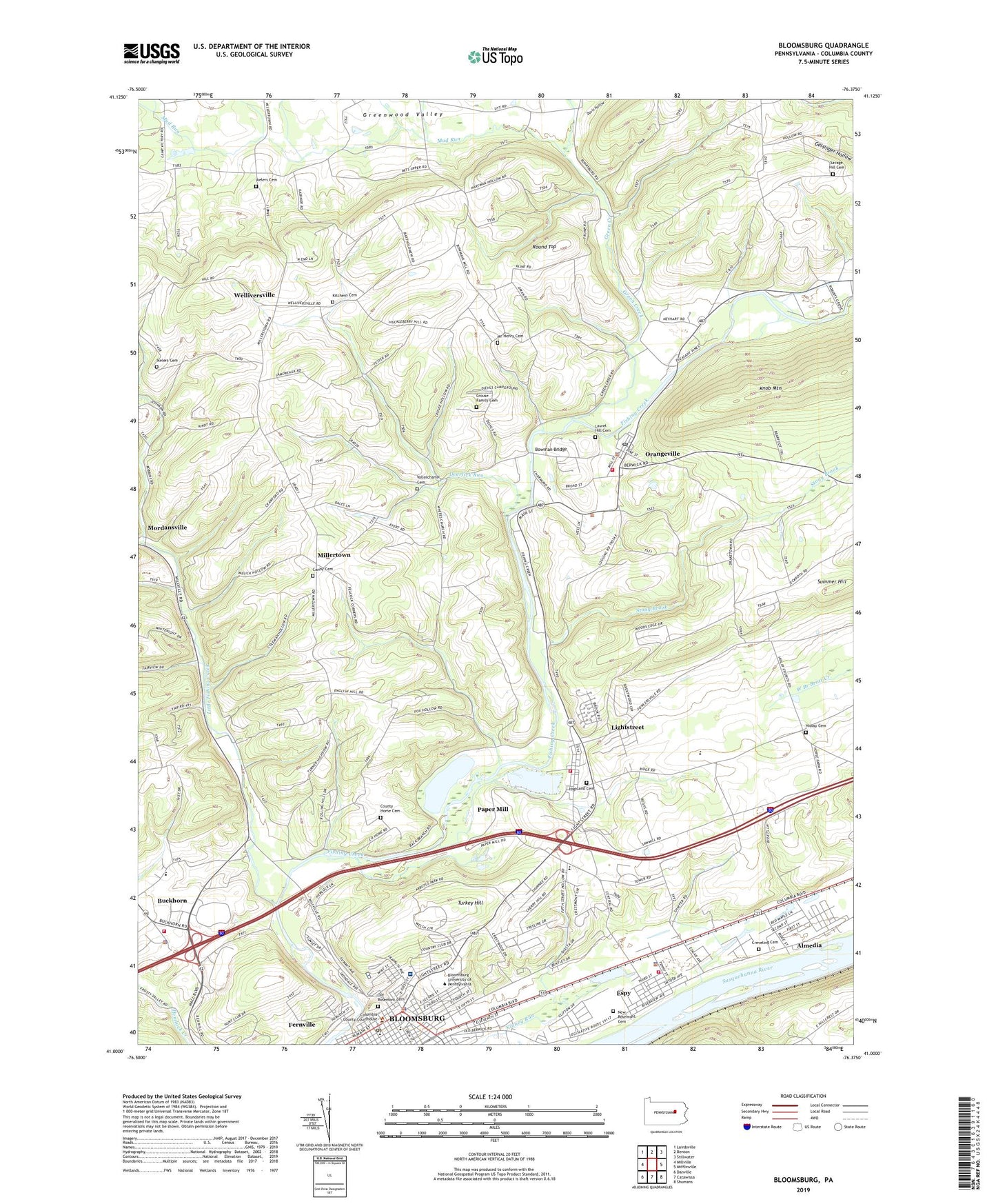
2023 topographic map quadrangle Bloomsburg in the state of Pennsylvania. Scale: 1:24000. Based on the newly updated USGS 7.5' US Topo map series, this map is in the following counties: Columbia. The map contains contour data, water features, and other items you are used to seeing on USGS maps, but also has updated roads and other features. This is the next generation of topographic maps. Printed on high-quality waterproof paper with UV fade-resistant inks.
Quads adjacent to this one:
West: Millville
Northwest: Lairdsville
North: Benton
Northeast: Stillwater
East: Mifflinville
Southeast: Shumans
South: Catawissa
Southwest: Danville
This map covers the same area as the classic USGS quad with code o41076a4.
Contains the following named places: Almedia, Almedia Census Designated Place, Bakeless Center for the Humanities, Benjamin Franklin Hall, Bloomsburg, Bloomsburg Hospital, Bloomsburg Post Office, Bloomsburg University of Pennsylvania, Bloomsburg Volunteer Ambulance Station 60, Borough of Orangeville, Bowman Bridge, Buckhorn Census Designated Place, Buckhorn Community Volunteer Fire Company Station 160, Buckingham Maintence Center, Camp Creasy, Canby Cemetery, Canby Church, Carrol Park, Charles Buckalew Place, Columbia County, Columbia County Sheriff's Office, Columbia Residence Hall, County Home Cemetery, Creveling Cemetery, Crouse Family Cemetery, Davis Hollow, Deerlick Run, Diana Van Fleet Mitchell House, Douglas Hippenstiel Fenstemaker Alumni House, Ed and Dicks Airport, Elna H Nelson Field House, Elwell Residence Hall, Espy, Espy Census Designated Place, Espy Fire Company Station 180, Fernville, Fernville Census Designated Place, Fernville Volunteer Fire Company, Forks School, Green Creek, Greenwood Valley, Gross Auditorium, Harrts Run, Hartline Science Center, Harvey A Andruss Library, Hass Center for the Arts, Henry Carver Hall, Hidlay Cemetery, Hidlay Church, Highland Cemetery, Ikeler Church, Ikelers Cemetery, Irondale Dam, James H McCormick Center for Human Services, Jan Hutchinson Field, Kitchens Cemetery, Laurel Hill Cemetery, Light Street, Lightstreet Census Designated Place, Lightstreet Community Fire Company Station 190, Little Fishing Creek, Litwhiler Field, Luzerne Residence Hall, Lycoming Residence Hall, Marco and Louise Mitrani Hall, Marquerite W Kehr Union Building, Mc Henry Cemetery, Millertown, Montgomery Place Apartments, Montour Residence Hall, Monty's, Mordansville, Mount Olympus Apartments, Mud Run, Navy Hall, New Rosemont Cemetery, North Centre, Northumberland Residence Hall, Old Rosemont Cemetery, Old Science Hall, Orangeville, Orangeville Borough Police Department, Orangeville Community Fire Company Station 280, Orangeville Post Office, Paper Mill, Robert B Redman Stadium, Round Top, Savage Hill Cemetery, Schylkill Residence Hall, Sky View Acres, State Teachers College, Stony Brook, Student Residence Center, Summer Hill, Sutliff Hall, Town of Bloomsburg, Township of Mount Pleasant, Township of Orange, Township of Scott, Turkey Hill, Vallerchamp Cemetery, Waller Administration Building, Walter Simon Hall, Warren Student Services Center, WCNR-AM (Bloomsburg), Welliversville, William W Scranton Commons, ZIP Codes: 17815, 17859