MyTopo
Lairdsville Pennsylvania US Topo Map
Couldn't load pickup availability
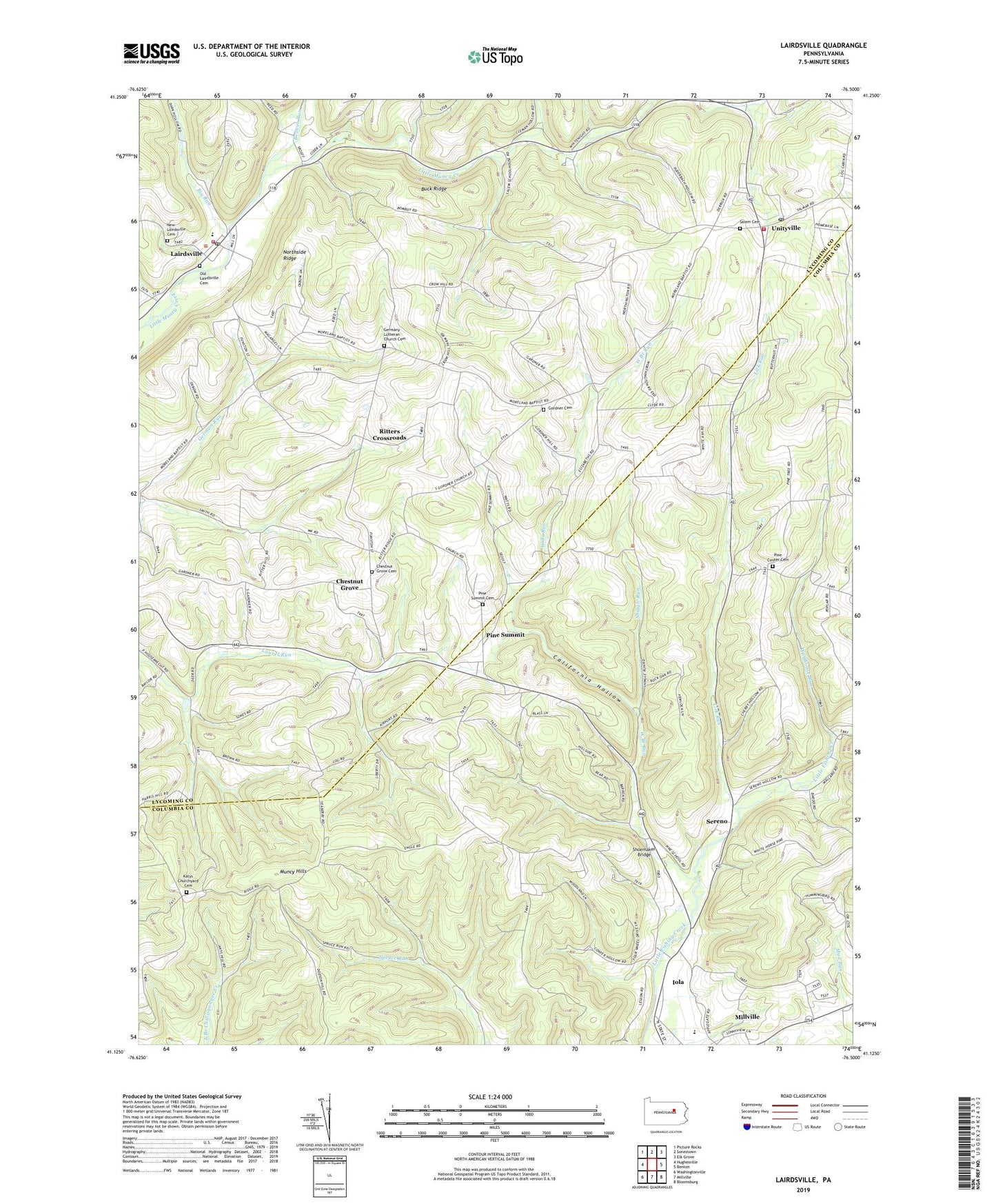
2023 topographic map quadrangle Lairdsville in the state of Pennsylvania. Scale: 1:24000. Based on the newly updated USGS 7.5' US Topo map series, this map is in the following counties: Columbia, Lycoming. The map contains contour data, water features, and other items you are used to seeing on USGS maps, but also has updated roads and other features. This is the next generation of topographic maps. Printed on high-quality waterproof paper with UV fade-resistant inks.
Quads adjacent to this one:
West: Hughesville
Northwest: Picture Rocks
North: Sonestown
Northeast: Elk Grove
East: Benton
Southeast: Bloomsburg
South: Millville
Southwest: Washingtonville
This map covers the same area as the classic USGS quad with code o41076b5.
Contains the following named places: A T A Memorial White Waltham Airport, Beaver Run, Big Run, Buck Ridge, California Hollow, Chestnut Grove, Chestnut Grove Cemetery, Chestnut Grove School, Derr Run, Gardner School, Germany Church, Germany Lutheran Church Cemetery, Gordner Cemetery, Iola, Iola Census Designated Place, Katys Churchyard Cemetery, Lairdsville, Lairdsville Community Volunteer Fire Company Station 27, Lairdsville Post Office, Lick Run, Little Indian Run, Muney Church, New Lairdsville Cemetery, Northside Ridge, Old Lairdsville Cemetery, Pine Center Cemetery, Pine Center Church, Pine School, Pine Summit, Pine Summit Cemetery, Pine Summit Church, Renn School, Ritters Crossroads, Saint Johns Church, Salem Cemetery, Salem Church, Sereno, Shingle Run, Shoemaker Bridge, Star School, State Game Lands Number 226, Sterenouville, Township of Franklin, Township of Jordan, Township of Pine, Unityville, Unityville Post Office, Unityville Volunteer Fire Company Station 32, Van Dine Church, West Branch Run, Wolfhouse Run, ZIP Codes: 17742, 17846