MyTopo
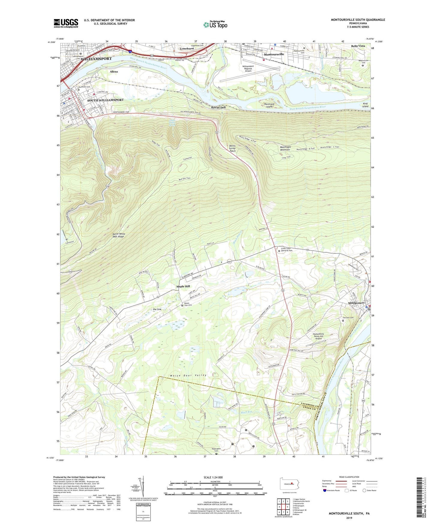
Montoursville South Pennsylvania US Topo Map
Couldn't load pickup availability
2019 topographic map quadrangle Montoursville South in the state of Pennsylvania. Scale: 1:24000. Based on the newly updated USGS 7.5' US Topo map series, this map is in the following counties: Lycoming, Union, Northumberland. The map contains contour data, water features, and other items you are used to seeing on USGS maps, but also has updated roads and other features. This is the next generation of topographic maps. Printed on high-quality waterproof paper with UV fade-resistant inks.
Quads adjacent to this one:
West: Williamsport
Northwest: Cogan Station
North: Montoursville North
Northeast: Huntersville
East: Muncy
Southeast: Milton
South: Allenwood
Southwest: Williamsport SE
Contains the following named places: Allens, Allenwood Prison Camp, Alvira, Basin Street Shopping Center, Bella Vista, Bennetts Run, Bishop Frances Asbury Hall, Bishop Neumann High School, Black Hole Creek, Black Hole Creek Park, Black Run, Borough of Montoursville, Central School, Citizens Fire Company 2, Clarke Chapel, Clarke Music Building, Clinton Township Volunteer Fire Company Station 12, Devils Turnip Patch, Fairview Cemetery, Faxon, Federal Correctional Institution Allenwood Low, Federal Correctional Institution Allenwood Medium, First Christian Church, Frank E Heller Dam, Fritz, Gibson Hollow Spring, Green Lawn Memorial Park, Gregg Township Office, Hackenburg-Penny Hill Airport, Hagermans Run, Honors Hall, J Milton Skeath Hall, Jefferson School, John Wesley Hall, Laurel Ridge School, Little League Baseball Headquarters and Museum, Long Hall Administrative Offices, Loyal Plaza Shopping Center, Loyalsock, Loyalsock Creek, Lycoming College, Lycoming Valley Baptist Church, Lymehurst, Lynch Farm, Maple Hill, Mass Communication Building, Millers Run, Montgomery, Montgomery Borough Police Department, Montgomery Post Office, Montgomery Volunteer Fire Company Station 13, Montoursville Cemetery, Montoursville Post Office, Montoursville Volunteer Fire Department Station 20, Mount Zion Cemetery, Mount Zion Church, Mountain Grove School, Mountainview Junior Academy, Muncy Point Trail, National Center for Little League Baseball, New Covenant Assembly Church, Nicely School, Oak Grove School, Pennsylvania Department of Conservation and Natural Resources District 12 Tiadaghton Forest, Pennsylvania State Police Troop F Headquarters and Montoursville Station, Peter Buck Trail, Pikes Peak School, Pine Street School, Racetrack Island, Resurrection Cemetery, Rocktown Cemetery, Russell School, Shaffers Path Lookout Tower, Shaffers Trail, Somerset School, South Williamsport, South Williamsport Fire Department Station 5, South Williamsport Police Department, State Game Lands Number 252, Stone Church, Sylvan Dell, The Gut, The Sink, Township of Brady, Township of Clinton, United States Penitentiary Allenwood, Wadham Creek Dam, Washington Presbyterian Church Cemetery, West Company Heliport, Williamsport Cemetery, Williamsport Regional Airport, Williamsport Regional Airport Fire Department Station 19, WILQ-FM (Williamsport), WKSB-FM (Williamsport), WLYC-AM (Williamsport), WMPT-AM (South Williamsport), WMPT-FM (South Williamsport), WRLC-FM (Williamsport), ZIP Codes: 17752, 17887