MyTopo
Huntersville Pennsylvania US Topo Map
Couldn't load pickup availability
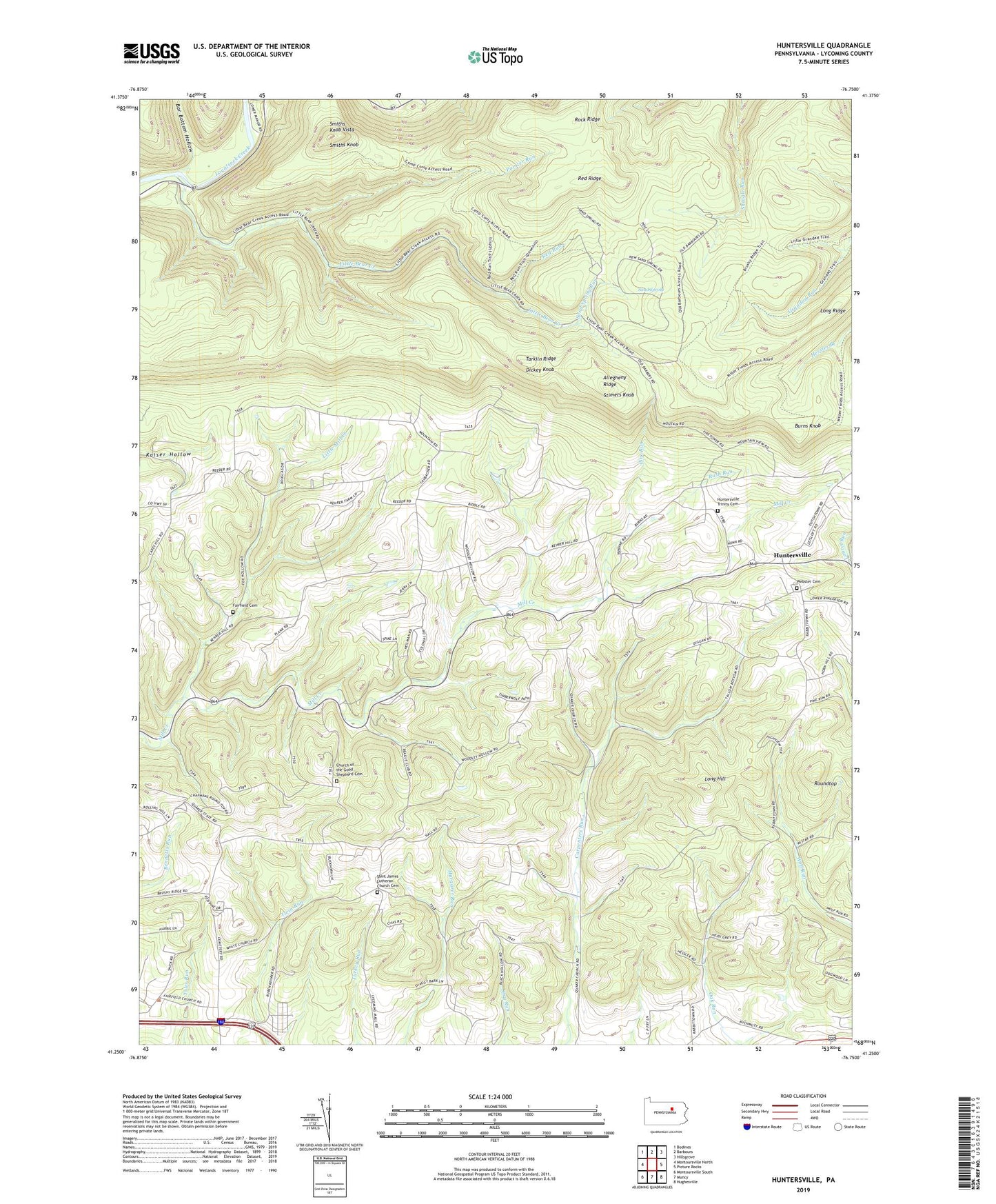
2023 topographic map quadrangle Huntersville in the state of Pennsylvania. Scale: 1:24000. Based on the newly updated USGS 7.5' US Topo map series, this map is in the following counties: Lycoming. The map contains contour data, water features, and other items you are used to seeing on USGS maps, but also has updated roads and other features. This is the next generation of topographic maps. Printed on high-quality waterproof paper with UV fade-resistant inks.
Quads adjacent to this one:
West: Montoursville North
Northwest: Bodines
North: Barbours
Northeast: Hillsgrove
East: Picture Rocks
Southeast: Hughesville
South: Muncy
Southwest: Montoursville South
This map covers the same area as the classic USGS quad with code o41076c7.
Contains the following named places: Allegheny Ridge, Bar Bottom Hollow, Burns Knob, Bushy Ridge Trail, Camp Conley, Church of the Good Shepherd, Church of the Good Shepherd Cemetery, Dewey Corner, Dickey Knob, Fairfield Cemetery, Fairfield Center, Fairfield Church, Fox Hollow Church, Graff Woolever Trail, Grandad Trail, Heilman Church, Huntersville, Huntersville Trinity Cemetery, Jordan Trail, Little Bear Creek, Little Grandad Run Trail, Little Mill Creek, Long Hill, Long Ridge, Long Ridge Lookout Tower, Miller Trail, Painter Run, Painter Trail, Peters Path, Pine Run, Red Ridge, Red Ridge Trail, Red Run, Rock Ridge, Roundtop, Rush Run, Saint James Church, Saint James Lutheran Church Cemetery, Sand Spring, Sand Spring Run, Smiths Knob, Smiths Knob Vista, Stimets Knob, Tarkiln Ridge, Township of Fairfield, Township of Mill Creek, Township of Muncy, Township of Upper Fairfield, Webster Cemetery, ZIP Code: 17701