
MyTopo
Morris Pennsylvania US Topo Map
Couldn't load pickup availability
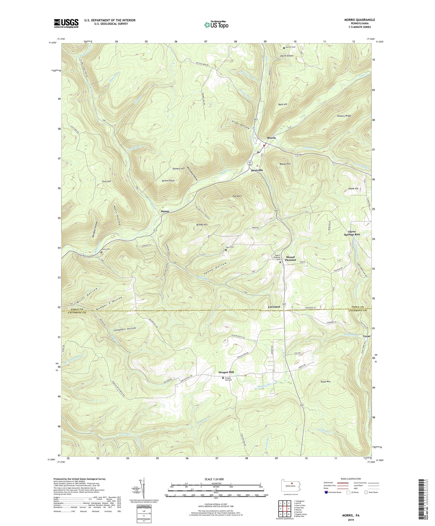
2019 topographic map quadrangle Morris in the state of Pennsylvania. Scale: 1:24000. Based on the newly updated USGS 7.5' US Topo map series, this map is in the following counties: Tioga, Lycoming. The map contains contour data, water features, and other items you are used to seeing on USGS maps, but also has updated roads and other features. This is the next generation of topographic maps. Printed on high-quality waterproof paper with UV fade-resistant inks.
Quads adjacent to this one:
West: Cedar Run
Northwest: Tiadaghton
North: Antrim
Northeast: Cherry Flats
East: Nauvoo
Southeast: White Pine
South: English Center
Southwest: Cammal
Contains the following named places: Antrim Cemetery, Ayers Hollow, Bald Hill, Basswood Run, Black Run, Blacks Hill, Brill Hollow, Brooks Hill, Brooks Hill Hollow, Brown Point, Campbell Hollow, Crawford Fire Tower, Custard Run, Devils Elbow, Dixie Run, Doane, East Branch Stony Fork, Fork Hill, Fork Hill Trail, Fry Fork, Harrison Run, Horn Cemetery, Hoytville, Hughes Run, Lewis Cemetery, Long Run, Lorenton, McCluskey Hollow, Morris, Morris Post Office, Morris Township Fire and Ambulance Company, Mount Pleasant, Mount Pleasant Cemetery, Number 2 Hollow, Opossum Run, Oregon Hill, Oregon Hill Airport, Oregon Hill Cemetery, Paint Run, Plank Hill, Rattler Run, Rock Run, Roland Run, Ski Sawmill Ski Area, Skunk Hollow, Slide Hollow, State Game Lands Number 268, Stone Quarry Trail, Stony Fork, Stony Fork Picnic Area, Tannery Hill, Tannery Hill Trail, Texas, Texas Mountain, The Horn, Three Springs Run, Township of Morris, Tumbling Run, West Branch Stony Fork, West Branch Trail, Wilcox Run, Williams Trail, Wilson Creek, Windfall Hollow, Zimmerman Creek, ZIP Code: 16938


