MyTopo
Cherry Flats Pennsylvania US Topo Map
Couldn't load pickup availability
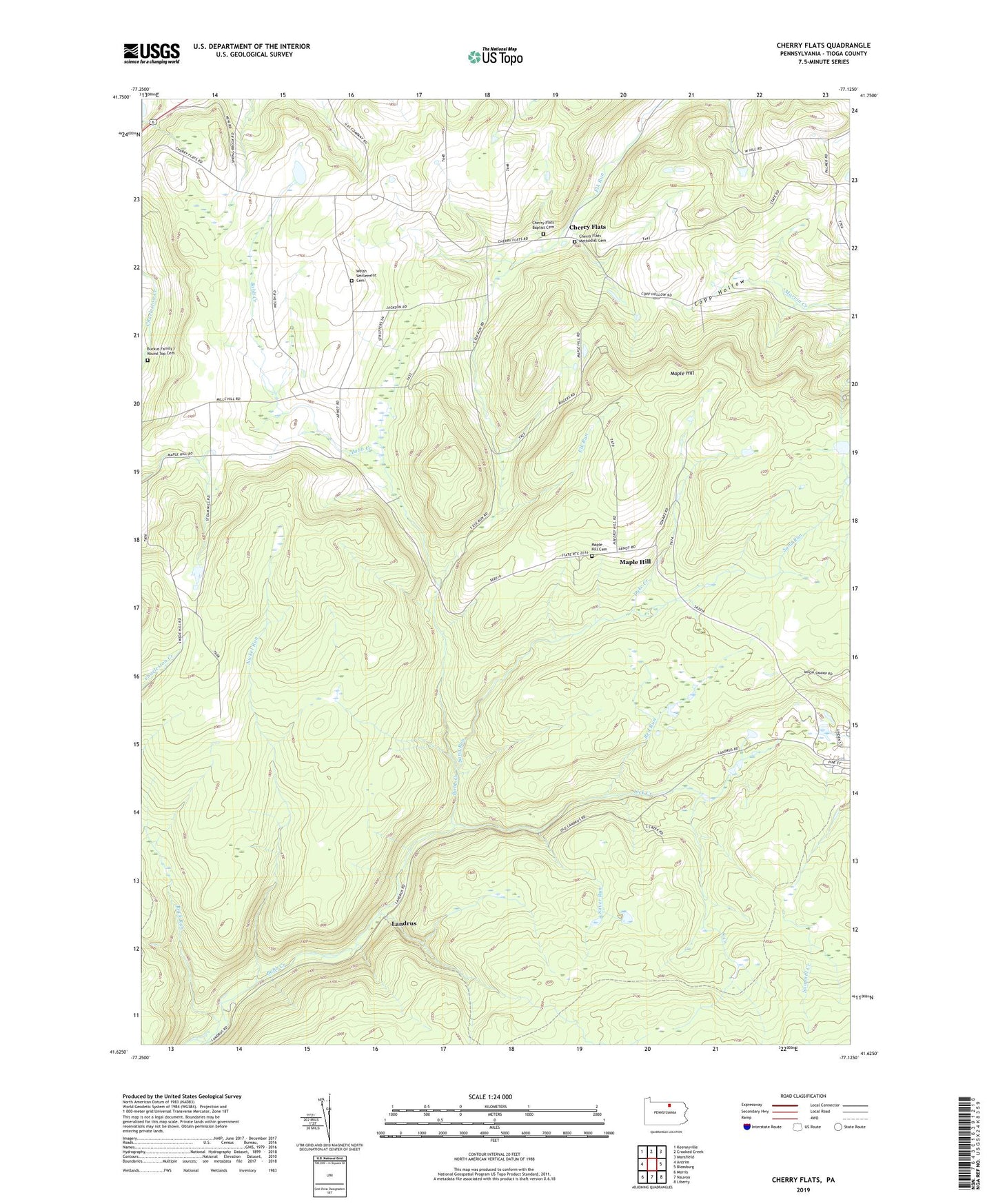
2023 topographic map quadrangle Cherry Flats in the state of Pennsylvania. Scale: 1:24000. Based on the newly updated USGS 7.5' US Topo map series, this map is in the following counties: Tioga. The map contains contour data, water features, and other items you are used to seeing on USGS maps, but also has updated roads and other features. This is the next generation of topographic maps. Printed on high-quality waterproof paper with UV fade-resistant inks.
Quads adjacent to this one:
West: Antrim
Northwest: Keeneyville
North: Crooked Creek
Northeast: Mansfield
East: Blossburg
Southeast: Liberty
South: Nauvoo
Southwest: Morris
This map covers the same area as the classic USGS quad with code o41077f2.
Contains the following named places: Cherry Flats, Cherry Flats Baptist Cemetery, Cherry Flats Methodist Cemetery, Culver School, Dyke Creek, Fisher Trail, Hi Line Lodge Airport, Klondike, Landrus, Lick Creek, Maple Hill, Maple Hill Cemetery, Maple Hill Fire Tower, Maple Hill School, Nickel Run, Red Run, Round Top Cemetery, Sand Run, Silver Run, South Creek, Township of Bloss, Welsh Settlement Cemetery, Welsh Settlement Church, ZIP Code: 16911