MyTopo
Antrim Pennsylvania US Topo Map
Couldn't load pickup availability
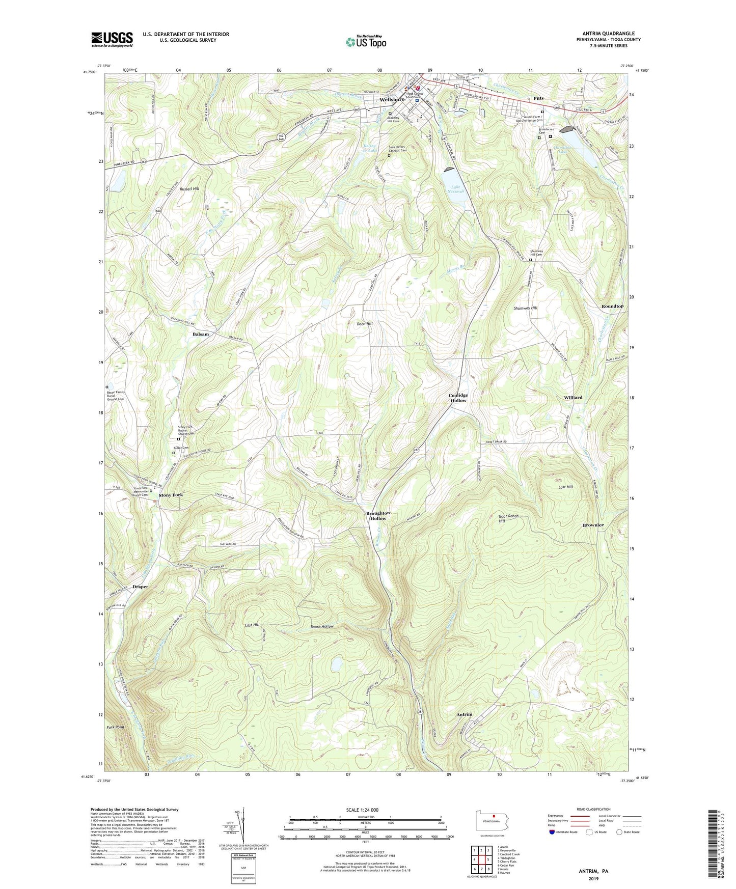
2023 topographic map quadrangle Antrim in the state of Pennsylvania. Scale: 1:24000. Based on the newly updated USGS 7.5' US Topo map series, this map is in the following counties: Tioga. The map contains contour data, water features, and other items you are used to seeing on USGS maps, but also has updated roads and other features. This is the next generation of topographic maps. Printed on high-quality waterproof paper with UV fade-resistant inks.
Quads adjacent to this one:
West: Tiadaghton
Northwest: Asaph
North: Keeneyville
Northeast: Crooked Creek
East: Cherry Flats
Southeast: Nauvoo
South: Morris
Southwest: Cedar Run
This map covers the same area as the classic USGS quad with code o41077f3.
Contains the following named places: Academy Hill Cemetery, Antrim, Bacon Family Burial Ground Cemetery, Balsam, Boose Hollow, Borough of Wellsboro, Boyden Brook, Broadacres Cemetery, Broughton Hollow, Brownlee, Coolidge Hollow, Dean Hill, Draper, Duncan, East Hill, Fork Point, Goat Ranch Hill, Hamilton Lake, Hamilton Lake Dam, Heise Run School, Hoover Brook, Johnson Run, Kelsey Creek Dam Pa-600, Kelsey Creek Lake, Lake Nessmuk, Lake Nessmuk Dam, Lost Hill, Mount Zion Church, Old Charleston Cemetery, Pitts, Roundtop, Roundtop Church, Russell Hill, Saint Peter's Cemetery, Sand Run, Shumway Hill, Shumway Hill Cemetery, Stony Fork, Stony Fork Baptist Church Cemetery, Stony Fork Butler Family Cemetery, Stony Fork Mennonite Church Cemetery, Tioga County Jail, Tioga County Sheriff's Office, Township of Delmar, Township of Duncan, UPMC Wellsboro Hospital, Wellsboro, Wellsboro Borough Police Department, Wellsboro Country Club, Wellsboro Fire Department, Wellsboro Firemen's EMS, WGCR-FM (Wellsboro), Williard, WNBT-AM (Wellsboro), ZIP Code: 16901