MyTopo
English Center Pennsylvania US Topo Map
Couldn't load pickup availability
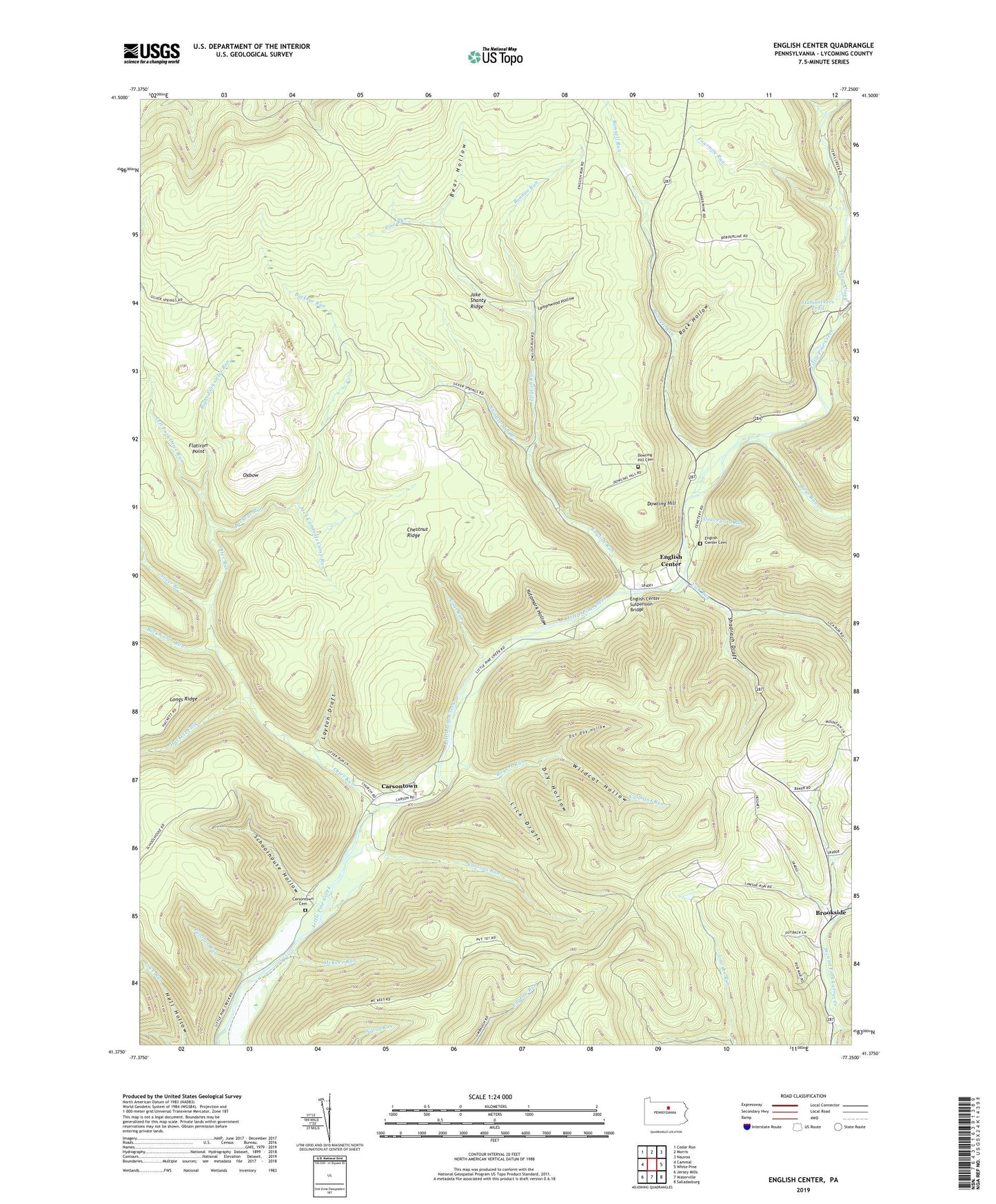
2023 topographic map quadrangle English Center in the state of Pennsylvania. Scale: 1:24000. Based on the newly updated USGS 7.5' US Topo map series, this map is in the following counties: Lycoming. The map contains contour data, water features, and other items you are used to seeing on USGS maps, but also has updated roads and other features. This is the next generation of topographic maps. Printed on high-quality waterproof paper with UV fade-resistant inks.
Quads adjacent to this one:
West: Cammal
Northwest: Cedar Run
North: Morris
Northeast: Nauvoo
East: White Pine
Southeast: Salladasburg
South: Waterville
Southwest: Jersey Mills
This map covers the same area as the classic USGS quad with code o41077d3.
Contains the following named places: Bannan Run, Bark Cabin Run, Bear Hollow, Bear Run, Blockhouse Creek, Bonnell Run, Brookside, Buckeye Run, Callhans Run, Carsons Run, Carsontown, Carsontown Cemetery, Chestnut Ridge, Coal Run, Dan Day Hollow, Dowling Hill, Dowling Hill Cemetery, Dry Hollow, English, English Center, English Center Cemetery, English Center Suspension Bridge, English Run, Flatiron Point, Fourmile Run, Graveyard Run, Hackett Fork, Jack Cammals Camp Run, Jake Shanty Ridge, Layton Draft, Left Fork Otter Run, Lick Draft, Lick Run, Little Pine Airport, Little Pine State Park, Long Point Trail, Longs Ridge, Love Run Trail, Lymanwood Hollow, McKees Run, Otter Run, Oxbow, Panther Run, Panther Run Trail, Pine Run, Rank Hollow Trail, Right Fork Otter Run, Rock Hollow, Rogers Run, Schoolhouse Hollow, Shadrach Draft, Shingle Mill Branch, Silver Branch, Smith Run, Stahineckers Pond, State Game Lands Number 75, Texas Creek, Township of Pine, Wildcat Hollow, Wolf Run, Yutamark Hollow, ZIP Code: 17776