MyTopo
Muncy Pennsylvania US Topo Map
Couldn't load pickup availability
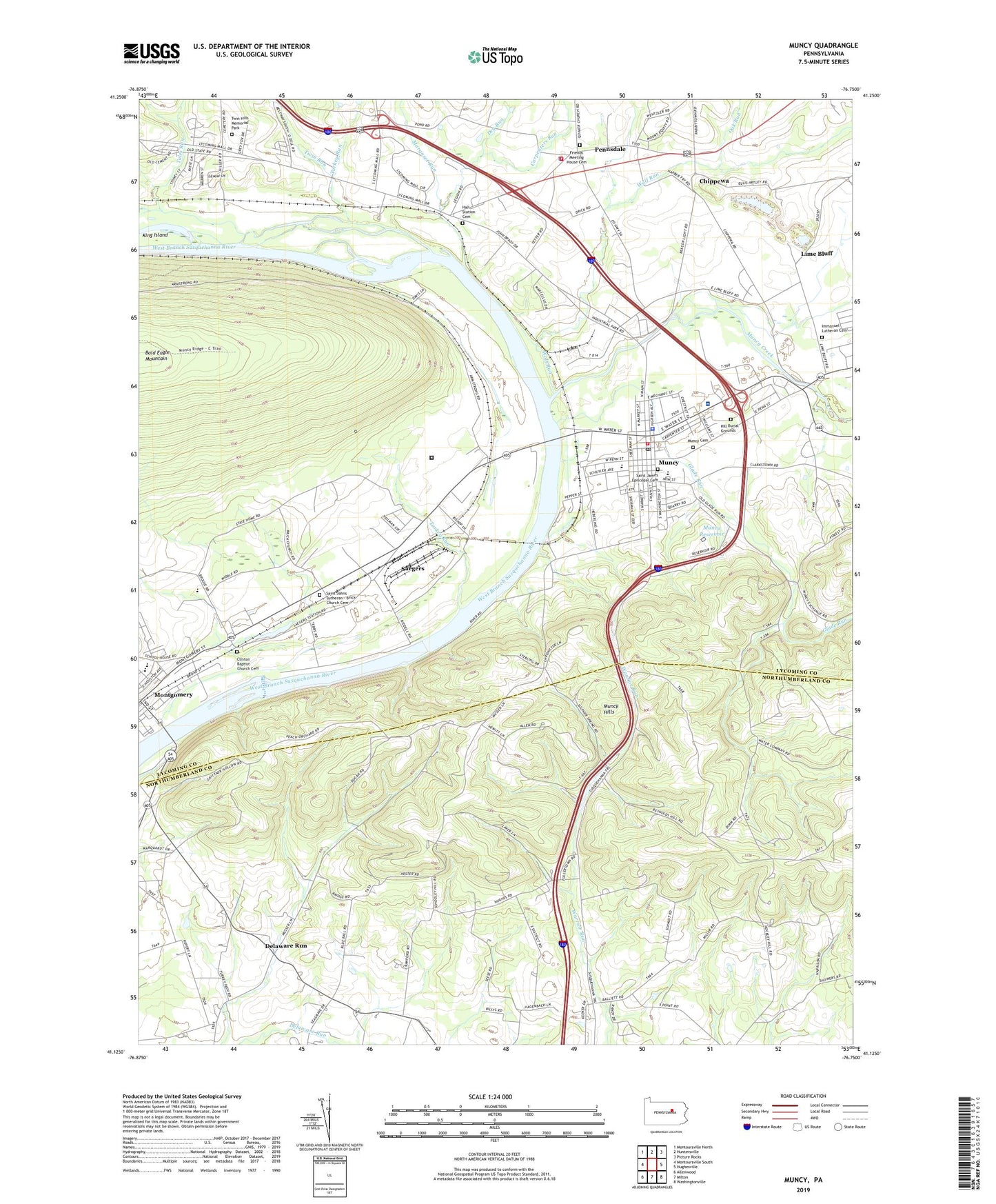
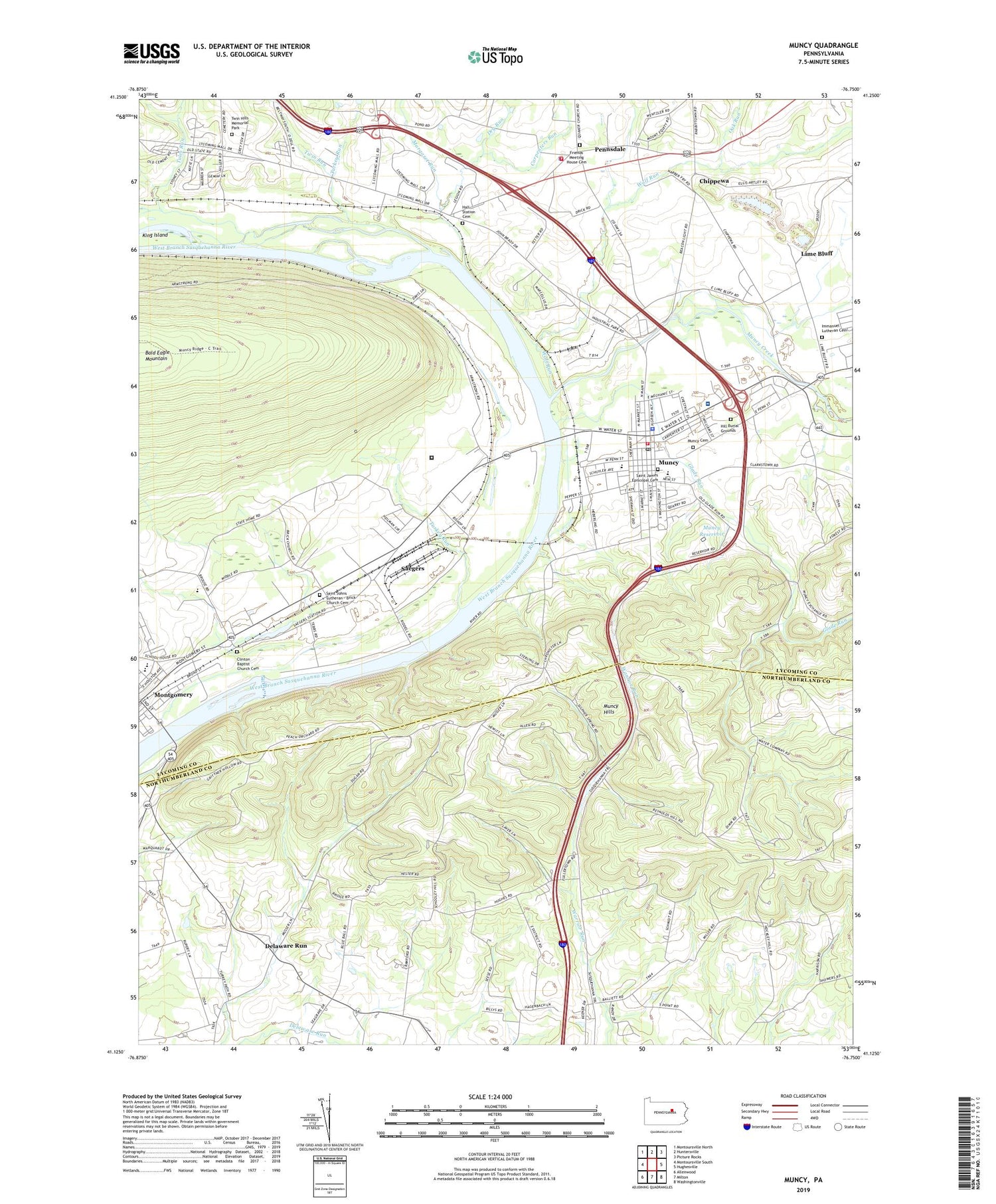
2019 topographic map quadrangle Muncy in the state of Pennsylvania. Scale: 1:24000. Based on the newly updated USGS 7.5' US Topo map series, this map is in the following counties: Lycoming, Northumberland. The map contains contour data, water features, and other items you are used to seeing on USGS maps, but also has updated roads and other features. This is the next generation of topographic maps. Printed on high-quality waterproof paper with UV fade-resistant inks.
Quads adjacent to this one:
West: Montoursville South
Northwest: Montoursville North
North: Huntersville
Northeast: Picture Rocks
East: Hughesville
Southeast: Washingtonville
South: Milton
Southwest: Allenwood
Contains the following named places: Borough of Montgomery, Borough of Muncy, Carpenters Run, Chippewa, Clinton Baptist Church Cemetery, Davis School, Delaware Run, Dividing Ridge School, Dry Run, Fairview School, Friends Meeting House Cemetery, Glade Run, Glade Run School, Hall Station Cemetery, Halls, Halls Station, Hey Field, Hill Burial Grounds, Immanuel Church, Immanuel Lutheran Cemetery, King Island, Lime Bluff, Lime Bluff Quarry, Margaret Run, Mountain School, Muncy, Muncy Area Volunteer Fire Company Station 23, Muncy Borough Police Department, Muncy Cemetery, Muncy Industrial Home for Women, Muncy Post Office, Muncy Reservoir, Muncy Station, Muncy Valley Hospital, Oak Run, Pennsdale, Pennsdale Volunteer Fire Department, Pilgrim Church, Pleasant View Church, Road School, Saegers, Saint James Episcopal Cemetery, Saint Johns Church, Saint Johns Lutheran - Brick Church Cemetery, State Correctional Institution Muncy, Stony Batter School, Township of Muncy Creek, Trinity Church, Tules Run, Turkey Run, Twin Hills Memorial Park, Twin Run, Warrior School, West Point School, Wolf Run