MyTopo
Picture Rocks Pennsylvania US Topo Map
Couldn't load pickup availability
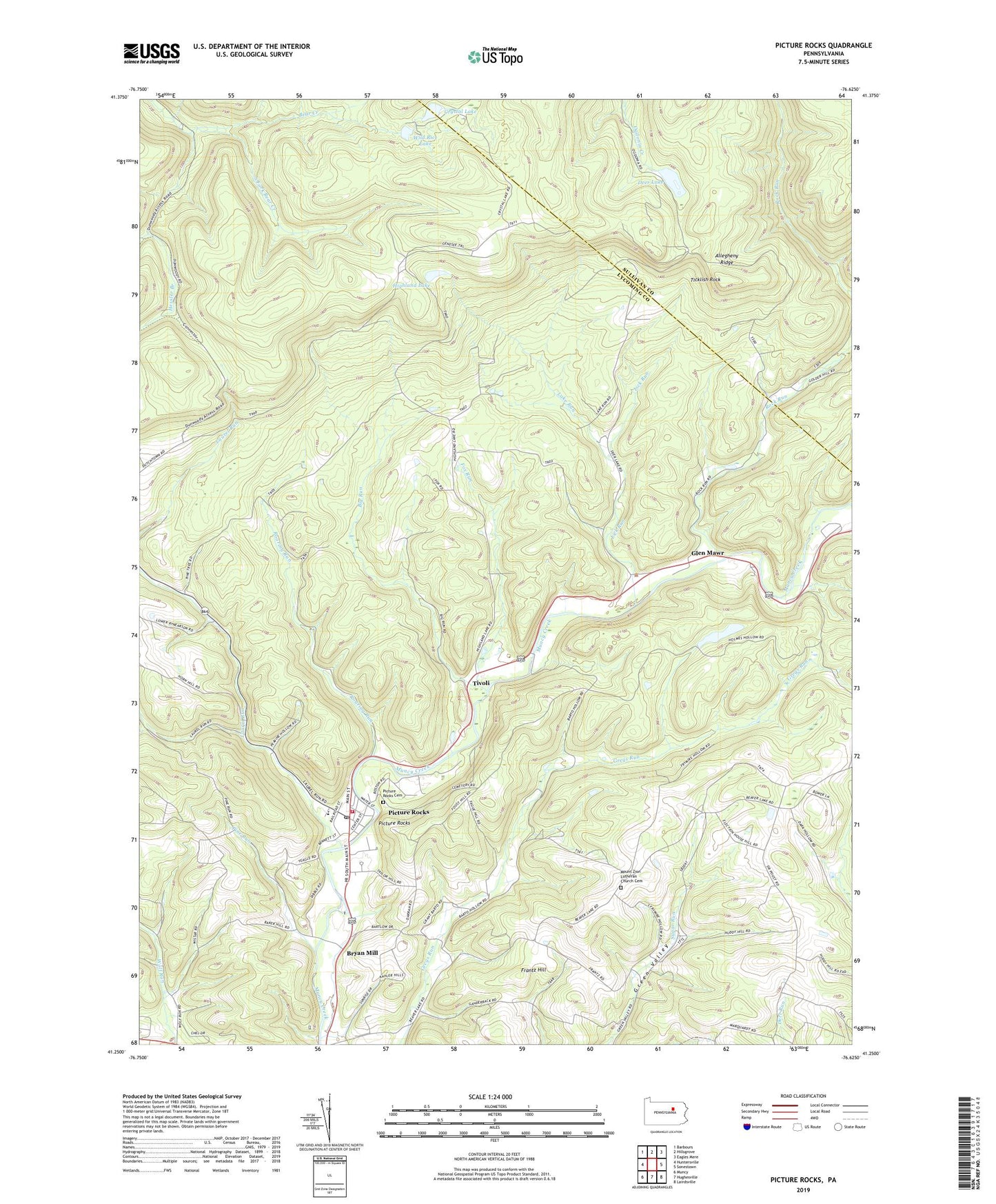
2023 topographic map quadrangle Picture Rocks in the state of Pennsylvania. Scale: 1:24000. Based on the newly updated USGS 7.5' US Topo map series, this map is in the following counties: Lycoming, Sullivan. The map contains contour data, water features, and other items you are used to seeing on USGS maps, but also has updated roads and other features. This is the next generation of topographic maps. Printed on high-quality waterproof paper with UV fade-resistant inks.
Quads adjacent to this one:
West: Huntersville
Northwest: Barbours
North: Hillsgrove
Northeast: Eagles Mere
East: Sonestown
Southeast: Lairdsville
South: Hughesville
Southwest: Muncy
This map covers the same area as the classic USGS quad with code o41076c6.
Contains the following named places: Bethel Church, Big Run, Borough of Picture Rocks, Bryan Mill, Camp Genesee, Crystal Lake, Deer Lake, Dunwoody Camp, Ebenezer Church, Fox Run, Frantz Hill, Frantz School, Glen Mawr, Grandad Run, Hessler Branch, Highland Lake, Lake Run, Laurel Run, Lick Run, Mapleton Church, Maurglen Post Office, Mill Race, Mount Zion Church, Mount Zion Lutheran Church Cemetery, Mud Lake, Picture Rocks, Picture Rocks Cemetery, Picture Rocks Post Office, Picture Rocks Volunteer Fire Department Station 26, Pine Run, Roaring Run, Rock Run, Rock Run Church, South Fork Bear Creek, Springhill Trail, Ticklish Rock, Tivoli, Township of Penn, Township of Shrewsbury, Township of Wolf, Villa Grove, Villa Grove School, Wild Rice Lake, ZIP Codes: 17737, 17762