MyTopo
Plumville Pennsylvania US Topo Map
Couldn't load pickup availability
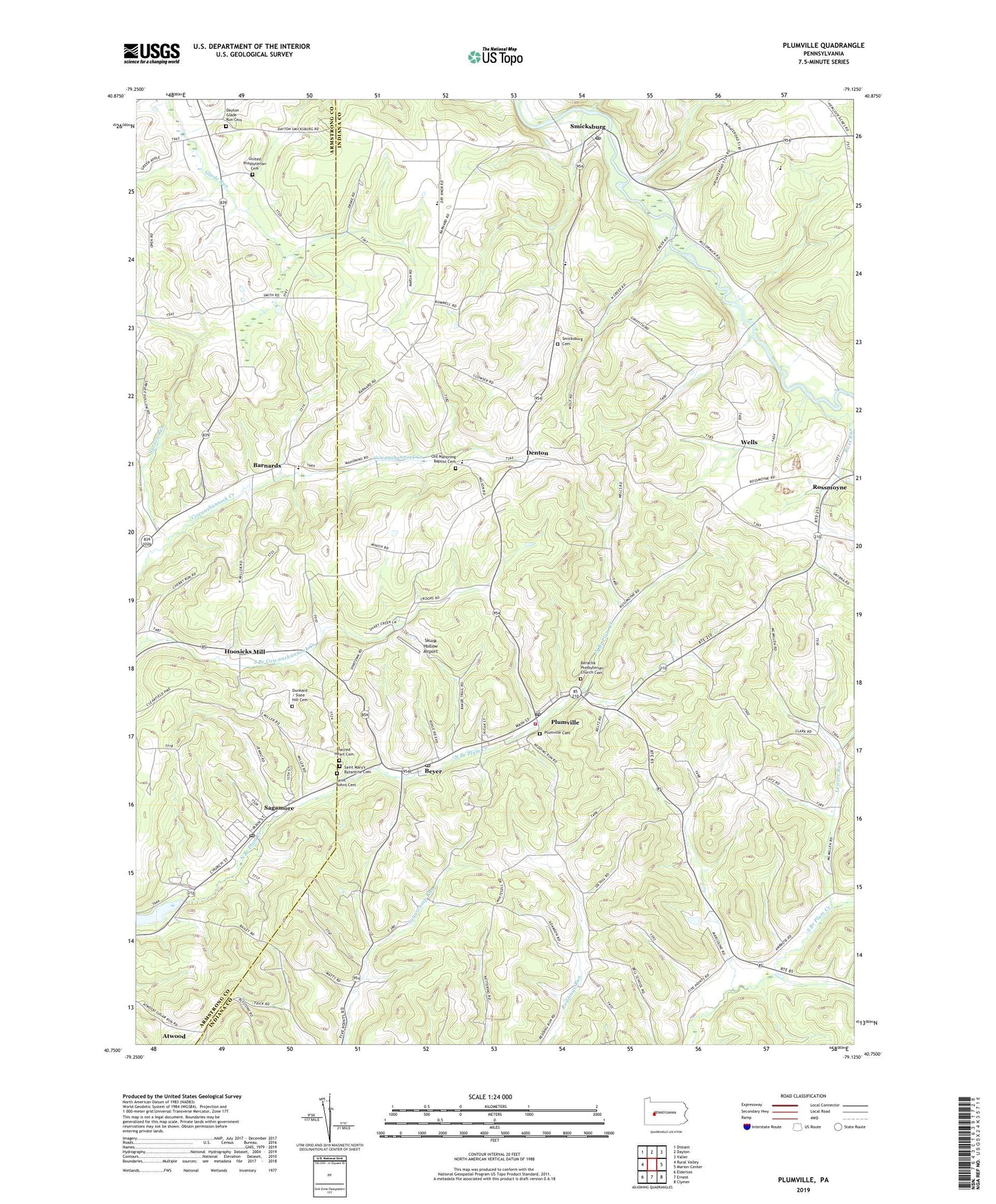
2019 topographic map quadrangle Plumville in the state of Pennsylvania. Scale: 1:24000. Based on the newly updated USGS 7.5' US Topo map series, this map is in the following counties: Indiana, Armstrong. The map contains contour data, water features, and other items you are used to seeing on USGS maps, but also has updated roads and other features. This is the next generation of topographic maps. Printed on high-quality waterproof paper with UV fade-resistant inks.
Quads adjacent to this one:
West: Rural Valley
Northwest: Distant
North: Dayton
Northeast: Valier
East: Marion Center
Southeast: Clymer
South: Ernest
Southwest: Elderton
Contains the following named places: Allison School, Barnard Post Office, Barnards, Beracha Presbyterian Church Cemetery, Beyer, Beyer Post Office, Borland School, Borough of Plumville, Borough of Smicksburg, Citizens Ambulance Service Plumsville Station 30, Crossroads School, Davis School, Dayton Glade Run Cemetery, Denton, Dormition of Saint Mary Cemetery, East Plumville, Flat School, Glade Run Church, Holiness Church, Hoosicks Mill, Leisure Run, Mahoning Church, Mahoning Creek Lake, Old Mahoning Baptist Cemetery, Ox Hill School, Plumville, Plumville Cemetery, Plumville District Volunteer Fire Department Station 350, Plumville Post Office, Ross Run, Rossmoyne, Sacred Heart Cemetery, Sagamore, Sagamore Post Office, Saint John Lutheran Cemetery, Skunk Hollow Airport, Slate Hill Cemetery, Smicksburg, Smicksburg Cemetery, Smicksburg Post Office, Spruce Run, Township of South Mahoning, Township of West Mahoning, United Presbyterian Cemetery, Wells, ZIP Codes: 15747, 16211, 16246, 16250, 16256