MyTopo
Rural Valley Pennsylvania US Topo Map
Couldn't load pickup availability
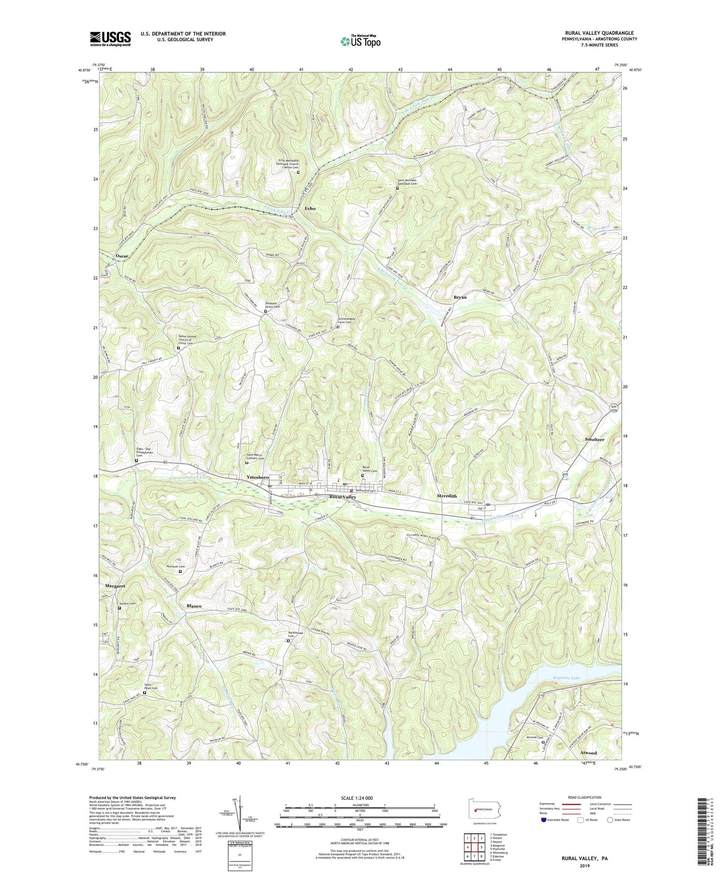
2023 topographic map quadrangle Rural Valley in the state of Pennsylvania. Scale: 1:24000. Based on the newly updated USGS 7.5' US Topo map series, this map is in the following counties: Armstrong. The map contains contour data, water features, and other items you are used to seeing on USGS maps, but also has updated roads and other features. This is the next generation of topographic maps. Printed on high-quality waterproof paper with UV fade-resistant inks.
Quads adjacent to this one:
West: Mosgrove
Northwest: Templeton
North: Distant
Northeast: Dayton
East: Plumville
Southeast: Ernest
South: Elderton
Southwest: Whitesburg
This map covers the same area as the classic USGS quad with code o40079g3.
Contains the following named places: Atwood, Atwood Cemetery, Blanco, Borough of Atwood, Borough of Rural Valley, Bryan, Craigs Run, Echo, Echo Methodist Episcopal Church Cemetery, Echo Post Office, Elgin - Old Presbyterian Cemetery, Green Oak, Harkleroad Cemetery, Huskins Run, Keystone Lake, Lumstead, Margaret, McIntosh Cemetery, Meredith, North Branch South Fork Pine Creek, North Star, Nu Mine Post Office, NuMine, Oscar, Pleasant Union Cemetery, Pleasant Union Church, Rose Valley, Rural Valley, Rural Valley Borough Police Department, Rural Valley Cemetery, Rural Valley Hose Company Station 210, Rural Valley Post Office, Saint Marys Catholic Cemetery, Saint Michaels Church, Saint Michaels Episcopal Cemetery, Saint Pauls Cemetery, Saint Pauls Church, Salem Church, Salem United Church of Christ Cemetery, Schrecengost Farm Cemetery, Shannock Valley Elementary School, Shannock Valley High School, Smeltzer, South Branch Cowanshannock Creek, South Branch South Fork Pine Creek, Sowers Cemetery, Township of Cowanshannock, Yatesboro, Yatesboro Post Office, ZIP Codes: 16222, 16244, 16249, 16263