MyTopo
Marion Center Pennsylvania US Topo Map
Couldn't load pickup availability
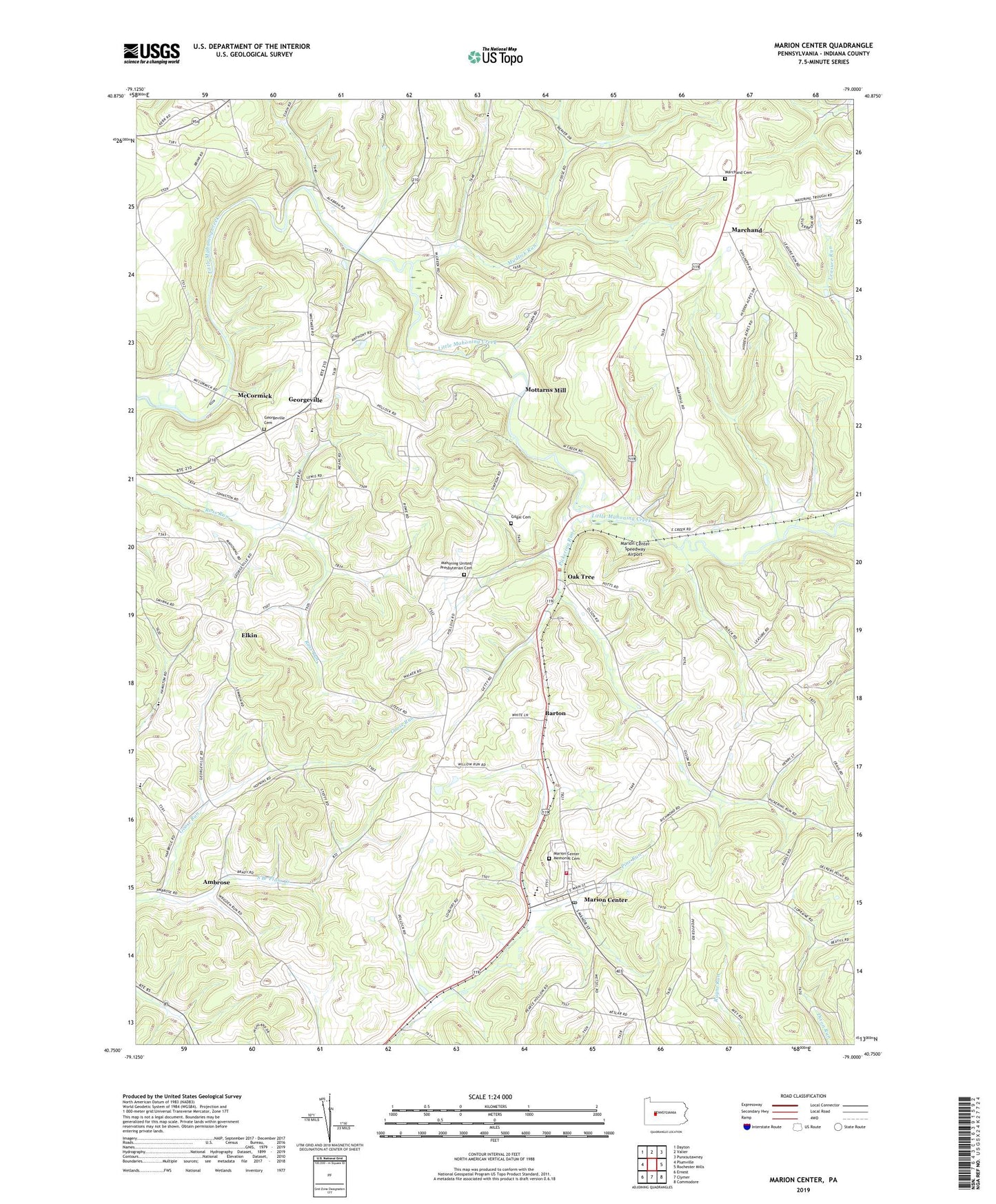
2023 topographic map quadrangle Marion Center in the state of Pennsylvania. Scale: 1:24000. Based on the newly updated USGS 7.5' US Topo map series, this map is in the following counties: Indiana. The map contains contour data, water features, and other items you are used to seeing on USGS maps, but also has updated roads and other features. This is the next generation of topographic maps. Printed on high-quality waterproof paper with UV fade-resistant inks.
Quads adjacent to this one:
West: Plumville
Northwest: Dayton
North: Valier
Northeast: Punxsutawney
East: Rochester Mills
Southeast: Commodore
South: Clymer
Southwest: Ernest
This map covers the same area as the classic USGS quad with code o40079g1.
Contains the following named places: Ambrose, Ambrose School, Anthony Airport, Barton, Borough of Marion Center, Brandon School, Covenanter Church, Dilts School, Elkin, Frantz, Georgeville, Georgeville Cemetery, Gilgal Cemetery, Gilgal Church, Goose Run, Lowman School, Mahoning Church, Mahoning School, Mahoning United Presbyterian Cemetery, Marchand, Marchand Cemetery, Marion Center, Marion Center Area Elementary School, Marion Center Area High School, Marion Center Memorial Cemetery, Marion Center Post Office, Marion Center Speedway, Marion Center Speedway Airport, Marion Center Volunteer Fire Department Station 190, McCormick, Mottarns Mill, Mudlick Run, Oak Tree, Pickering Run, Smyrna Church, Stuchell School, Township of East Mahoning, Township of North Mahoning, Trade City Station, White Oak School, ZIP Code: 15759