MyTopo
Rachelwood Pennsylvania US Topo Map
Couldn't load pickup availability
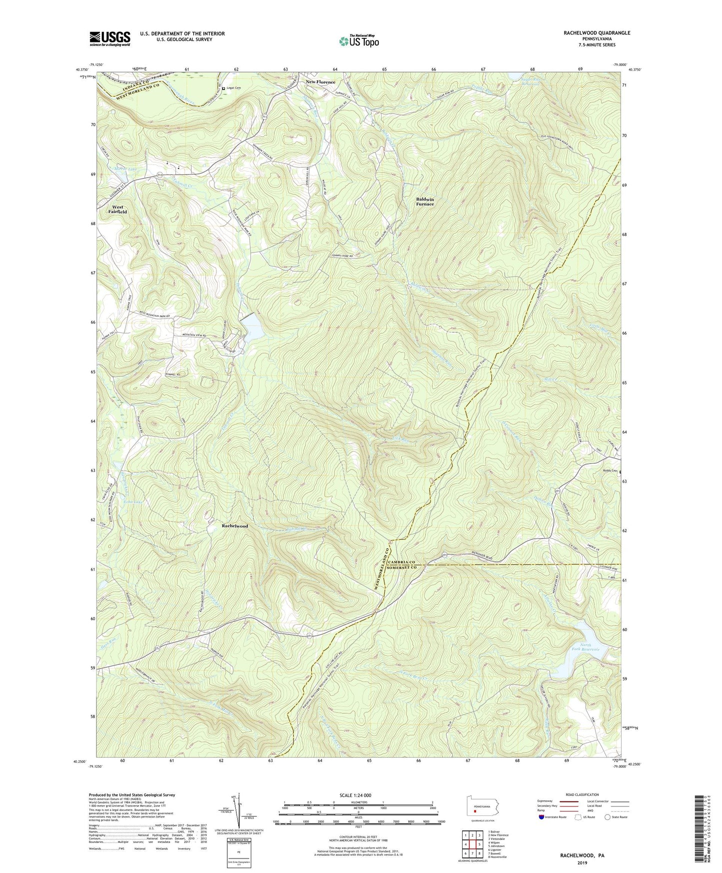
2019 topographic map quadrangle Rachelwood in the state of Pennsylvania. Scale: 1:24000. Based on the newly updated USGS 7.5' US Topo map series, this map is in the following counties: Westmoreland, Somerset, Cambria, Indiana. The map contains contour data, water features, and other items you are used to seeing on USGS maps, but also has updated roads and other features. This is the next generation of topographic maps. Printed on high-quality waterproof paper with UV fade-resistant inks.
Quads adjacent to this one:
West: Wilpen
Northwest: Bolivar
North: New Florence
Northeast: Vintondale
East: Johnstown
Southeast: Hooversville
South: Boswell
Southwest: Ligonier
Contains the following named places: Allwine Creek, Baldwin Furnace, Camp Twin Echo, Camp Wood Echo, Centennial Church, Church in the Wilderness, Echo Lake, Keafer School, Laurel Ridge State Park, Laurel School, Laurel Valley High School, Legat Cemetery, Lick Run, Menoher Heights Volunteer Fire Company, Mirror Lake, New Florence Reservoir, North Fork Dam, North Fork Reservoir, O'Connor Run, Poplar Run, Powdermill Run, Rachelwood, Riffle Run, Ross Mountain, Shannon Run, Township of Saint Clair, Tubmill Dam, Tubmill Reservoir, Tubmill School, Wertz School, ZIP Code: 15944