MyTopo
Wilpen Pennsylvania US Topo Map
Couldn't load pickup availability
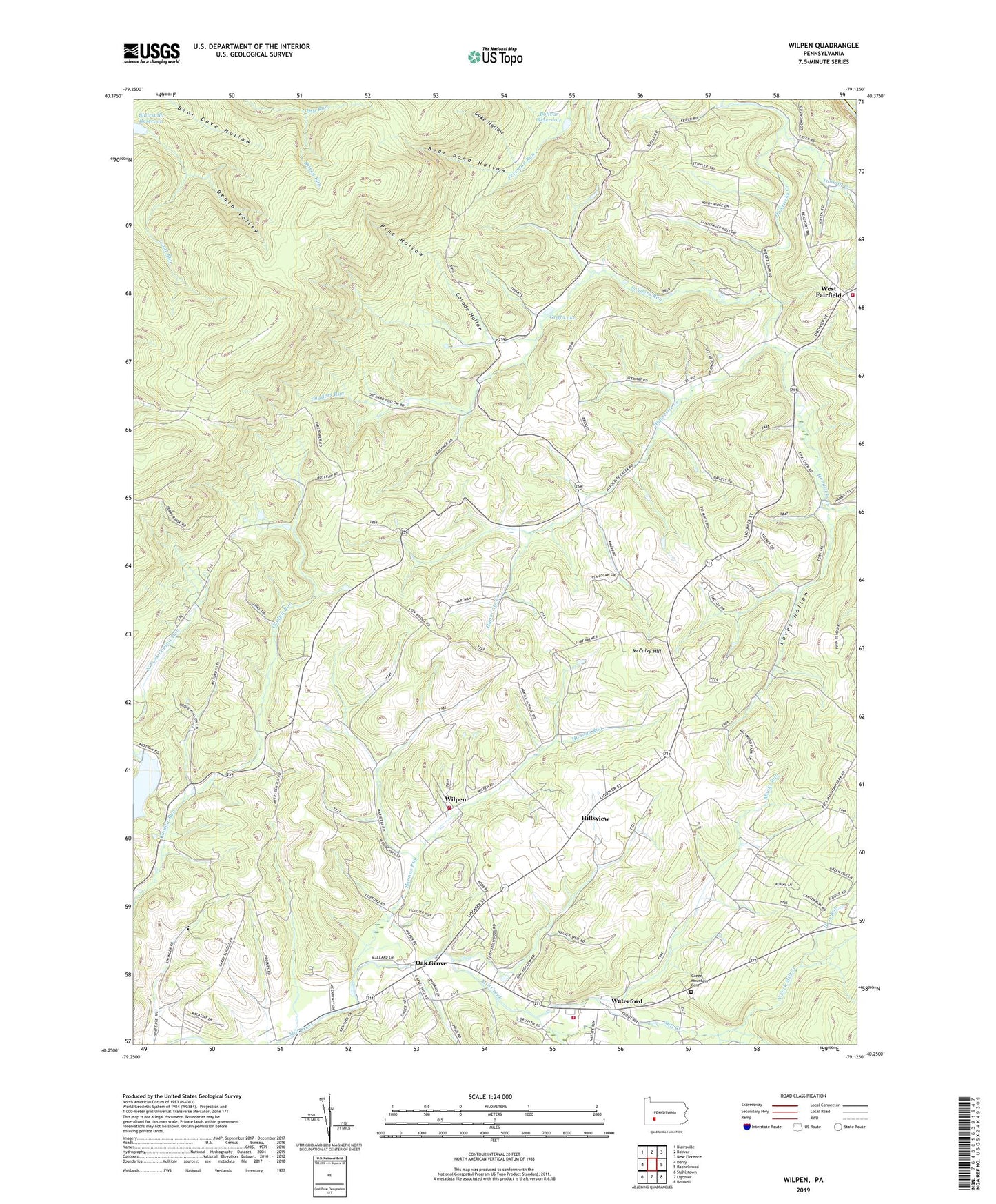
2023 topographic map quadrangle Wilpen in the state of Pennsylvania. Scale: 1:24000. Based on the newly updated USGS 7.5' US Topo map series, this map is in the following counties: Westmoreland, Indiana. The map contains contour data, water features, and other items you are used to seeing on USGS maps, but also has updated roads and other features. This is the next generation of topographic maps. Printed on high-quality waterproof paper with UV fade-resistant inks.
Quads adjacent to this one:
West: Derry
Northwest: Blairsville
North: Bolivar
Northeast: New Florence
East: Rachelwood
Southeast: Boswell
South: Ligonier
Southwest: Stahlstown
This map covers the same area as the classic USGS quad with code o40079c2.
Contains the following named places: Bear Cave Lookout Tower, Bear Pond Hollow, Bethlen Home, Blairsville Reservoir, Bolivar Reservoir, Camp Fairfield, Camp Kaufmann, Champion Lakes Golf Course, Covode Hollow, Covode School, Death Valley, Dry Run, Dyke Hollow, Factory School, Fairfield Township Volunteer Fire Company 1, First Church Camp, Flying H Airport, Fort Palmer Church, Fort School, Green Mountain Cemetery, Griff Lake, Hannas Run, Hendricks Creek, Hess Run, Hillsview, Hillview School, Hypocrite Creek, Liberty Hall, Ligonier Township Volunteer Fire Department 1, Ligonier Valley High School, Loves Hollow, Luther School, Macks Run, McCalvy Hill, Myers School, North Fork Mill Creek, Oak Grove, Old Colony, Pine Hollow, Powell Kaiser Airport, Reed School, Saint Anns Church, Saint Johns Church, Shawley School, Snyders Run, South Fork Mill Creek, Stewart School, Township of Fairfield, Waterford, West Fairfield, West School, Wilpen, Wilpen Ligonier Township Volunteer Fire Department 2, ZIP Code: 15923