MyTopo
Boswell Pennsylvania US Topo Map
Couldn't load pickup availability
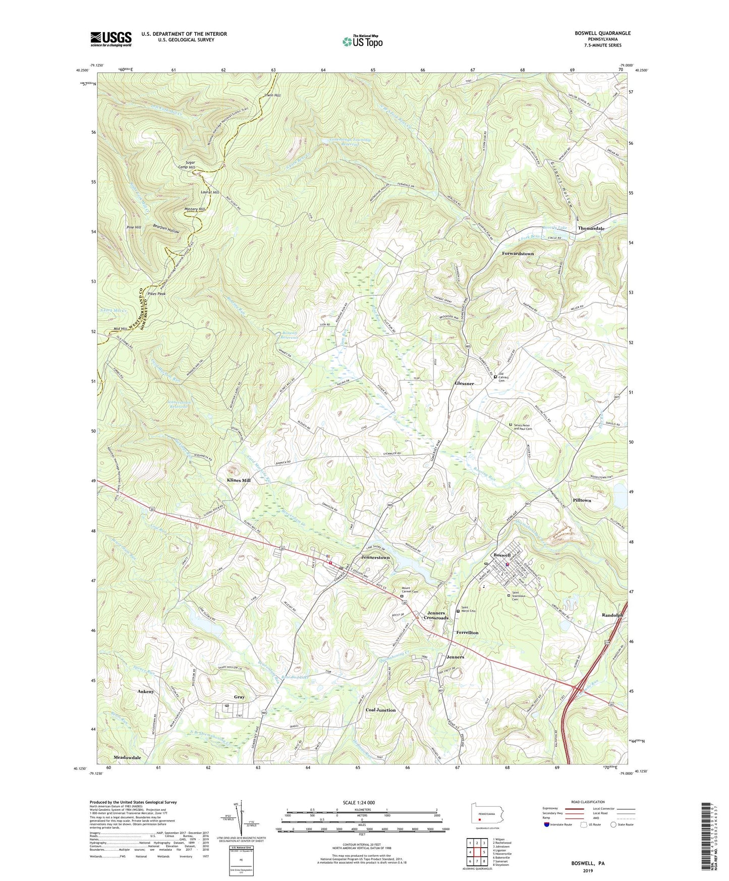
2023 topographic map quadrangle Boswell in the state of Pennsylvania. Scale: 1:24000. Based on the newly updated USGS 7.5' US Topo map series, this map is in the following counties: Somerset, Westmoreland. The map contains contour data, water features, and other items you are used to seeing on USGS maps, but also has updated roads and other features. This is the next generation of topographic maps. Printed on high-quality waterproof paper with UV fade-resistant inks.
Quads adjacent to this one:
West: Ligonier
Northwest: Wilpen
North: Rachelwood
Northeast: Johnstown
East: Hooversville
Southeast: Stoystown
South: Somerset
Southwest: Bakersville
This map covers the same area as the classic USGS quad with code o40079b1.
Contains the following named places: Ankeny, Beam Church, Beam Run, Bearpen Hollow, Beaverdam Creek, Beaverdam Run, Beisecker School, Beverly Lake, Borough of Boswell, Borough of Jennerstown, Boswell, Boswell Borough Police Department, Boswell Post Office, Boswell Quarry, Boswell Reservoir, Boswell Volunteer Fire Department - Station 605, Calvary Cemetery, Camp Sequanota, Card Machine Run, Coal Junction, Coal Run, Conemaugh Township Impounding Dam, Conemaugh Township Reservoir, Conner Post Office, Cooper School, Ferrellton, Flat Run, Forwardstown, Gallo Dam, Gilbert Hollow, Glessner, Gray, Gray Post Office, Gum Run, Hare School, Hoffman Run, Irwin Hill, Jenners, Jenners Crossroads, Jennerstown, Jennerstown Borough Police Department, Jennerstown Dam, Jennerstown Post Office, Jennerstown Reservoir, Jennerstown Volunteer Fire Department - Station 606, Klines Mill, Lake Gloria, Laurel Hill, Laurel Hill Tabernacle, Lohr's Landing Airport, Maurer School, Meadowdale, Middle Hill, Morgans Mills, Mount Carmel Cemetery, Mount Zion Church, Muller School, Mystery Hill, North Branch Quemahoning Creek, North Branch South Fork Bens Creek, Oakbrook Golf Course, Pickings Run, Pikes Peak, Pilltown, Pine Hill, Pine Run, Pine Springs Camp, Randolph, Roaring Run, Roaring Run Camp, Rose Bud Lake, Saint James Church, Saint Josephs Church, Saint Marys Church, Saint Mary's Polish National Cemetery, Saint Stanislaus Cemetery, Saints Peter and Paul Cemetery, Saylor School, Shunk, Spruce Run, State Game Lands Number 42, Stoughton Lake, Sugar Camp Hill, Thomasdale, Thomasdale School, Township of Jenner, ZIP Codes: 15531, 15544, 15546, 15547