MyTopo
Richland Pennsylvania US Topo Map
Couldn't load pickup availability
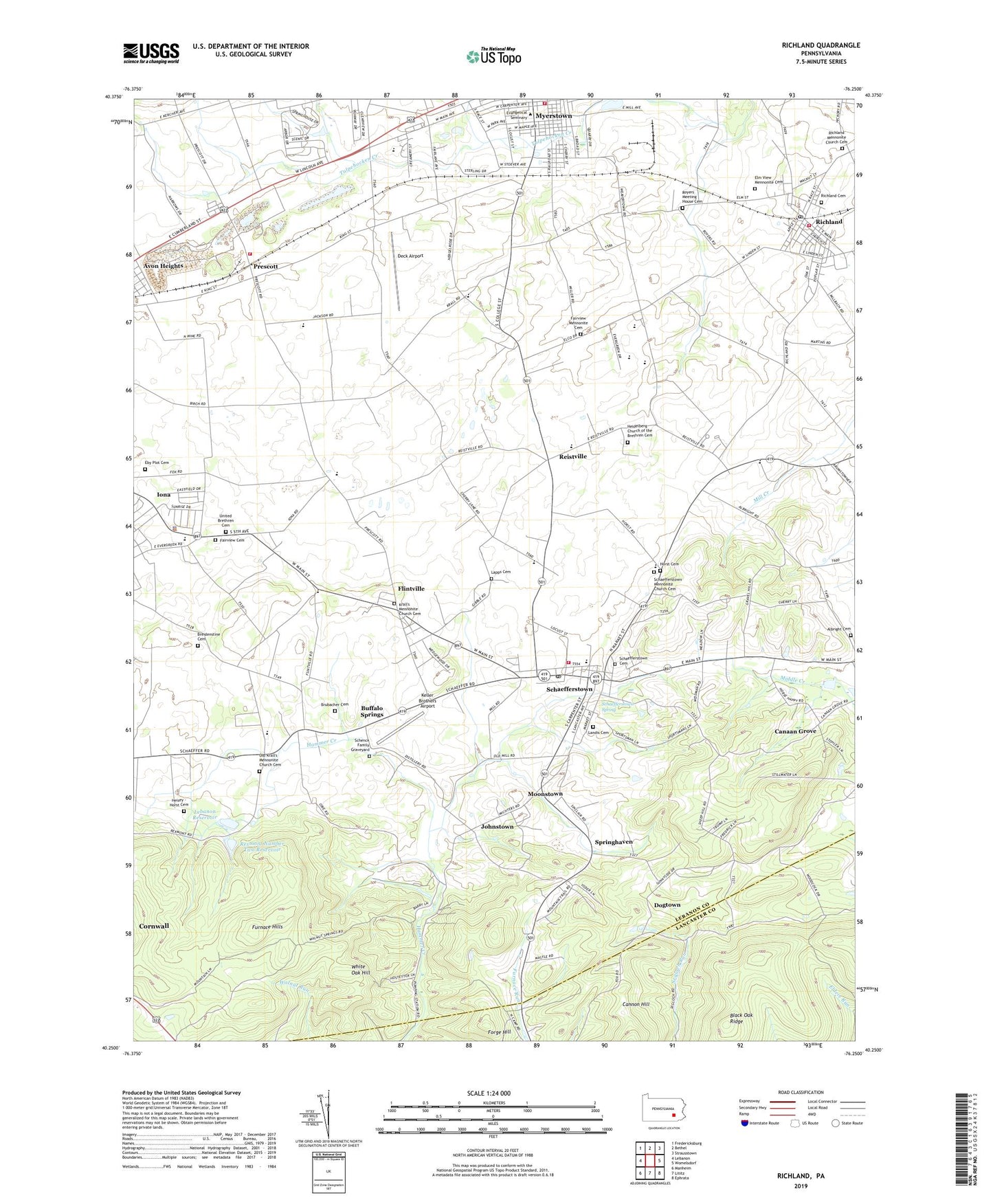
2023 topographic map quadrangle Richland in the state of Pennsylvania. Scale: 1:24000. Based on the newly updated USGS 7.5' US Topo map series, this map is in the following counties: Lebanon, Lancaster. The map contains contour data, water features, and other items you are used to seeing on USGS maps, but also has updated roads and other features. This is the next generation of topographic maps. Printed on high-quality waterproof paper with UV fade-resistant inks.
Quads adjacent to this one:
West: Lebanon
Northwest: Fredericksburg
North: Bethel
Northeast: Strausstown
East: Womelsdorf
Southeast: Ephrata
South: Lititz
Southwest: Manheim
This map covers the same area as the classic USGS quad with code o40076c3.
Contains the following named places: Albright Cemetery, Avon Heights, Black Oak Ridge, Borough of Myerstown, Borough of Richland, Breidenstine Cemetery, Brubacher Cemetery, Buffalo Springs, Canaan Grove, Cannon Hill, Cherry Lane School, Deck Airport, Dogtown, Eby Plot Cemetery, Elco Middle School, Elco Senior High School, Elm View Mennonite Cemetery, Fairview Cemetery, Fairview Church, Fairview Mennonite Cemetery, Flintville, Forge Hill, Furnace Hills, Heidelberg Church, Heidelberg Church of the Brethren Cemetery, Heisey - Horst Cemetery, Horseshoe Trail, Horst Cemetery, Iona, Johnstown, Keller Brothers Airport, Keystone Hook and Ladder Company 1 Station 31, Kralls Church, Krall's Mennonite Church Cemetery, Landis Cemetery, Lapps Cemetery, Lebanon Dam Number One, Lebanon Reservoir, Lebanon Valley Airpark, Michters Distillery, Millbach School, Moonstown, Myerstown, Myerstown Elementary School, Neptune Fire Department Station 33, Old Krall's Mennonite Church Cemetery, Prescott, Prescott Community Fire Company Station 29, Reistville, Rexmont Number Two Dam, Rexmont Number Two Reservoir, Richland, Richland Cemetery, Richland Mennonite Church Cemetery, Richland Post Office, Royers Church, Royers Meeting House Cemetery, Schaefferstown, Schaefferstown Cemetery, Schaefferstown Census Designated Place, Schaefferstown Elementary School, Schaefferstown Emergency Medical Services 160, Schaefferstown Mennonite Church Cemetery, Schaefferstown Post Office, Schaefferstown Spring, Schaefferstown Volunteer Fire Company Station 35, Schenck Family Graveyard, Shaeffer School, South Lebanon Township Police Department, Spangler School, Springhaven, Township of Heidelberg, Township of South Lebanon, Tulpehocken Fishing Club Dam, United Brethren Cemetery, Waldeck, Weavertown, West School, White Oak Hill, WVLV-AM (Lebanon), ZIP Codes: 17073, 17088