MyTopo
Rome Pennsylvania US Topo Map
Couldn't load pickup availability
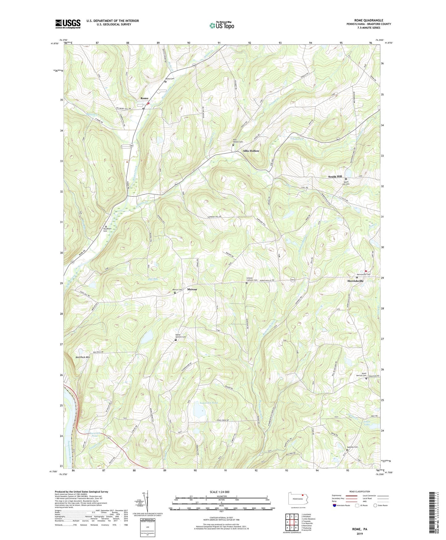
2019 topographic map quadrangle Rome in the state of Pennsylvania. Scale: 1:24000. Based on the newly updated USGS 7.5' US Topo map series, this map is in the following counties: Bradford. The map contains contour data, water features, and other items you are used to seeing on USGS maps, but also has updated roads and other features. This is the next generation of topographic maps. Printed on high-quality waterproof paper with UV fade-resistant inks.
Quads adjacent to this one:
West: Towanda
Northwest: Litchfield
North: Windham
Northeast: Little Meadows
East: Le Raysville
Southeast: Laceyville
South: Wyalusing
Southwest: Monroeton
Contains the following named places: Allis Hollow, Allis Hollow Cemetery, Ballibay Cemetery, Ballibay School, Bear Creek, Borough of Rome, Bullard Creek, Cebu School, Center School, Chestnut School, Claverack Pond, Dry Run, Fall Run, Herrick Post Office, Herrickville, Herrickville Cemetery, Herrickville Volunteer Fire Department 4, Ireland Catholic Cemetery, Jannone-Ballibay Airport, Jerome Creek, Johnson Creek, Keene Summit Cemetery, Keene Summit Church, London School, Mercur, Mercur Cemetery, Parks Creek, Red Rock Mountain, Rome, Rome Cemetery, Rome Post Office, Sierra Ridge Airport, South Creek, South Herrick Cemetery, South Hill, South Hill Cemetery, Tamarack Pond, Taylers Creek, Township of Herrick, Township of Orwell, Township of Rome, Township of Standing Stone, Vigilante Engine Company 1, West Valley School, Wickizer Run, Woodburn Cemetery, ZIP Code: 18854