MyTopo
Monroeton Pennsylvania US Topo Map
Couldn't load pickup availability
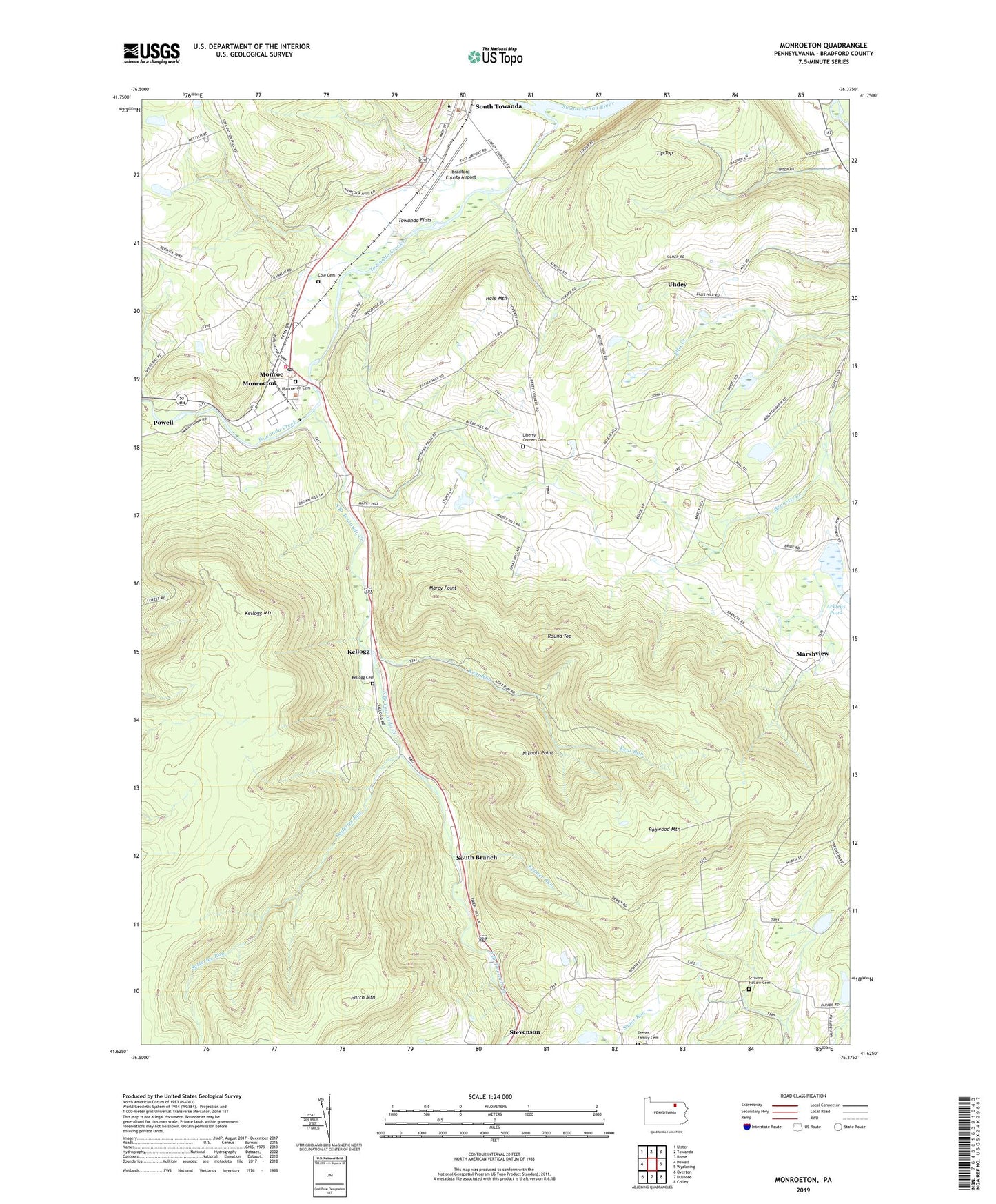
2023 topographic map quadrangle Monroeton in the state of Pennsylvania. Scale: 1:24000. Based on the newly updated USGS 7.5' US Topo map series, this map is in the following counties: Bradford. The map contains contour data, water features, and other items you are used to seeing on USGS maps, but also has updated roads and other features. This is the next generation of topographic maps. Printed on high-quality waterproof paper with UV fade-resistant inks.
Quads adjacent to this one:
West: Powell
Northwest: Ulster
North: Towanda
Northeast: Rome
East: Wyalusing
Southeast: Colley
South: Dushore
Southwest: Overton
This map covers the same area as the classic USGS quad with code o41076f4.
Contains the following named places: Borough of Monroe, Bradford County Airport, Bull School, Cole Cemetery, Fenner Run, Hale Mountain, Hatch Mountain, Kellogg, Kellogg Cemetery, Kellogg Mountain, Kellogg Mountain Lookout Tower, Kent Run, Liberty Corners, Liberty Corners Cemetery, Marcy Point, Marshview, Monroe Hose Company Station 7, Monroeton, Monroeton Cemetery, Monroeton Post Office, Nichols Point, Robwood Mountain, Round Top, Satterlee Run, Scrivens Hollow Cemetery, South Branch, South Branch Towanda Creek, State Game Lands Number 240, Teeter Family Cemetery, Tip Top, Towanda Creek, Towanda Flats, Township of Monroe, Township of Towanda, Uhdey