MyTopo
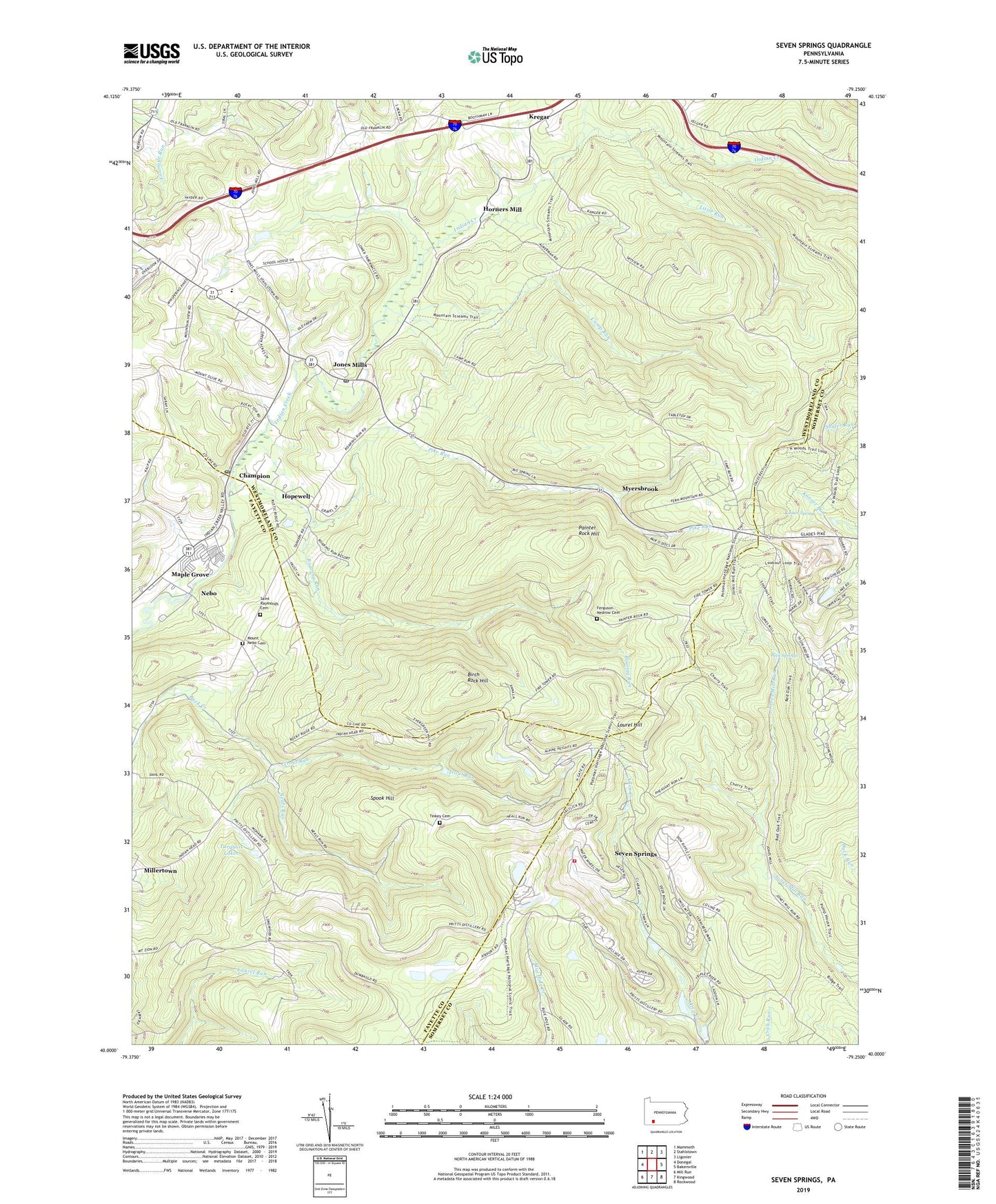
Seven Springs Pennsylvania US Topo Map
Couldn't load pickup availability
2019 topographic map quadrangle Seven Springs in the state of Pennsylvania. Scale: 1:24000. Based on the newly updated USGS 7.5' US Topo map series, this map is in the following counties: Westmoreland, Fayette, Somerset. The map contains contour data, water features, and other items you are used to seeing on USGS maps, but also has updated roads and other features. This is the next generation of topographic maps. Printed on high-quality waterproof paper with UV fade-resistant inks.
Quads adjacent to this one:
West: Donegal
Northwest: Mammoth
North: Stahlstown
Northeast: Ligonier
East: Bakersville
Southeast: Rockwood
South: Kingwood
Southwest: Mill Run
Contains the following named places: Beck Springs, Birch Rock Hill, Borough of Seven Springs, Camp Alliquippa, Camp Run, Center Church, Champion, Champion Post Office, Clifford N Pritts School, Donegal School, Ferguson - Nedrow Cemetery, Hidden Valley Ski Area, Hopewell, Horners Mill, Jones Mills, Jones Mills Post Office, Kooser Firetower, Kooser Run Dam, Kooser Spring, Kregar, Laurel Hill State Park, Little Run, Maple Grove, Mount Hope Church, Mount Nebo Cemetery, Mount Nebo Church, Mount Olive Church, Myersbrook, Neals Run, Nebo, Painter Rock Hill, Pike Run, Pike Run Country Club, Roaring Run, Roaring Run Natural Area, Saint Raymonds Cemetery, Saint Raymonds Church, Seven Springs, Seven Springs Airport, Seven Springs Mountain Resort, Seven Springs Resort Golf Course, Seven Springs Volunteer Fire Company - Station 625, Somerset Quarry, Spook Hill, Tinkey Cemetery, Township of Donegal, Trout Run, Turquois Lakes, White Mountain Ski Area, ZIP Codes: 15622, 15628, 15646