MyTopo
Mammoth Pennsylvania US Topo Map
Couldn't load pickup availability
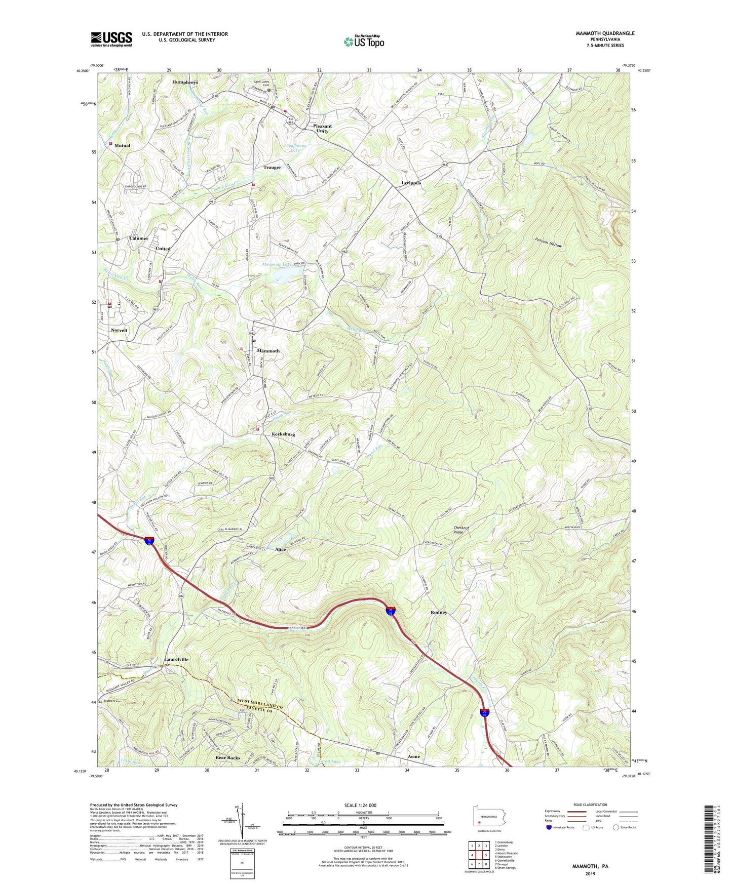
2023 topographic map quadrangle Mammoth in the state of Pennsylvania. Scale: 1:24000. Based on the newly updated USGS 7.5' US Topo map series, this map is in the following counties: Westmoreland, Fayette. The map contains contour data, water features, and other items you are used to seeing on USGS maps, but also has updated roads and other features. This is the next generation of topographic maps. Printed on high-quality waterproof paper with UV fade-resistant inks.
Quads adjacent to this one:
West: Mount Pleasant
Northwest: Greensburg
North: Latrobe
Northeast: Derry
East: Stahlstown
Southeast: Seven Springs
South: Donegal
Southwest: Connellsville
This map covers the same area as the classic USGS quad with code o40079b4.
Contains the following named places: Acme, Acme Lake, Acme Post Office, Alice, Bear Rocks Census Designated Place, Brothers Cemetery, Calumet, Calumet Census Designated Place, Calumet Volunteer Fire Department, Calumet-Norvelt Census Designated Place, County Reservoir, Fairview Church, Forest Lake, Forty Mourners Church, Franklin School, Humphreys, Humphreys Run, Hurst Junior High School, Immel Dam, Kecksburg, Kecksburg Volunteer Fire Department, Laurel Run, Laurel Run School, Laurelville, Loyalhanna Dam, Loyalhanna Lake, Lycippus, Mammoth, Mammoth Census Designated Place, Mammoth County Park, Mammoth Lake, Mammoth Lake Dam, Mammoth Post Office, Mutual, Mutual Aid Ambulance Service Pleasant Unity, Mutual Volunteer Fire Department, North Branch Sewickley Creek, Norvelt, Norvelt / Westmoreland Homesteads Volunteer Fire Department, Norvelt Census Designated Place, Norvelt Emergency Medical Services, Norvelt Golf Course, Norvelt Post Office, Oakdale School, Pa-657 Dam, Pleasant Unity, Pleasant Unity Post Office, Pleasant Unity Volunteer Fire Department, Porch Mine, Possum Hollow, Rodney, Rumbaugh, Saint Boniface Chapel, Saint Boniface Lookout Tower, Saint Florian School, Saint Lukes Cemetery, Saint Lukes Church, Saint Marys Church, Saint Pauls Church, Saint Stanislaus Church, Southerwood, Southerwood Church, Township of Mount Pleasant, Trauger, Trauger Volunteer Fire Department, United, United Post Office, Welty Run, Weltytown, Whitney Ridge Dam, Whitney School, ZIP Codes: 15610, 15621, 15676, 15689