MyTopo
Stahlstown Pennsylvania US Topo Map
Couldn't load pickup availability
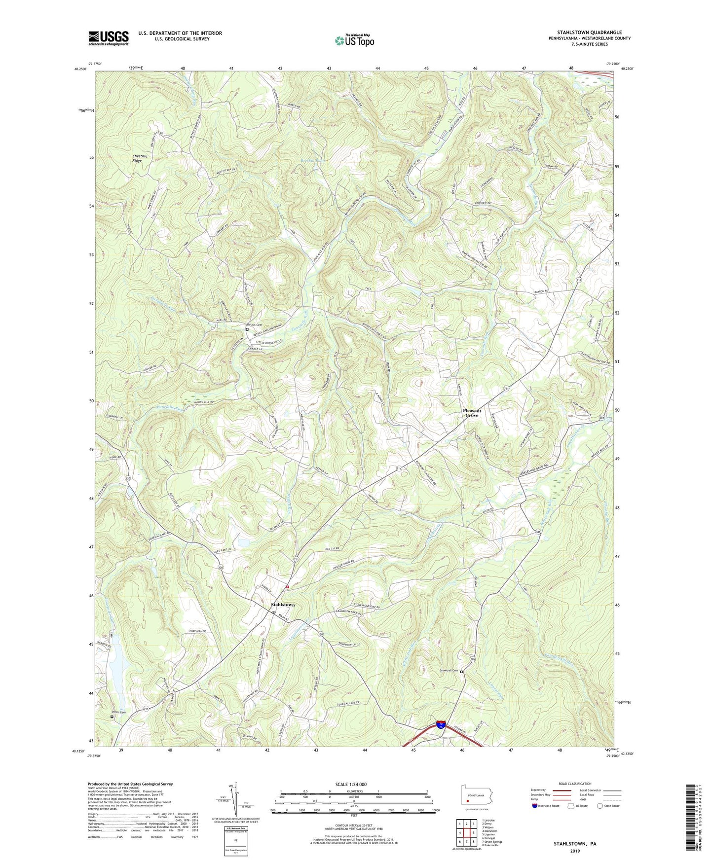
2023 topographic map quadrangle Stahlstown in the state of Pennsylvania. Scale: 1:24000. Based on the newly updated USGS 7.5' US Topo map series, this map is in the following counties: Westmoreland. The map contains contour data, water features, and other items you are used to seeing on USGS maps, but also has updated roads and other features. This is the next generation of topographic maps. Printed on high-quality waterproof paper with UV fade-resistant inks.
Quads adjacent to this one:
West: Mammoth
Northwest: Latrobe
North: Derry
Northeast: Wilpen
East: Ligonier
Southeast: Bakersville
South: Seven Springs
Southwest: Donegal
This map covers the same area as the classic USGS quad with code o40079b3.
Contains the following named places: Bethel Cemetery, Bethel Church, Breskin Dam Number Two, Breskin Pond, Breskin Pond Dam Number One, Camp Wesco, Campbelle Run, Chestnut Ridge, Chestnut Ridge Community Volunteer Fire Department, Enoch Stahl School, Four Mile Run Dam, Fourmile Run Dam, Keffer Run, Laurel Run, Ligonier Country Club, Mansville, Mill Creek, Mutual Aid Emergency Medical Service Chestnut Ridge Station, Phoebe Run, Pleasant Grove, Porch Cemetery, Powdermill Run, Ridge School, Snowball Cemetery, Stahlstown, Stahlstown Post Office, Township of Cook, Weaver School, White Oak Run, Zion Church, ZIP Code: 15687