MyTopo
Shade Gap Pennsylvania US Topo Map
Couldn't load pickup availability
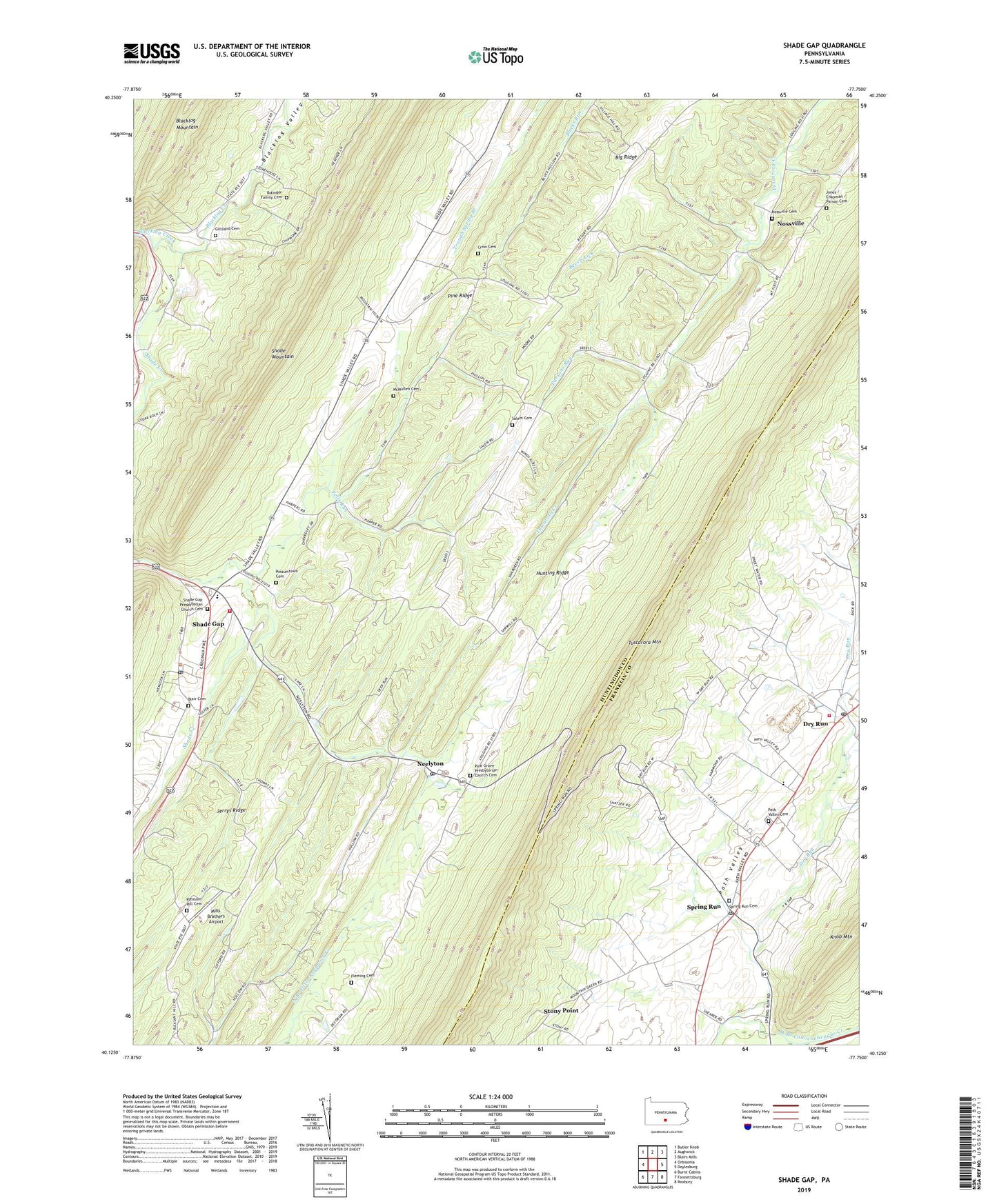
2019 topographic map quadrangle Shade Gap in the state of Pennsylvania. Scale: 1:24000. Based on the newly updated USGS 7.5' US Topo map series, this map is in the following counties: Huntingdon, Franklin. The map contains contour data, water features, and other items you are used to seeing on USGS maps, but also has updated roads and other features. This is the next generation of topographic maps. Printed on high-quality waterproof paper with UV fade-resistant inks.
Quads adjacent to this one:
West: Orbisonia
Northwest: Butler Knob
North: Aughwick
Northeast: Blairs Mills
East: Doylesburg
Southeast: Roxbury
South: Fannettsburg
Southwest: Burnt Cabins
Contains the following named places: Beech Lick, Blacklog Valley, Blair Cemetery, Bolinger Family Cemetery, Borough of Shade Gap, Crow Cemetery, Dry Run, Dry Run Post Office, Dry Run Quarry, Fannett - Metal Fire and Ambulance Department - Company 12, Felix Run, Fleming Cemetery, Gilliland Cemetery, Harpers Memorial Park, Hunting Ridge, Jerrys Ridge, Jones / Chapman / Parson Cemetery, McMullen Cemetery, McNeil School, Mills Brothers Airport, Narrows School, Neelyton, Neelyton Post Office, Nossville, Nossville Cemetery, Orbisonia Quarry, Parsons Run, Path Valley Cemetery, Pine Grove Church, Pine Grove Presbyterian Church Cemetery, Pine Ridge, Pleasant Hill Cemetery, Pleasant Hill Church, Possumtown Cemetery, Salem Cemetery, Salem Church, Salem School, Shade Creek, Shade Gap, Shade Gap Area Fire Company Station 14, Shade Gap Elementary School, Shade Gap Post Office, Shade Gap Presbyterian Church Cemetery, Shade Gap Station, Spring Run, Spring Run Cemetery, Spring Run Post Office, State Game Lands Number 251, Stony Point, Township of Dublin, Union School, Upper Path Valley Church, ZIP Codes: 17213, 17239, 17255