MyTopo
Butler Knob Pennsylvania US Topo Map
Couldn't load pickup availability
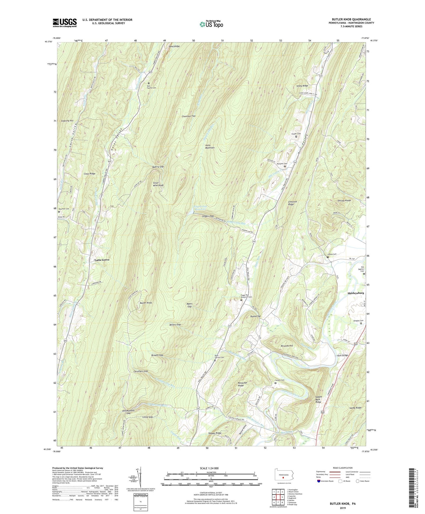
2023 topographic map quadrangle Butler Knob in the state of Pennsylvania. Scale: 1:24000. Based on the newly updated USGS 7.5' US Topo map series, this map is in the following counties: Huntingdon. The map contains contour data, water features, and other items you are used to seeing on USGS maps, but also has updated roads and other features. This is the next generation of topographic maps. Printed on high-quality waterproof paper with UV fade-resistant inks.
Quads adjacent to this one:
West: Cassville
Northwest: Huntingdon
North: Mount Union
Northeast: Newton Hamilton
East: Aughwick
Southeast: Shade Gap
South: Orbisonia
Southwest: Saltillo
This map covers the same area as the classic USGS quad with code o40077c8.
Contains the following named places: Bare - Garver Cemetery, Beech Run Church, Blacklog Creek, Borough of Shirleysburg, Bowman Cemetery, Browns Gap, Browns Gap Run, Butler Knob, Butler Trail, Carothers Gap, Carothers Gap Run, Chestnut Flat, Chestnut Grove School, Chestnut Ridge, Colgate School, Dell Family Cemetery, Douglas Cemetery, Enyeart School, Fort Run, Gilboa Cemetery, Gilboa School, Jacks Mountain Firetower, Lake Mount Union Dam, Latta Grove, Latta Grove Church, Latta Grove School, Lincoln School, Little Gap, Logan Run, Lower Hill Valley School, Millers Gap, Miranda Hill, Monroe Valley, Mount Union Airport, Myers Gap, Old Baptist Cemetery, Old Womans Gap, Old Womans Run, Page, Querry Gap, Renecker Ridge, Ricketts Cemetery, Round Top, Runk Bridge, Sand Ridge, Sandy Ridge, Sherman School, Shirley Knobs, Silver Mine Knob, Singers Gap, Singers Gap Reservoir, Singers Gap Run, Snyder Cemetery, State Game Lands Number 71, Stony Ridge, Sugar Run, Sugar Run Brethren Cemetery, Sugar Run Church, Swartz Cemetery, Township of Union, ZIP Codes: 17052, 17260