MyTopo
Blairs Mills Pennsylvania US Topo Map
Couldn't load pickup availability
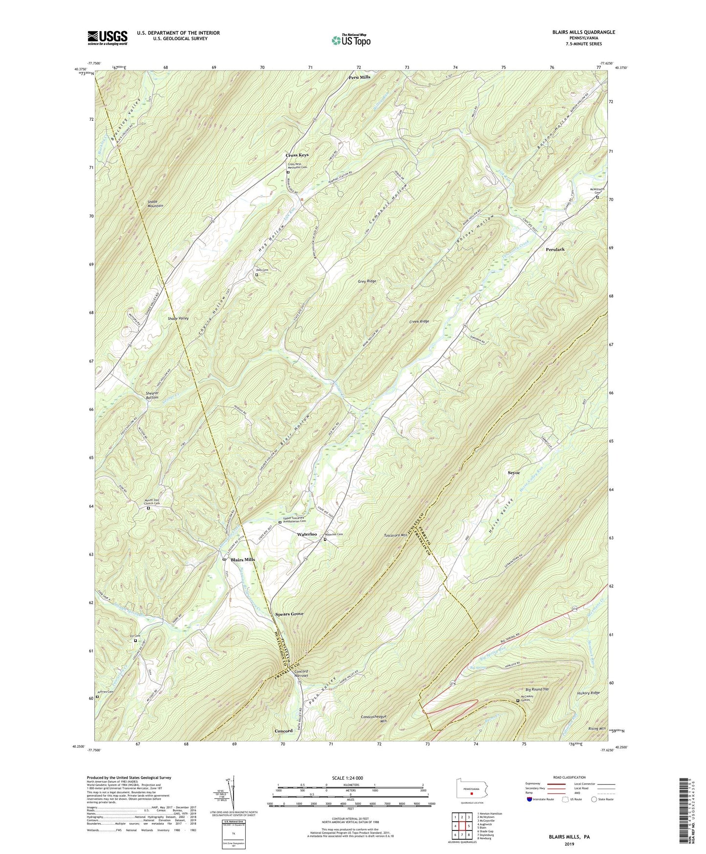
2023 topographic map quadrangle Blairs Mills in the state of Pennsylvania. Scale: 1:24000. Based on the newly updated USGS 7.5' US Topo map series, this map is in the following counties: Juniata, Huntingdon, Perry, Franklin. The map contains contour data, water features, and other items you are used to seeing on USGS maps, but also has updated roads and other features. This is the next generation of topographic maps. Printed on high-quality waterproof paper with UV fade-resistant inks.
Quads adjacent to this one:
West: Aughwick
Northwest: Newton Hamilton
North: McVeytown
Northeast: McCoysville
East: Blain
Southeast: Newburg
South: Doylesburg
Southwest: Shade Gap
This map covers the same area as the classic USGS quad with code o40077c6.
Contains the following named places: Barton Hollow, Beers Trail, Big Round Top, Big Roundtop Trail, Big Spring, Big Spring Run, Big Spring State Park, Blair Hollow, Blairs Mills, Blairs Mills Post Office, Burns Valley Overlook, Campbell Hollow, Cherry Hollow, Colter School, Concord, Concord Narrows, Creek Ridge, Cross Keys, Cross Keys Methodist Cemetery, Cross Keys Path, Elf Cemetery, George Creek, Grey Ridge, Harts Run, Hemlock Run, Hog Hollow, Iron Horse Trail, Jeffries Cemetery, Lick Run, McCabe Chapel, McCabe School, McCaskey Graves, McWilliams Cemetery, Mount Zion Church Cemetery, Narrows Branch Tuscarora Creek, O'Donel Trail, Old State Road Trail, Patterson Run, Perulack, Polk Cemetery, Rhines Hollow, Seyoc, Shade Valley, Shearer Bottom, Spears Grove, Township of Lack, Trough Spring Branch, Upper Tuscarora Presbyterian Cemetery, Waterloo, Waterloo Cemetery, Wistie, Zion Church, ZIP Code: 17021