MyTopo
Shunk Pennsylvania US Topo Map
Couldn't load pickup availability
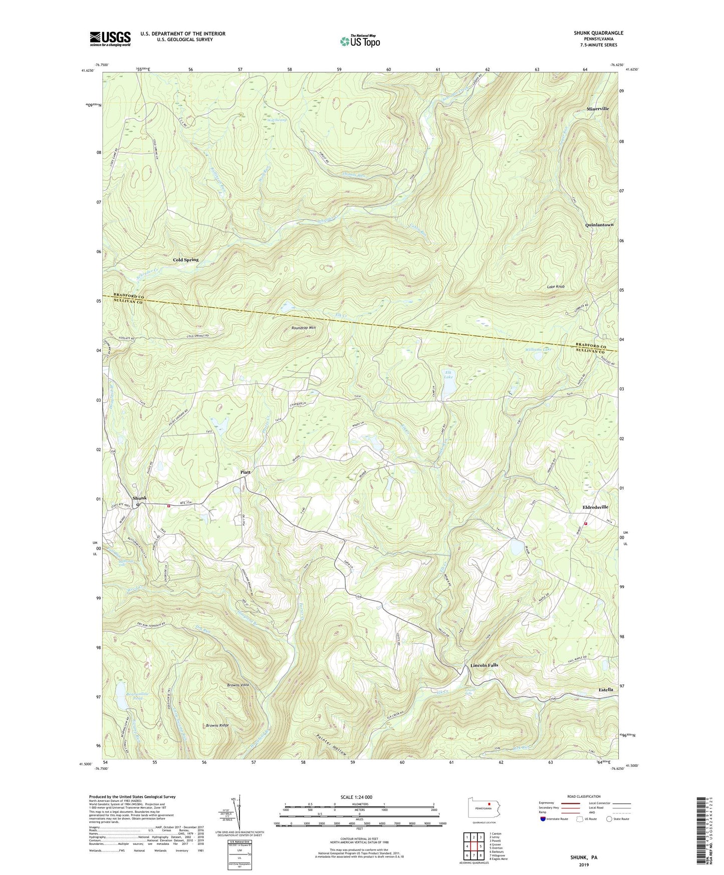
2023 topographic map quadrangle Shunk in the state of Pennsylvania. Scale: 1:24000. Based on the newly updated USGS 7.5' US Topo map series, this map is in the following counties: Sullivan, Bradford. The map contains contour data, water features, and other items you are used to seeing on USGS maps, but also has updated roads and other features. This is the next generation of topographic maps. Printed on high-quality waterproof paper with UV fade-resistant inks.
Quads adjacent to this one:
West: Grover
Northwest: Canton
North: Leroy
Northeast: Powell
East: Overton
Southeast: Eagles Mere
South: Hillsgrove
Southwest: Barbours
This map covers the same area as the classic USGS quad with code o41076e6.
Contains the following named places: Bearwallow Pond, Browns Ridge, Browns Vista, Buttermilk Falls, Cabin Run, Camp Brule, Center School, Cold Spring, Dry Run, East School, Eldredsville, Eldredsville Volunteer Fire Company Station 56, Elk Lake, Elkland Meetinghouse, Endless Winds Volunteer Fire Company Station 55, Fall Run, Hoagland Trail, Lake Knob, Lake Run, Lick Run, Lincoln Falls, Little Schrader Creek, Loyalsock State Forest, Lye Run, Minerville, Piatt, Pine Swamp Run, Porter Creek, Quinlantown, Rollinson Run, Roundtop Mountain, Shunk, Shunk Post Office, State Game Lands Number 12, Thomas Run, Township of Elkland, Township of Fox, Weed Creek, Williams Lake, Wolf Run, Wolf Swamp, Wyoming State Forest, ZIP Code: 18616