MyTopo
Hillsgrove Pennsylvania US Topo Map
Couldn't load pickup availability
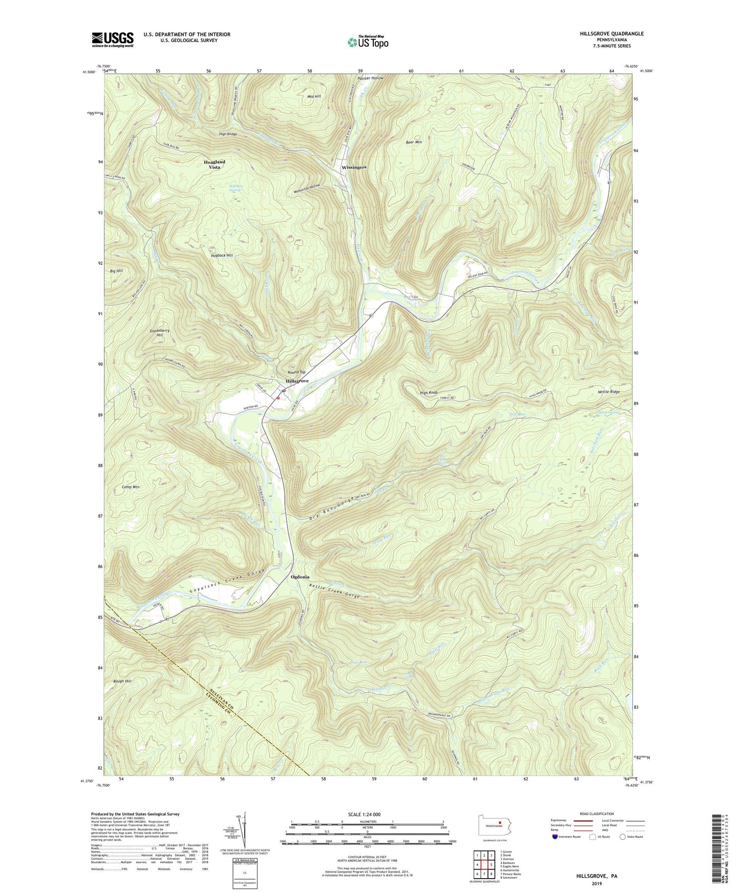
2023 topographic map quadrangle Hillsgrove in the state of Pennsylvania. Scale: 1:24000. Based on the newly updated USGS 7.5' US Topo map series, this map is in the following counties: Sullivan, Lycoming. The map contains contour data, water features, and other items you are used to seeing on USGS maps, but also has updated roads and other features. This is the next generation of topographic maps. Printed on high-quality waterproof paper with UV fade-resistant inks.
Quads adjacent to this one:
West: Barbours
Northwest: Grover
North: Shunk
Northeast: Overton
East: Eagles Mere
Southeast: Sonestown
South: Picture Rocks
Southwest: Huntersville
This map covers the same area as the classic USGS quad with code o41076d6.
Contains the following named places: Angel Falls, Bark Shed Trail, Barkshed Run, Bear Mountain, Browns Trail, Brunnerdale Run, Camels Trail, Camp Lycogis, Camp Mountain, Camslab Trail, Cape Run, Dead Horse Trail, Detters Trail, Dry Run, Dry Run Falls, Dry Run Gorge, Dry Run Picnic Area, East Slab Trail, Elk Creek, Falls Run, Falls Run Trail, Gooseberry Hill, Gooseberry Trail, Hardwood Trail, High Bridge, High Knob, High Knob Natural Area, High Knob Overlook, High Knob Trail, High Landing Trail, Hillsgrove, Hillsgrove Post Office, Hillsgrove Volunteer Fire Company Station 54, Hoagland Branch, Hoagland Vista, Hogback Hill, Huckle Run, Jackson Trail, Joes Run, Ketchum Run, Kettle Creek, Kettle Creek Gorge, Kettle Creek Gorge Natural Area, Laurel Ridge Trail, Little Swamp Run, Loyalsock Creek Gorge, Middle Hill, Middle Hill Trail, Mill Creek, Nettle Ridge, Nettle Ridge Trail, Ogdonia, Ogdonia Clubhouse, Ogdonia Creek, Old House Trail, Painter Hollow, Pine Run, Plunkett, Pole Hill Trail, Ridge Trail, Rough Hill, Round Top, Ryans Trail, Scar Run, Scar Run Trail, Short Trail, Slab Run, Slab Run Swamp, Spook Swamp, Stony Run, Stony Run Trail, Swamp Run, Township of Hillsgrove, Trout Hill Trail, Walnut Trail, Warburton Hollow, Wissingers, ZIP Code: 18619