MyTopo
Powell Pennsylvania US Topo Map
Couldn't load pickup availability
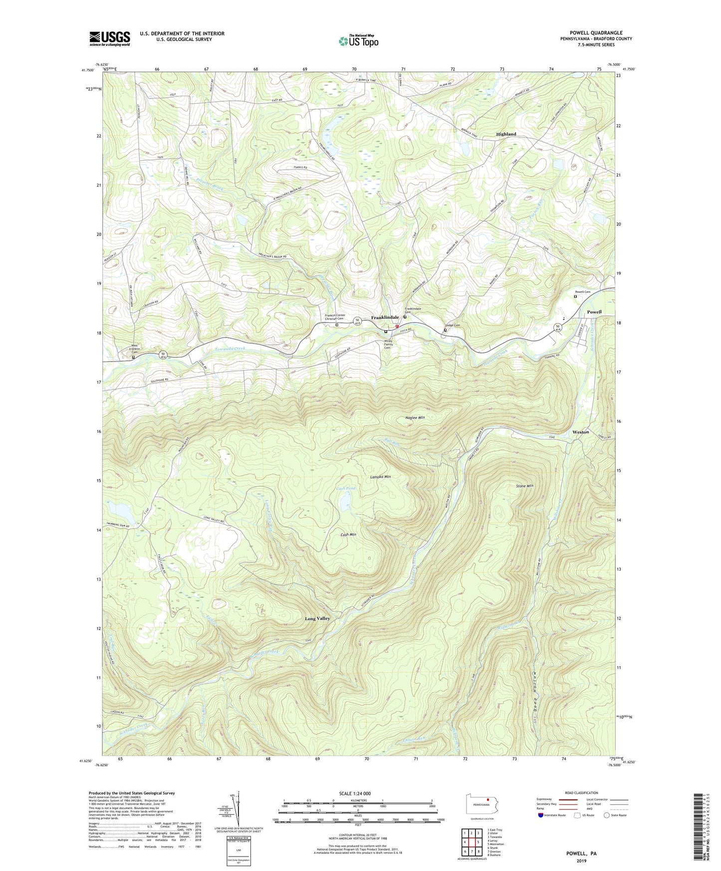
2023 topographic map quadrangle Powell in the state of Pennsylvania. Scale: 1:24000. Based on the newly updated USGS 7.5' US Topo map series, this map is in the following counties: Bradford. The map contains contour data, water features, and other items you are used to seeing on USGS maps, but also has updated roads and other features. This is the next generation of topographic maps. Printed on high-quality waterproof paper with UV fade-resistant inks.
Quads adjacent to this one:
West: Leroy
Northwest: East Troy
North: Ulster
Northeast: Towanda
East: Monroeton
Southeast: Dushore
South: Overton
Southwest: Shunk
This map covers the same area as the classic USGS quad with code o41076f5.
Contains the following named places: Barclay Station, Bull Run, Cash Mountain, Cash Pond, Chilson Run, Coal Run, Deep Hollow, Dodge Cemetery Old, Falls Creek, Franklin Center, Franklin Center Christian Cemetery, Franklin Township Volunteer Fire and Rescue Department, Franklindale, Franklindale Cemetery, French Run, Highland, Lamoka Mountain, Long Valley, Long Valley Run, Millstone Creek, Monroe Franklin School, Naglee Mountain, Nates Run, North Branch Towanda Creek, Powell, Powell Cemetery, Preacher Brook, Schrader Creek, State Game Lands Number 36, Stone Mountain, Sugar Run, Township of Barclay, Township of Franklin, West Franklin Cemetery, Weston, Willey Family Cemetery, ZIP Code: 18832