
MyTopo
South Connellsville Pennsylvania US Topo Map
Couldn't load pickup availability
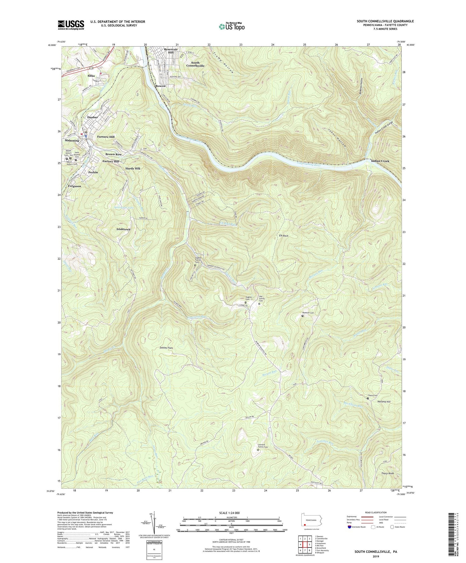
2019 topographic map quadrangle South Connellsville in the state of Pennsylvania. Scale: 1:24000. Based on the newly updated USGS 7.5' US Topo map series, this map is in the following counties: Fayette. The map contains contour data, water features, and other items you are used to seeing on USGS maps, but also has updated roads and other features. This is the next generation of topographic maps. Printed on high-quality waterproof paper with UV fade-resistant inks.
Quads adjacent to this one:
West: Uniontown
Northwest: Dawson
North: Connellsville
Northeast: Donegal
East: Mill Run
Southeast: Ohiopyle
South: Fort Necessity
Southwest: Brownfield
Contains the following named places: Blackberry Run, Borough of Dunbar, Borough of South Connellsville, Bowest, Brown Row, Camp Carmel, Casparis, Dunbar, Dunbar Borough Volunteer Fire Department Station 12, Dunbar Post Office, Elk Rock, Elk Rock Run, Factory Hill, Ferguson, Flat Rock Run, Foleys Dam, Full Gospel Church, Furnace Hill, Gettamy School, Gist Run, Glade Run, Greenbrier Church, Greenbrier School, Hardy Hill, Hay Family Cemetery, Holland Hill, Hughes Cemetery - 3, Hughes Family Cemetery - 1, Hughes School, Indian Creek, Indian Creek Gorge, Irishtown, Irishtown Run, Johns Hollow, Laurel Run, Leonard Family Cemetery, Limestone Run, Liston School, McGowans Lake, McManas Hollow, Morgan Run, Morrell Volunteer Fire Department Station 24, Mount Auburn Cemetery, Mount Auburn Cemetery - Old, Pechin, Reservoir Hill, Richter Run, Rock Run, Roebuck Cemetery, Saint Aloysius Cemetery, Sitka, South Connellsville, State Game Lands Number 51, Sugar Run School, Tates Run, Tharp Cemetery, Tharp Knob, Township of Dunbar, Tucker Run, Zebley Flats, ZIP Code: 15431


