
MyTopo
Starrucca Pennsylvania US Topo Map
Couldn't load pickup availability
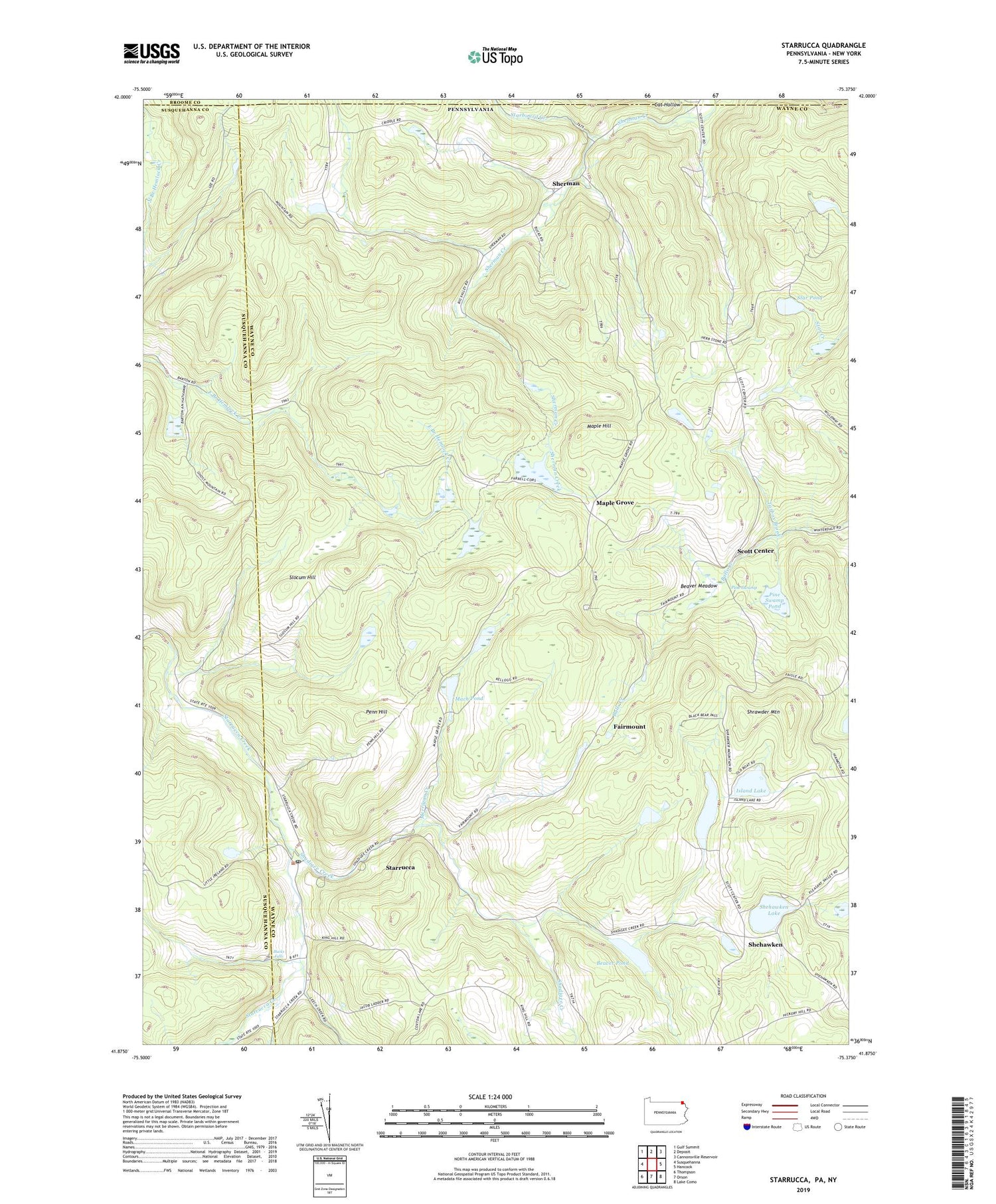
2019 topographic map quadrangle Starrucca in the states of Pennsylvania, New York. Scale: 1:24000. Based on the newly updated USGS 7.5' US Topo map series, this map is in the following counties: Wayne, Susquehanna, Broome. The map contains contour data, water features, and other items you are used to seeing on USGS maps, but also has updated roads and other features. This is the next generation of topographic maps. Printed on high-quality waterproof paper with UV fade-resistant inks.
Quads adjacent to this one:
West: Susquehanna
Northwest: Gulf Summit
North: Deposit
Northeast: Cannonsville Reservoir
East: Hancock
Southeast: Lake Como
South: Orson
Southwest: Thompson
Contains the following named places: Beaver Meadow, Beaver Pond, Beaver Pond Dam, Borough of Starrucca, Bucks Falls, Cat Hollow, Fairmont School, Fairmount, Farrell Corners, Finnegan Corners, Gardinier Corners, Island Lake, Island Pond, King Hill School, Mach Pond, Maple Grove, Maple Hill, Merrigan Creek, Mission Chapel, Penn Hill, Pine Swamp, Pine Swamp Pond, Saint Pauls Church, Scott Center, Shadigee Creek, Shehawken, Shehawken Dam, Shehawken Lake, Shehawken School, Sherman, Shrawder Mountain, Slocum Hill, Star Pond, Starboard Creek, Starrucca, Starrucca Post Office, Starrucca Station, State Game Lands Number 299, State Game Lands Number 70, Tarbox Brook, Township of Scott, ZIP Code: 18462


