MyTopo
Thompson Pennsylvania US Topo Map
Couldn't load pickup availability
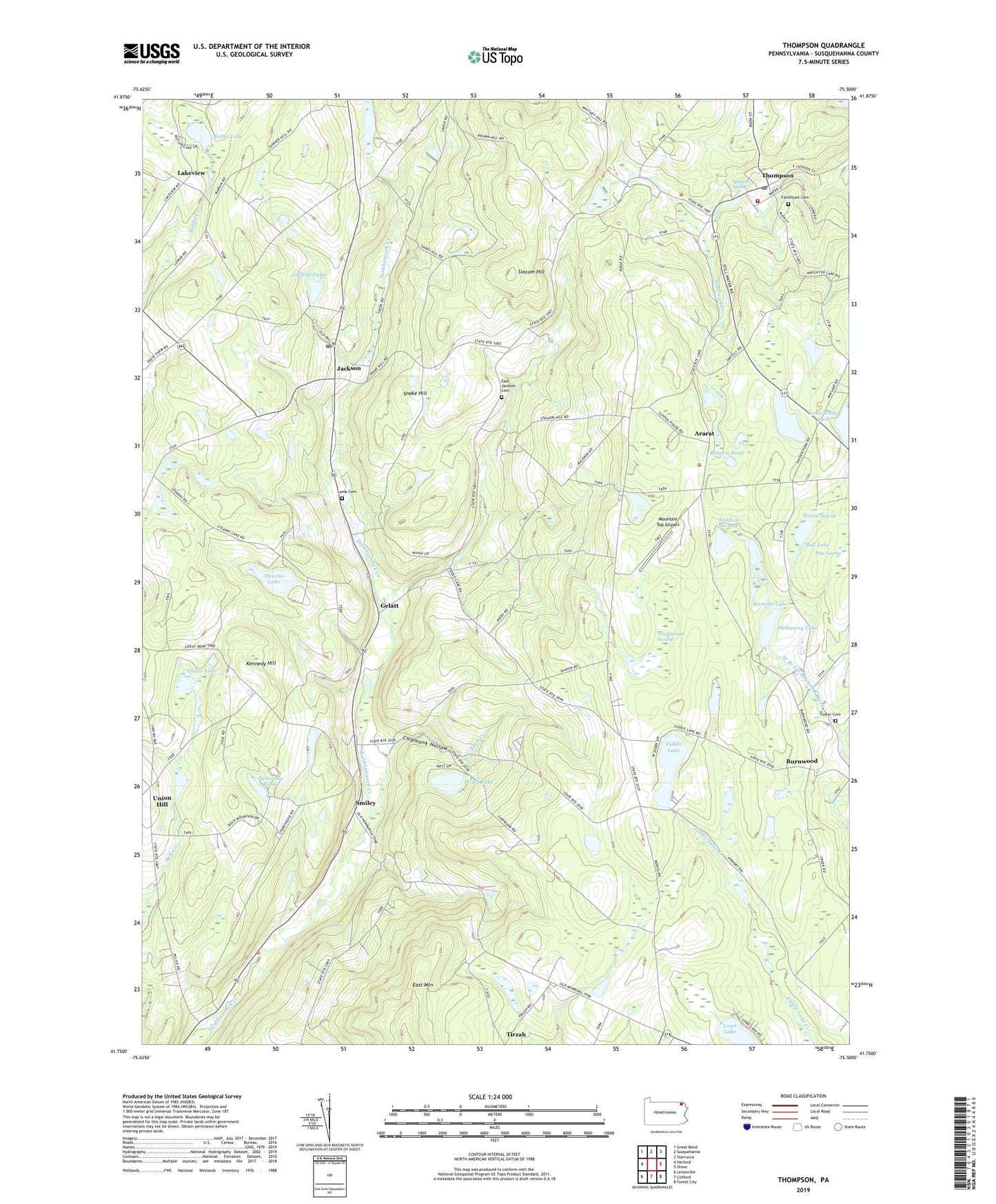
2023 topographic map quadrangle Thompson in the state of Pennsylvania. Scale: 1:24000. Based on the newly updated USGS 7.5' US Topo map series, this map is in the following counties: Susquehanna. The map contains contour data, water features, and other items you are used to seeing on USGS maps, but also has updated roads and other features. This is the next generation of topographic maps. Printed on high-quality waterproof paper with UV fade-resistant inks.
Quads adjacent to this one:
West: Harford
Northwest: Great Bend
North: Susquehanna
Northeast: Starrucca
East: Orson
Southeast: Forest City
South: Clifford
Southwest: Lenoxville
This map covers the same area as the classic USGS quad with code o41075g5.
Contains the following named places: Aldrich Airport, Ararat, Ararat Church, Avery School, Ball Lake, Borough of Thompson, Brooks School, Burnwood, Butler Lake, Chipmunk Hollow, Dimock Corners, East Jackson Cemetery, Fairmount Cemetery, Fiddle Lake, Foster Cemetery, Gelatt, Griffith Pond, Hathaway Lake, Hathaway Pond Dam, Hobbs School, Jackson, Jackson Post Office, Kennedy Hill, Lake White Lark, Lakeview, Lamb Cemetery, Lowe Lake, Mountain Top Airport, Pickering Pond, Pine Swamp, Potter Lake, Roberts Pond, Rock Creek, Romobe Lake, Romobe Lake Dam, Saint Martins Church, Sinkhole Swamp, Slocum Hill, Smiley, Smiley School, Snake Hill, Spencer Spring, State Game Lands Number 236, Stearns Lake, Stearns Swamp, Thompson, Thompson Hose Company, Thompson Post Office, Tinglepaugh Swamp, Tirzah, Township of Ararat, Township of Gibson, Township of Jackson, Union Hill, Walker School, Willis Lake, ZIP Codes: 18465, 18825