MyTopo
Susquehanna Pennsylvania US Topo Map
Couldn't load pickup availability
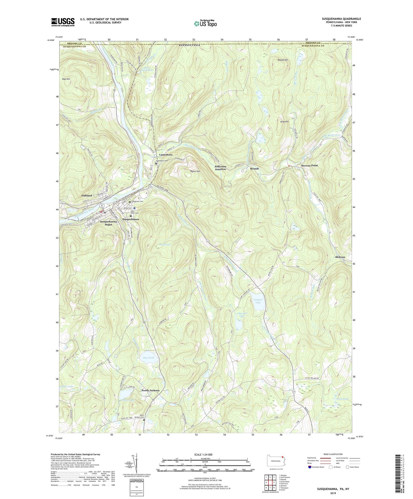
2023 topographic map quadrangle Susquehanna in the states of Pennsylvania, New York. Scale: 1:24000. Based on the newly updated USGS 7.5' US Topo map series, this map is in the following counties: Susquehanna, Broome. The map contains contour data, water features, and other items you are used to seeing on USGS maps, but also has updated roads and other features. This is the next generation of topographic maps. Printed on high-quality waterproof paper with UV fade-resistant inks.
Quads adjacent to this one:
West: Great Bend
Northwest: Windsor
North: Gulf Summit
Northeast: Deposit
East: Starrucca
Southeast: Orson
South: Thompson
Southwest: Harford
This map covers the same area as the classic USGS quad with code o41075h5.
Contains the following named places: Barnes - Kasson County Hospital, Bear Swamp, Bethel Hill Church, Borough of Lanesboro, Borough of Oakland, Borough of Susquehanna Depot, Brandt, Canawacta Creek, Cascade Creek, Centerville Church, Churchill Lake, Comfort Lake, Deep Hollow Brook, Devils Punch Bowl, Drinker Creek, East Branch Canawacta Creek, East Branch Hemlock Creek, Evergreen Cemetery, Foxton Lake, Foxton Lake Dam, Hemlock Creek, Hilborn Creek, Jefferson Junction, King Hill, Lanesboro, Lanesboro Cemetery, Lewis Creek, Little Roaring Brook, Melrose, Melrose Church, North Branch Hemlock Creek, North Jackson, North Jackson Cemetery, Oak Hill, Oakland, Oakland Dam, Pigpen Creek, Raskelly Corners, Roaring Run, Ross Pond, Round Hill, Saint Johns Cemetery, South Branch Canawacta Creek, Starrucca Creek, Stevens Point, Susquehanna, Susquehanna Borough Police Department, Susquehanna Consolidated School, Susquehanna Fire Department, Susquehanna Post Office, Taylor Hill, Township of Harmony, Township of Oakland, Township of Thompson, Weirs Pond, Wildcat Run, ZIP Code: 18847