MyTopo
Orson Pennsylvania US Topo Map
Couldn't load pickup availability
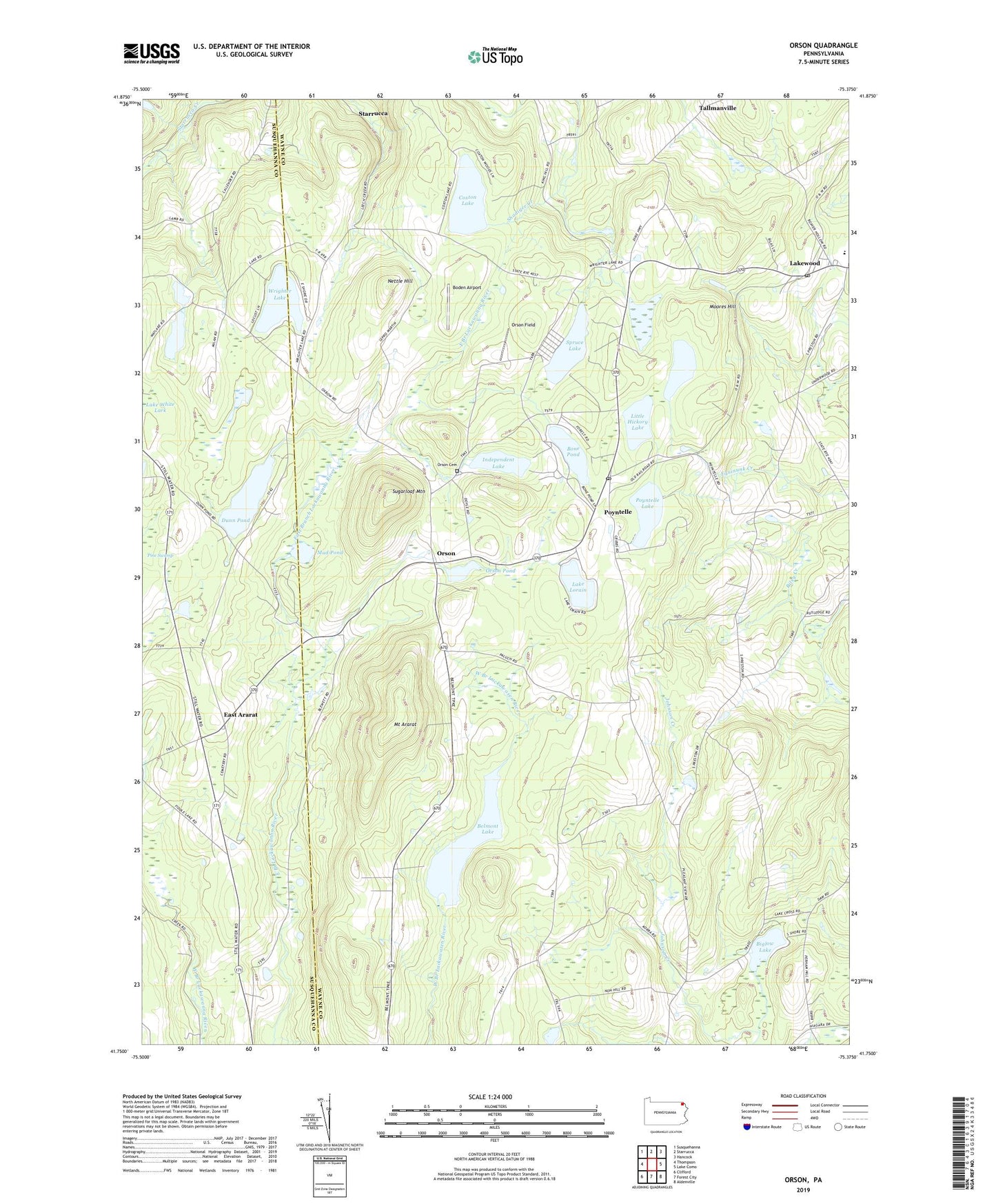
2023 topographic map quadrangle Orson in the state of Pennsylvania. Scale: 1:24000. Based on the newly updated USGS 7.5' US Topo map series, this map is in the following counties: Wayne, Susquehanna. The map contains contour data, water features, and other items you are used to seeing on USGS maps, but also has updated roads and other features. This is the next generation of topographic maps. Printed on high-quality waterproof paper with UV fade-resistant inks.
Quads adjacent to this one:
West: Thompson
Northwest: Susquehanna
North: Starrucca
Northeast: Hancock
East: Lake Como
Southeast: Aldenville
South: Forest City
Southwest: Clifford
This map covers the same area as the classic USGS quad with code o41075g4.
Contains the following named places: Belmont Lake, Belmont Lake Dam, Biglow Lake, Boden Airport, Bone Pond, Coxton Lake, Dix School, Dunn Pond, East Ararat, East Ararat School, Free Church, Fulkerson School, Giles and Sikorsky Airport, Hickory Lake, Hines Corners, Independent Lake, Lake Lorain, Lakewood, Lakewood Post Office, Little Hickory Lake, Monroe School, Moores Hill, Mount Ararat, Mud Pond, Mulligan Airport, Nettle Hill, Orson, Orson Cemetery, Orson Church, Orson Field, Orson Pond, Orson Pond Dam, Poyntelle, Poyntelle Lake, Poyntelle Post Office, Preston Center, South Preston School, Spruce Lake, Stevenson School, Sugarloaf Mountain, Tallmanville, Tamarack Swamp Pond, Township of Preston, Watson Airport, Wrighter Corner, Wrighter Lake, ZIP Codes: 18430, 18454