MyTopo
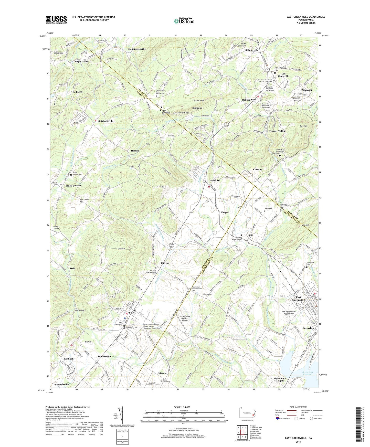
East Greenville Pennsylvania US Topo Map
Couldn't load pickup availability
2023 topographic map quadrangle East Greenville in the state of Pennsylvania. Scale: 1:24000. Based on the newly updated USGS 7.5' US Topo map series, this map is in the following counties: Berks, Lehigh, Montgomery. The map contains contour data, water features, and other items you are used to seeing on USGS maps, but also has updated roads and other features. This is the next generation of topographic maps. Printed on high-quality waterproof paper with UV fade-resistant inks.
Quads adjacent to this one:
West: Manatawny
Northwest: Topton
North: Allentown West
Northeast: Allentown East
East: Milford Square
Southeast: Perkiomenville
South: Sassamansville
Southwest: Boyertown
This map covers the same area as the classic USGS quad with code o40075d5.
Contains the following named places: Bally, Bally Borough Hall, Bally Borough Police Department, Bally Community Ambulance, Bally Community Swimming Pool, Bally Mennonite Cemetery, Bally Mennonite Church, Bally Post Office, Barto, Barto Bridge, Barto Community Park, Barto Post Office, Bethany Congregational Cemetery, Bethany Evangelical Congregational Church, Bethesda Cemetery, Blackhead Hill, Borneman Mill, Borough of Bally, Borough of East Greenville, Butter Valley Golf Course, Butter Valley Golf Port Airport, Calvary United Church of Christ, Carl Hill, Chapel, Christ Union Cemetery, Christ Union Church, Churchville, Clayton, Corning, Dale, Diehl School, East Greenville, East Greenville Fire Company Station 38, East Greenville Post Office, Eastern Berks Fire Department 97 - 1, Eastern Berks Fire Department 97 - 2, Eshbach, Evangelical Cemetery, Fruitville, Furnace Hill, Gehringer Family Farm, Green Lane Reservoir Park, Harlem, Hensingersville, Hensingersville Dam, Hereford, Hereford Census Designated Place, Hereford Elementary School, Hereford Estates Mobile Home Park, Hereford Mennonite Cemetery, Hereford Mennonite Church, Hereford Post Office, Hereford Township Office, Hereford Township Park, Hereford Volunteer Fire Company Station 58, Herring School, Hosensack Church, Hosensack Creek, Hosensack Evangelical Congregational Cemetery, Hosensack Number Four Dam, Hosensack Schwenkfelder Cemetery, Hosensack Station, Huff Union Cemetery - North, Huffs Church, Huff's Union Church, Indian Creek, Kings Highway Elementary School, Kurtzs Dam, Maple Grove, Melcher Park, Milford Park, Mill Dam, Mill Hill, Mill Side Park Dam, Molasses Creek, Most Blessed Sacrament Church, Most Blessed Sacrament Church Cemetery, Mountain Village Mobile Home Park, National Centre for Padre Pio, New Goshenhoppen Church, New Goshenhoppen United Church of Christ Cemetery, Niantic, Old Zionsville, Old Zionsville Post Office, Old Zionsville United Church of Christ Cemetery, Our Lady of Grace Chapel, Pachwechen Run, Palm, Palm Post Office, Palm Schwenkfelder Church, Palm Schwenkfelder Church Cemetery, Pennsburg Square, Perkiomen Heights, Perkiomen Place, Perkiomen Preparatory School, Powder Valley, Rauch Hertzog Cemetery, Red Lion, Saint Francis Academy, Saint Peters Church, Saint Peters Union Church Cemetery, Saint Philip Neri School, Saint Pio of Pietrelcina Museum, Salem Church, Salem Evangelical Cemetery, Salem United Methodist Church Cemetery, Schultzville, Schwenkfelder Library Museum, Seisholtzville, Seisholtzville Fire Company Station 39, Shimerville, Shuhler Farms, Sigmund, Snyders School, Township of Hereford, Township of Upper Hanover, Township of Upper Milford, Township of Washington, Upper Milford Church, Upper Milford Mennonite Church Cemetery, Upper Milford Western District Fire Company Station 19, Upper Perkiomen Middle School, Valley Run, Washington Schwenkfelder Cemetery, Washington Township Elementary School, Washington Township Municipal Building, Washington Township Park, Yeakel Cemetery, Zions Evangelical Lutheran Church Cemetery, Zionsville, Zionsville Reformed Church Cemetery, ZIP Codes: 18041, 18056, 18068, 18070, 18092, 19503, 19504, 19505


