MyTopo
Valley View Pennsylvania US Topo Map
Couldn't load pickup availability
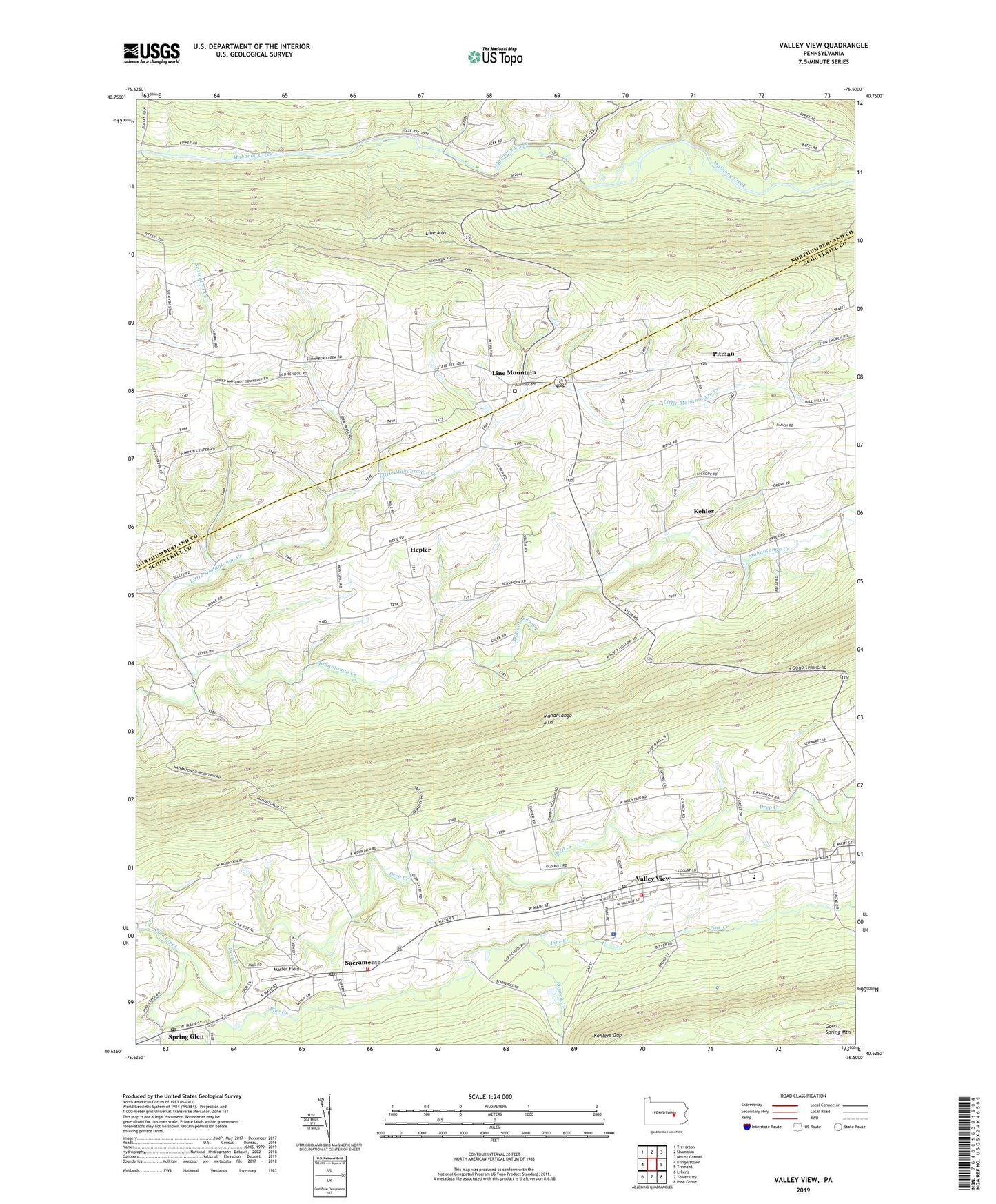
2023 topographic map quadrangle Valley View in the state of Pennsylvania. Scale: 1:24000. Based on the newly updated USGS 7.5' US Topo map series, this map is in the following counties: Schuylkill, Northumberland. The map contains contour data, water features, and other items you are used to seeing on USGS maps, but also has updated roads and other features. This is the next generation of topographic maps. Printed on high-quality waterproof paper with UV fade-resistant inks.
Quads adjacent to this one:
West: Klingerstown
Northwest: Trevorton
North: Shamokin
Northeast: Mount Carmel
East: Tremont
Southeast: Pine Grove
South: Tower City
Southwest: Lykens
This map covers the same area as the classic USGS quad with code o40076f5.
Contains the following named places: Christ Church, Deep Creek, Friedens Church, Good Spring Mountain, Hegins Area Ambulance, Hegins Post Office, Hegins Township Police Department, Hegins-Hubley School, Hepler, Heplers Church, Heplers Summer Church, Jacobs Cemetery, Kehler, Leck Kill School, Line Mountain, Little Mahantango Creek, Mahantango Fire Company District 10 Station 1, Mahantango Valley School, Mahantongo Valley Ambulance, Masser Field, Pitman, Pitman Post Office, Rausch Creek, Sacramento, Sacramento Community Fire Company District 14 Station 1, Sacramento Post Office, Saint James Church, Saint Pauls Church, Spring Glen, Spring Glen Post Office, State Game Lands Number 132, State Game Lands Number 84, Township of East Cameron, Township of Hegins, Township of Hubley, Township of Upper Mahantongo, Tri Valley High School, Valley View, Valley View Census Designated Place, Valley View Fire Company District 13 Station 2, Valley View Park, Valley View Post Office, ZIP Codes: 17836, 17938, 17941, 17964, 17968, 17978, 17983