MyTopo
Twelvemile Pond Pennsylvania US Topo Map
Couldn't load pickup availability
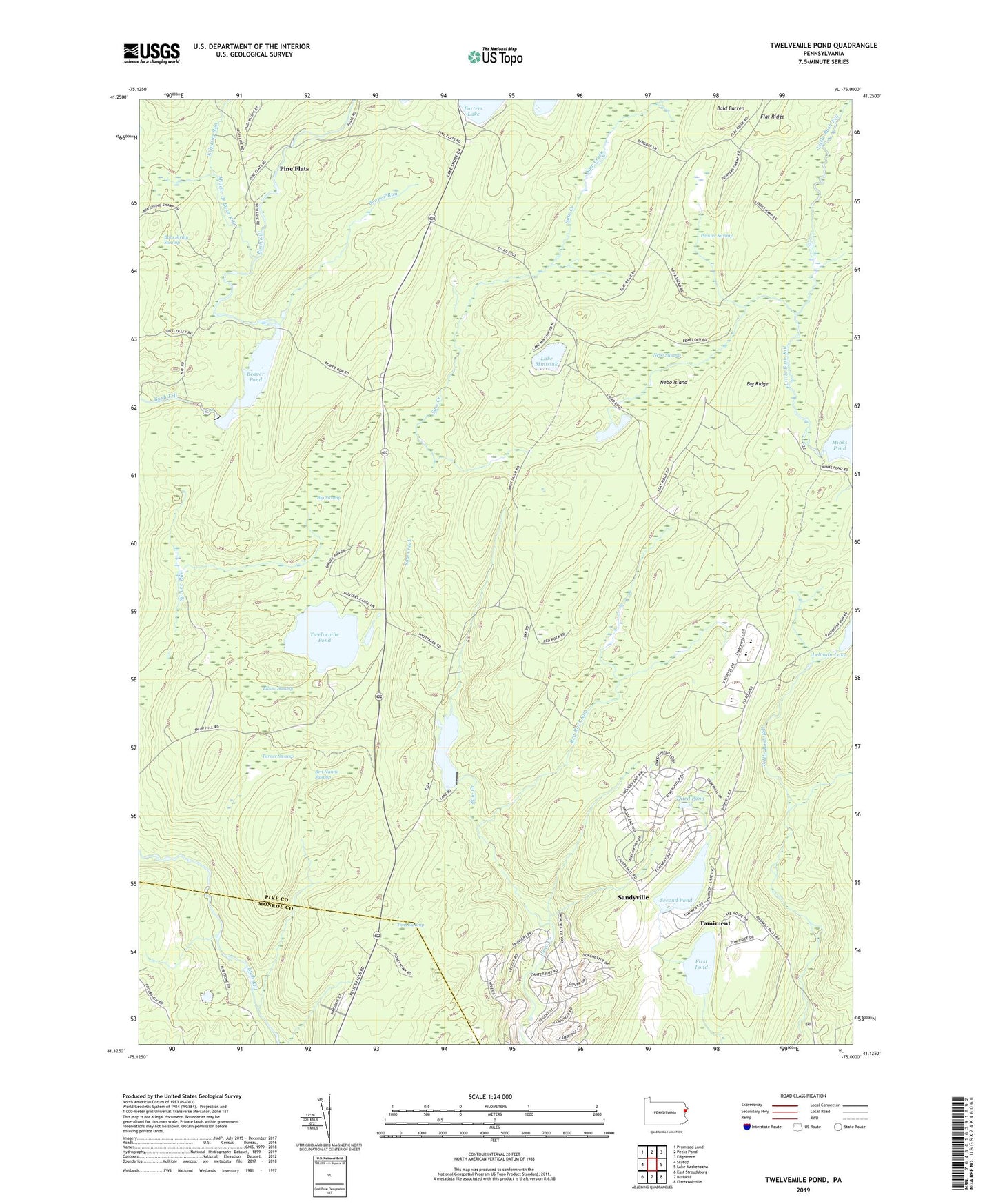
2019 topographic map quadrangle Twelvemile Pond in the state of Pennsylvania. Scale: 1:24000. Based on the newly updated USGS 7.5' US Topo map series, this map is in the following counties: Pike, Monroe. The map contains contour data, water features, and other items you are used to seeing on USGS maps, but also has updated roads and other features. This is the next generation of topographic maps. Printed on high-quality waterproof paper with UV fade-resistant inks.
Quads adjacent to this one:
West: Skytop
Northwest: Promised Land
North: Pecks Pond
Northeast: Edgemere
East: Lake Maskenozha
Southeast: Flatbrookville
South: Bushkill
Southwest: East Stroudsburg
Contains the following named places: Bald Barren, Bald Barren Trail, Beaver Pond, Beaver Run, Beaver Run Club, Beaver Run Dam, Ben Hanna Swamp, Big Ridge, Big Swamp, Bobs String Swamp, Bushkill Post Office, East Spring Run, Elbow Swamp, First Forest Tree Planting, First Pond, Forest Park, Forest Park Post Office, Hunters Range, Hunters Range School, Lake Minisink, Lake Minisink Dam, Lehman Lake Dam, Maskenozha Lake Dam, Middle Branch Bush Kill, Mishawaka Club, Nebo Island, Nebo Swamp, Old Mill Dam, Painter Swamp, Pine Flats, Porters Lake Club, Red Rock Run, Sandyville, Saw Creek Club Dam, Saw Creek Pond, Second Pond, Second Pond Dam, Tamiment, Tamiment Resort Golf Course, Tamiment Ski Area, Taylor Creek, Third Pond, Tims Swamp, Township of Porter, Turner Swamp, Twelve Mile Pond Dam, Twelvemile Pond, ZIP Codes: 18324, 18371